The Welsh Three Peaks challenge consists of three specific mountains: Snowdon, Cadair Idris, and Pen y Fan. Snowdon stands at 1,085 metres in the north. Cadair Idris measures 893 metres in mid-Wales. Pen y Fan reaches 886 metres in the south.
- How Long Is The Total Walking Distance?
- What Is The Driving Route Between The Mountains?
- How Much Total Ascent Does The Challenge Involve?
- What Are The Specific Route Paths For Each Mountain?
- What Gear And Preparation Do Hikers Need?
- How Does The Welsh Version Compare To The National Challenge?
- What Are The Historical Records For Completion?
- What Are The Physical Fitness Requirements?
- FAQs About 3 Peaks Wales Challenge
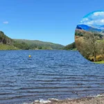
The route mandates scaling three high peaks: Snowdon, Cadair Idris, and Pen y Fan. The journey begins in Eryri National Park, a protected geographic zone. Participants travel south through the Cambrian Mountains, a designated upland region. The challenge concludes in the Brecon Beacons National Park, an area famous for sandstone peaks. The geographic spread requires significant logistical planning across three Welsh counties: Gwynedd, Powys, and Carmarthenshire. Participants must navigate three diverse terrains: rocky paths, glacial valleys, and grassy ridges.
Historical mapping designates these summits as the highest points within three distinct regions: northern, central, and southern Wales. Snowdon features the highest elevation across three British nations: Wales, England, and Northern Ireland. Cadair Idris dominates the skyline above the Mawddach Estuary. Pen y Fan stands as the tallest peak in southern Britain. Hikers experience three distinct climates: alpine weather, temperate mountain conditions, and exposed moorland systems. The varied environments demand preparation for three weather factors: high winds, heavy rain, and sudden fog.
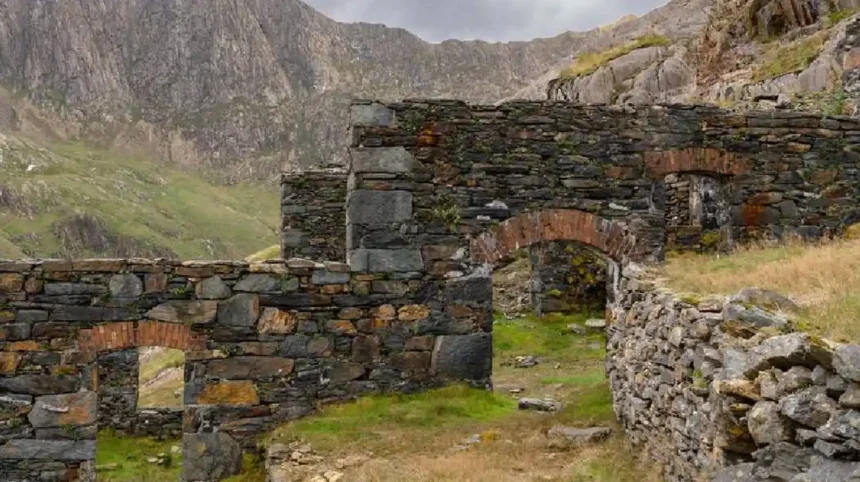
Geological history shaped these three landscapes: volcanic activity, glacial carving, and sedimentary deposits. Snowdon features sharp ridges formed by ancient volcanic eruptions. Cadair Idris displays a massive glacial cirque carved during the last ice age. Pen y Fan consists of old red sandstone layers deposited millions of years ago. These geological differences create three distinct visual experiences: jagged rocky peaks, deep crater lakes, and flat-topped plateaus. Understanding the geology enhances the appreciation of the environment.
How Long Is The Total Walking Distance?
The total walking distance for the challenge measures exactly 17 miles across three mountains: Snowdon, Cadair Idris, and Pen y Fan. This distance converts to 27.4 kilometres of active hiking. Participants must cover this horizontal distance alongside significant vertical climbs.
The total distance divides into three specific segments: 7.5 miles, 5.8 miles, and 4.4 miles. Snowdon requires the longest hike covering 7.5 miles up and down the mountain. Cadair Idris demands a 5.8-mile circular walk around a glacial lake. Pen y Fan offers the shortest leg at 4.4 miles on a well-maintained path. Hikers must sustain a strong walking pace across three gradient types: steep ascents, flat ridges, and rapid descents. Managing pace across these distances ensures completion within the target timeframe.
The 17-mile distance differs significantly from walking equivalent distances on flat terrain. Mountain miles require more energy due to three resistance factors: gravity, uneven footing, and wind resistance. A standard 17-mile flat walk takes approximately six hours. The mountain equivalent requires fifteen hours of active walking time. Participants experience severe strain on three lower-body areas: quadriceps, hamstrings, and knee joints. Maintaining a consistent speed prevents three common physical issues: muscle cramps, severe fatigue, and joint swelling.
The walking distance demands proper pacing strategies to prevent early exhaustion. Groups organize their speed into three pace categories: fast ascent, steady plateau, and careful descent. The final 4.4 miles often feel the longest due to cumulative fatigue. Participants track their distance using three specific tools: GPS watches, mobile applications, and traditional pedometers. Monitoring progress ensures the group reaches the final summit before total exhaustion occurs. The 17 miles represent a true test of human stamina.
What Is The Driving Route Between The Mountains?
The driving route covers 135 miles between three checkpoints: Llanberis, Minffordd, and Pont ar Daf. Drivers navigate the Cambrian Way through rural Welsh roads. The transit time requires approximately four hours and thirty minutes under standard national traffic conditions.
The vehicular journey serves as a mandatory rest period connecting the three peak locations: Llanberis, Minffordd, and Pont ar Daf. The first driving leg spans 57 miles from Eryri National Park to the base of Cadair Idris. This section typically takes one hour and thirty minutes to complete. The second driving segment covers 78 miles from Cadair Idris to the Brecon Beacons. This final transit requires approximately three hours of driving time. Teams often utilize three vehicle types: minibuses, private cars, and hired vans.
The route follows rural highways rather than high-speed motorways. Drivers must navigate three road hazards: narrow lanes, steep inclines, and slow agricultural vehicles. Navigation relies on the A470 road, which forms the primary north-to-south artery in Wales. Teams must factor in time for three logistical stops: refueling, eating meals, and changing clothing. Speed limits fluctuate frequently across three settlement types: small villages, market towns, and rural hamlets. Strict adherence to driving laws prevents delays and ensures team safety.
Drivers carry immense responsibility during the transit phases. The driving crew must maintain focus despite operating during three difficult periods: early morning, late afternoon, and late evening. The crew monitors three critical vehicle systems: fuel levels, tire pressure, and engine temperature. Participants sleep in the vehicles to recover energy for the next climb. A safe driving strategy prevents accidents on the winding Welsh roads. Proper vehicle preparation guarantees a smooth transition between the geographical points.
How Much Total Ascent Does The Challenge Involve?
The challenge demands a total vertical ascent of 2,334 metres across three climbs: Snowdon, Cadair Idris, and Pen y Fan. This measurement equals 7,657 feet of elevation gain. The climbing exceeds the Yorkshire equivalent despite featuring a shorter total distance.
The total elevation gain accumulates through three individual mountain ascents: 723 metres, 850 metres, and 761 metres. Snowdon contributes the smallest vertical climb if participants begin at Pen-y-Pass. Cadair Idris features the highest vertical gain from the Minffordd parking area. Pen y Fan requires a steep but steady climb from the Storey Arms elevation point. The combined ascent forces the cardiovascular system to operate under three stress conditions: high exertion, altitude variation, and prolonged output.
The total ascent surpasses the famous Yorkshire Three Peaks route. The Yorkshire challenge involves more walking distance but features less vertical climbing. Welsh participants face steeper gradients over three shorter distances: 7.5 miles, 5.8 miles, and 4.4 miles. The concentrated climbing taxes three specific muscle groups: calves, glutes, and lower back muscles. Hikers must utilize three climbing techniques: short steps, paced breathing, and steady rhythmic walking. Proper climbing mechanics reduce energy expenditure during the massive vertical gain.
The physiological impact of ascending 2,334 metres requires careful management. The body consumes massive amounts of oxygen during three peak effort zones: the Pyg Track incline, the Minffordd steps, and the Corn Du ascent. Heart rates elevate rapidly during these specific sections. Hikers prevent oxygen debt by taking three scheduled breaks: water stops, nutrition pauses, and brief stretching intervals. Managing the vertical effort ensures energy remains for the descent phases. The total climbing metric defines the true difficulty of the event.
What Are The Specific Route Paths For Each Mountain?
Hikers utilize three primary paths: the Pyg Track, the Minffordd Path, and the main tourist route. The Pyg Track ascends Snowdon. The Minffordd Path tackles Cadair Idris. The final tourist route leads to the summit of Pen y Fan.
The Pyg Track offers the most efficient ascent route for Snowdon. Participants start at an elevated car park, which removes several hundred metres of climbing. The path crosses rocky terrain before reaching the summit trig point. Descent usually occurs via the Llanberis Path, offering a gradual decline to the village. The Minffordd Path on Cadair Idris involves three terrain features: stone steps, a glacial lake basin, and a rocky ridge. This circular route requires significant scrambling near the summit.
The final peak uses the main path from the Pont ar Daf car park. This route provides a wide surface suitable for walking in darkness. The trail ascends steadily to the Corn Du ridge before reaching the Pen y Fan summit. Participants navigate three specific markers: a wooden bridge, a steep final pitch, and the National Trust summit sign. Descending the same path ensures a safe return to the transport vehicle. The chosen paths maximize safety across three risk factors: darkness, fatigue, and weather degradation.
What Gear And Preparation Do Hikers Need?
Participants require specific technical equipment including three clothing layers: base layers, insulating layers, and waterproof shells. Food supplies must include high-energy items. Hikers must carry three navigational tools: physical maps, compasses, and digital GPS devices for guaranteed safety.
Equipment choices dictate success or failure in the Welsh mountains. The mandatory packing list includes three footwear items: supportive hiking boots, wool socks, and blister prevention tape. Participants must carry sufficient hydration systems containing at least two litres of water. Nutrition plans require three macronutrient sources: complex carbohydrates, lean proteins, and simple sugars. A specialized medical kit must treat three common injuries: sprains, cuts, and severe blisters. Carrying unnecessary weight accelerates physical fatigue during the steep climbs.
Weather conditions on Welsh summits change rapidly without warning. Participants must carry three protective accessories: waterproof gloves, thermal hats, and neck gaiters. Darkness often factors into the final climb on Pen y Fan. Hikers require three illumination devices: primary head torches, backup torches, and spare batteries. Emergency shelters form a vital part of the safety equipment. The lead navigator must demonstrate proficiency using three map formats: waterproof paper maps, laminated route cards, and offline digital mapping applications.
How Does The Welsh Version Compare To The National Challenge?
The Welsh version requires 135 miles of driving compared to 462 miles for the National event. The total walking distance measures 17 miles instead of 23 miles. The total ascent reaches exactly 2,334 metres rather than 3,064 metres nationally.
The Welsh Three Peaks requires less driving time than the National challenge. Participants spend approximately four hours in vehicles rather than ten hours. The reduced transit time increases the focus on physical hiking rather than enduring long drives. The National event requires climbing three mountains: Ben Nevis, Scafell Pike, and Snowdon. The Welsh version localizes the effort entirely within the borders of Wales. Teams experience three logistical advantages: reduced fuel costs, less driver fatigue, and simpler vehicle scheduling.

The physical intensity differs between the two popular events. The National challenge requires more total walking distance and higher total elevation gain. The Welsh version presents a higher density of climbing per mile walked. Participants in the Welsh event face three steep ascents: the Pyg Track, the Minffordd steps, and the Brecon incline. The shorter timeframe prevents muscles from fully recovering during the brief transit periods. Both challenges demand three mental attributes: determination, resilience, and positive group morale.
What Are The Historical Records For Completion?
The fastest known time currently stands at seven hours and eleven minutes. Owain Jones achieved this supported record on May 17, 2024. The total duration includes three distinct activities: running the mountain trails, cycling between trails, and rapid transition phases.
Endurance athletes regularly attempt to set new completion records. The official timing includes every minute from the start of the first mountain to the finish of the third. Record attempts utilize three specific movement categories: unsupported, self-supported, and supported runs. A supported runner relies on a dedicated crew for three operational tasks: providing food, refilling water, and navigating the route. Owain Jones secured the overall fastest time using a support team. Unassisted runners carry all necessary equipment for the entire duration.
Athletes also record times for completing the challenge using bicycles instead of cars. Tom Gibbs set a cycling record of ten hours and fifty-three minutes in 2008. The cycling version demands 135 miles of road pedaling combined with 17 miles of mountain running. Competitors face three extreme physical demands: lactic acid buildup, caloric deficit, and sleep deprivation. Female athletes hold distinct category records for the route. Jo Meek completed the self-supported female record in exactly seven hours and thirty minutes.
What Are The Physical Fitness Requirements?
Success requires high cardiovascular endurance and specific leg strength. Participants must train using three specific methods: stair climbing, weighted hiking, and core stabilization exercises. Completing the event inside twenty hours demands continuous physical exertion across steep gradients and uneven terrain.
A standard training program requires a minimum of twelve weeks of preparation. Participants must build endurance through three weekly activities: long walks, cardiovascular gym sessions, and targeted strength workouts. Leg strength prevents catastrophic fatigue during the steep descent phases. The training must simulate three mountain conditions: steep angles, heavy backpacks, and poor weather. Completing local hill walks provides the best preparation for the actual event. Gym machines like the stair climber offer alternative training options for urban residents.
Inadequate fitness levels cause severe problems for entire teams. A slow participant extends the exposure time for the whole group. Extended exposure leads to three medical risks: hypothermia, severe dehydration, and physical collapse. Participants must practice consuming food while walking to maintain energy levels. A lack of training exposes three specific vulnerabilities: weak ankles, poor knee stability, and weak lower back muscles. Achieving peak physical condition guarantees a safe and successful completion of the mountain challenge.
FAQs About 3 Peaks Wales Challenge
How hard is the Welsh Three Peaks Challenge?
The Welsh Three Peaks Challenge ranks as a highly demanding physical event requiring excellent cardiovascular fitness. Participants must ascend over 2,300 metres within a single day. Proper training involving three key exercises: hill walking, stair climbing, and weight training remains essential for a safe completion.
How long does the Welsh Three Peaks Challenge take?
The standard target time to complete the challenge is exactly 24 hours. This duration includes approximately fifteen hours of active mountain hiking. The remaining nine hours account for the 135 miles of driving and the transition periods between the mountains.
How many miles is the Welsh Three Peaks Challenge?
The challenge requires exactly 17 miles of total active mountain walking. This physical distance converts to 27.4 kilometres of steep terrain. The driving portion adds an additional 135 miles of travel along the Cambrian Way connecting the three locations.
Which of the Welsh Three Peaks is the hardest to climb?
Snowdon generally ranks as the hardest peak due to its total elevation of 1,085 metres. It requires the longest walking distance of 7.5 miles. However, many participants find Cadair Idris physically harder because it features extremely steep stone steps immediately from the car park.
What is the best order to do the Welsh Three Peaks?
The traditional route begins in the north with Snowdon. Participants then drive south to tackle Cadair Idris in mid-Wales. The challenge concludes in the south with Pen y Fan, ensuring the easiest walking path occurs during the final exhausted phase in the dark.