Gower Wales is a peninsula located on the southern coast of Wales within the county borough of uk/local/swansea/">Swansea. It extends westward into the Bristol Channel and cover an area of approximately one hundred and eighty square kilometers in total. Gower Wales represents a distinct geographical peninsula projecting into the Bristol Channel on the south coast of Wales. The region falls under the administrative boundary of the City and County of Swansea. Geographically, it is bounded by the Burry Estuary to the north and Carmarthen Bay to the west. The landscape consists of a elevated limestone plateau terminated by dramatic sea cliffs, sandy bays, and tidal islands. The region was designated as the United Kingdom’s first Area of Outstanding Natural Beauty in nineteen fifty six.
- How did Gower Wales earn its historic conservation status?
- What are the primary geographical features of Gower Wales?
- What historic sites and ancient monuments exist in Gower Wales?
- Which beaches are the most notable across Gower Wales?
- What plant and animal species inhabit Gower Wales?
- How do human activities and agriculture shape Gower Wales?
- What outdoor recreational activities are available in Gower Wales?
- What conservation challenges face Gower Wales in the future?
- How can visitors responsibly access and explore Gower Wales?
- Frequently Asked Questions
The boundary begins east near Oystermouth and extends west to Worms Head at Rhossili. The physical geography comprises seventy miles of coastline containing varied geological formations, including carboniferous limestone cliffs, coastal salt marshes, and inland heathlands. The population remains distributed across small rural villages such as Reynoldston, Rhossili, Murton, and Bishopston. Transportation access relies primarily on the A4118 and B4271 roads connecting the peninsula to central Swansea. The peninsula functions as a critical environmental conservation zone housing multiple sites of special scientific interest, national nature reserves, and protected habitats.
How did Gower Wales earn its historic conservation status?
Gower Wales secured the designation of the United Kingdom’s first Area of Outstanding Natural Beauty in nineteen fifty six due to its extraordinary coastal geography, ecological diversity, intact rural heritage, and unique geological formations spanning seventy miles. The environmental preservation movement in South Wales gained significant momentum following the National Parks and Access to the Countryside Act of nineteen forty nine. Authorities identified the Gower Peninsula as an exemplary landscape combining rich ecological biodiversity with ancient cultural history. On July nine, nineteen fifty six, the Minister of Housing and Local Government officially signed the order declaring Gower an Area of Outstanding Natural Beauty. This landmark decision recognized the urgent need to protect the area from unregulated industrial expansion and modern urban sprawl.
The designation protected seventy square miles of diverse physical terrain including sea cliffs, sand dune systems, commons, and ancient woodlands. Conservation management passed to local municipal councils working alongside national environmental bodies such as the Natural Resources Wales. Over subsequent decades, statutory protections expanded to include five National Nature Reserves, three Ramsar wetland sites, and twenty four Sites of Special Scientific Interest. The historic status established a legal framework for strict planning regulations, preserving medieval field patterns, ancient archaeological monuments, and pristine coastal ecosystems for future research and low-impact public recreation.
What are the primary geographical features of Gower Wales?
Gower Wales contains three main geographical zones comprising dramatic southern limestone sea cliffs, extensive northern salt marshes along the Burry Estuary, and an undulating inland plateau featuring expansive heathlands, ancient woodlands, and traditional rural farmland. The physical landscape of Gower Wales divides into clear ecological and geological zones defined by underlying rock structures. The southern coast consists of carboniferous limestone sea cliffs reaching heights exceeding two hundred feet, punctuated by famous sandy embayments such as Oxwich Bay, Three Cliffs Bay, and Caswell Bay. These limestone formations exhibit extensive karst features, including sea caves, natural arches, and blowholes created by marine erosion over millions of years.
In contrast, the northern shoreline borders the Burry Estuary, characterized by vast intertidal mudflats and salt marshes such as Llanrhidian Marsh. These salt marshes provide feeding grounds for migratory waterfowl and support traditional saltmarsh lamb farming practices. The interior of the peninsula features elevated sandstone ridges, notably Cefn Bryn and Rhossili Down, which rise to over six hundred feet above sea level. These upland areas consist of unimproved commons covered in heather, gorse, and bracken, surrounded by lower agricultural fields. Water drainage occurs through short river valleys, known locally as pill valleys, such as Bishopston Valley, where streams flow through wooded limestone gorges before reaching the sea.
What historic sites and ancient monuments exist in Gower Wales?
Gower Wales contains over one thousand recorded archaeological sites spanning prehistoric burial mounds, Iron Age hillforts, medieval castles, and historic churches that document human habitation across thirty thousand years of regional history. Archaeological evidence confirms human occupancy in Gower Wales dating back to the Upper Paleolithic period. The most famous early site is Paviland Cave, located along the southern cliffs, where archaeologists discovered the skeleton known as the Red Lady of Paviland in eighteen twenty three. Radiocarbon testing dates this human burial to approximately thirty three thousand years before present, making it one of the oldest ceremonial burials in Western Europe.
The Neolithic period left prominent megalithic monuments across the landscape, most notably Arthur’s Stone, known locally as Maen Ceti, a massive capstone burial chamber situated on Cefn Bryn common. The Bronze Age and Iron Age added numerous earthworks, including cliff castles like Culver Hole and hillforts at Hardings Down and Llanmadoc Hill. Following the Norman conquest of Glamorgan in the late eleventh century, Anglo-Norman lords erected stone fortifications to control the peninsula. Notable medieval structures include Pennard Castle, Weobley Castle, Oxwich Castle, and Oystermouth Castle. The peninsula also features ancient ecclesiastical sites, such as Saint Madoc’s Church in Llanmadoc and Saint Rhiannon’s Church in Rhossili, which showcase early Christian architectural heritage.
Which beaches are the most notable across Gower Wales?
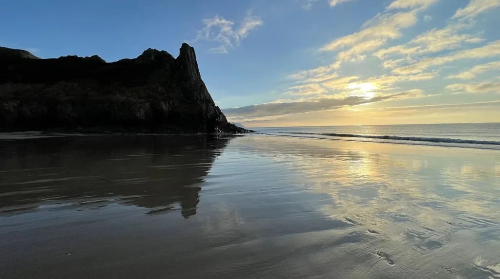
Gower Wales features iconic beaches including Rhossili Bay, Three Cliffs Bay, Oxwich Bay, Llangennith Beach, and Caswell Bay, each offering distinct coastal environments ranging from expansive sandy shorelines to protected swimming coves. Rhossili Bay occupies the westernmost tip of Gower Wales and features three miles of continuous sand backed by steep sand dunes and Rhossili Down. At the southern end of Rhossili Bay lies Worms Head, a tidal island accessible only during a two-hour window on either side of low tide. Three Cliffs Bay presents a complex estuarine landscape featuring three pointed limestone cliffs, sand dunes, and the meandering Pennard Pill stream. Oxwich Bay stretches over two miles along the southern shore, featuring broad sands bordered by the Oxwich National Nature Reserve, which contains sand dunes, freshwater marshes, and woodlands.
Llangennith Beach forms the northern continuation of Rhossili Bay and serves as the primary surfing location in South Wales due to consistent Atlantic swells. Caswell Bay and Langland Bay lie closer to Swansea, featuring sheltered sandy beaches with rock pools, high accessibility, and seaside amenities. Port Eynon Bay offers a sheltered south-facing beach with historic limestone kilns and traditional maritime infrastructure. Mewslade Bay and Fall Bay offer isolated, steep-sided coves surrounded by limestone cliffs, accessible primarily via coastal footpaths.
What plant and animal species inhabit Gower Wales?
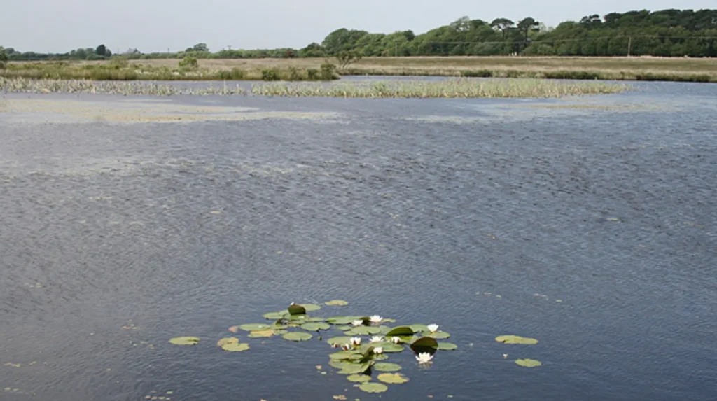
Gower Wales supports diverse ecosystems housing rare plant species like yellow whitlow-grass, marine mammals such as grey seals, bird populations including choughs and ospreys, and specialized wetland plants across its coastal sand dunes. The variety of habitats across Gower Wales allows a vast array of flora and fauna to thrive within protected nature reserves. The southern limestone cliffs host specialized maritime flora, including the rare yellow whitlow-grass, which grows almost exclusively on Gower sea cliffs within the United Kingdom. Sea lavender, thrift, and rock samphire cover the lower rock faces, while rare orchids grow across the coastal grasslands.
The coastal waters and rocky outcrops shelter marine mammals, including resident grey seals, harbor porpoises, and short-beaked common dolphins visible off Worms Head. Avian species are abundant across the peninsula, with red-billed choughs nesting along the southern sea cliffs and peregrine falcons hunting prey along the precipitous limestone ledges. The Burry Estuary on the northern shore forms a RAMSAR wetland site of international importance, wintering over forty thousand migratory waterfowl, including oystercatchers, curlews, and pintails. Inland, the sand dune systems at Oxwich and Whiteford support rare invertebrates, including the dune tiger beetle, along with specialized amphibians like the great crested newt residing in coastal freshwater pools.
How do human activities and agriculture shape Gower Wales?
Gower Wales maintains a traditional agricultural economy focused on arable farming, livestock grazing, saltmarsh sheep rearing, and seasonal tourism, governed by centuries-old common land grazing customs and environmental management policies. Human land use in Gower Wales remains closely tied to historic farming traditions and communal land management frameworks. Approximately fifty percent of the total land area is dedicated to active agriculture, primarily livestock grazing for cattle and sheep. The northern salt marshes support specialized saltmarsh lamb production, where livestock graze on vegetation flushed by tidal seawater, imparting distinct culinary characteristics to the meat.
The peninsula contains large expanses of registered common land, such as Fairwood Common, Cefn Bryn, and Welsh Moor. On these commons, local farmers known as commoners exercise ancient legal rights to graze livestock, collect fuel, and pasture horses. In addition to agriculture, tourism represents a dominant economic sector, drawing hundreds of thousands of day visitors and long-stay tourists to the area annually. Modern planning regulations enforce strict controls on development to preserve the rural character and protect historic field boundaries formed by ancient drystone walls and hedgerows. Balancing environmental conservation with agricultural productivity and tourist infrastructure remains a primary objective for local administrative bodies and conservation trusts.
What outdoor recreational activities are available in Gower Wales?
Gower Wales offers extensive recreational opportunities including long-distance hiking along the Wales Coast Path, Atlantic surfing at Llangennith, sea kayaking, rock climbing, coasteering, and wildlife observation along protected coastal reserves. Outdoor recreation forms a major component of public engagement with the natural environment of Gower Wales.
The Wales Coast Path encircles the entire perimeter of the peninsula, providing hikers with continuous access to thirty-nine miles of coastal scenery from Mumbles to Crofty. Trail runners and walkers utilize inland networks connecting ancient monuments, such as the Gower Way long-distance footpath running along the central sandstone ridge. Surfing is centered around Llangennith and Rhossili, where open Atlantic swells create consistent beach breaks suitable for novice and advanced surfers. Rock climbers utilize the southern limestone cliffs, which offer over one thousand established climbing routes across locations like Boiler Slab, Great Tor, and Rhossili Cliffs.
Water sports enthusiasts engage in sea kayaking, stand-up paddleboarding, and coasteering along the secluded coves and sea caves between Oxwich and Port Eynon. Birdwatchers and nature photographers utilize hides at Whiteford National Nature Reserve and the WWT Llanelli Wetland Centre nearby. Local outdoor centers provide guided excursions, ensuring that recreational activities adhere to environmental conservation guidelines to protect sensitive coastal ecosystems.
What conservation challenges face Gower Wales in the future?
Gower Wales faces ongoing conservation challenges including coastal erosion caused by climate change, visitor pressure on fragile sand dunes, habitat fragmentation, invasive non-native species, and balancing rural development with environmental protection. Managing the environmental integrity of Gower Wales requires addressing modern ecological threats and anthropogenic pressures. Climate change accelerates sea-level rise and increases storm intensity, causing severe coastal erosion along vulnerable dune systems at Oxwich, Port Eynon, and Rhossili Bay. Increased rainfall events impact soil stability and increase runoff into fragile estuary ecosystems, affecting water quality within the Burry Estuary. High visitor density during peak summer months creates localized environmental degradation, leading to footpath erosion, littering, and disturbance to cliff-nesting birds and marine wildlife.
Sand dune habitats face stabilization issues due to overgrowth, requiring active management like artificial notch creation to restore dynamic sand movement vital for specialized species. Invasive non-native plant species, such as Japanese knotweed and Himalayan balsam, threaten native plant biodiversity in river valleys and damp woodlands. Conservation bodies including Natural Resources Wales, the National Trust, and Swansea Council implement long-term coastal retreat strategies, habitat restoration projects, and sustainable traffic management plans to mitigate these environmental impacts and protect the ecosystem.
How can visitors responsibly access and explore Gower Wales?
Visitors explore Gower Wales using public bus networks from Swansea, designated parking facilities, marked coastal trails, and local visitor centers, while adhering to environmental codes that protect fragile ecosystems. Accessing Gower Wales responsibly involves utilizing established transport infrastructure designed to minimize environmental disruption across the peninsula. Swansea bus station operates regular public transit routes connecting central Swansea to major Gower destinations, including Rhossili, Port Eynon, and Oxwich Bay. Visitors arriving by private vehicle use designated pay-and-display parking areas managed by the National Trust and local authorities, preventing illegal parking on sensitive commons and narrow rural lanes.
Travelers navigating the coastal paths follow the Countryside Code by keeping dogs under close control to protect grazing livestock and ground-nesting birds. Tidal safety requires careful planning, particularly when crossing the causeway to Worms Head or exploring isolated coves during incoming tides. Visitor information centers at Rhossili and Mumbles provide updated tide tables, trail maps, and environmental safety guidelines. Camping and campervan parking are strictly limited to licensed campsites to prevent habitat damage and illegal waste disposal across protected heathlands. By respecting local conservation guidelines, visitors help preserve the physical environment and natural heritage of Gower Wales for future generations.
Frequently Asked Questions
What is the best month to visit Gower Wales for good weather?
The best time to visit Gower Wales for warm weather and clear skies is between June and August. During these summer months, daytime temperatures average around twenty degrees Celsius, making it ideal for coastal hiking and swimming. However, May and September offer milder weather with significantly smaller crowds along the main beach locations.
Can you walk across to Worms Head at any time of day?
No, you can only walk across the rocky causeway to Worms Head during a specific four-hour window during low tide. The causeway opens approximately two hours before low tide and closes two hours after. Visitors must check daily tide tables at the Rhossili coastguard station before crossing to avoid becoming stranded by incoming water.
Are dogs allowed on the beaches in Gower Wales year-round?
Dogs are welcome year-round on many Gower beaches, including Rhossili Bay, Llangennith, Mewslade Bay, and Oxwich Bay. However, seasonal dog restrictions apply on specific popular beaches such as Caswell Bay, Langland Bay, and Port Eynon from May 1 to September 30. Always check local signage at beach access points before entering.
Is public transport reliable for exploring Gower Wales without a car?
Public transport is available via daily bus services running from Swansea Bus Station to key villages like Rhossili, Port Eynon, and Oxwich. While routes cover major tourist sites, schedules are less frequent on Sundays and during winter months. Planning journey times in advance is necessary when relying solely on public buses.
Do you need to pay an entry fee to visit Gower Wales?
No, access to the Gower Peninsula and its beaches is entirely free of charge to the public. However, visitors traveling by car should budget for parking fees at popular coastal locations managed by the National Trust or local councils. Walking along the coastal paths and exploring nature reserves carries no entrance costs.