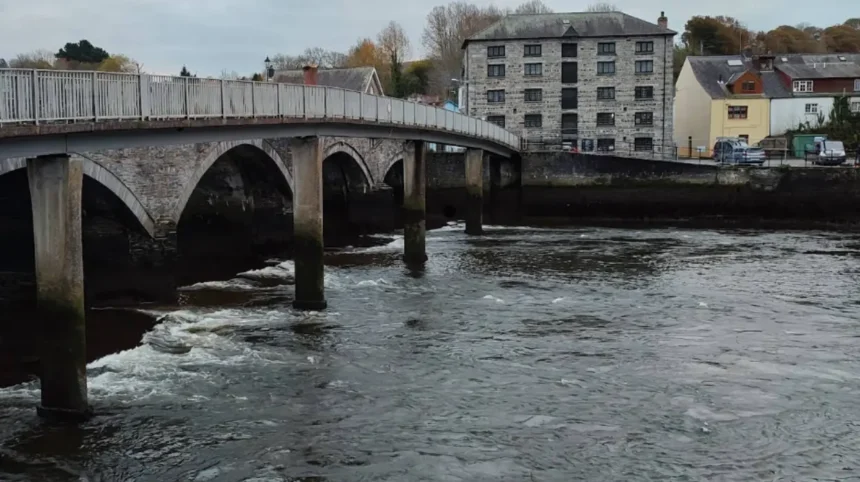
Cardigan, Wales features a maritime climate categorized as Cfb under the Köppen climate classification system. The region experiences cool summers, mild wet winters, and consistent year-round atmospheric moisture due to strong oceanic currents originating from the Atlantic Ocean.
Cardigan is a coastal town located in Ceredigion, West Wales, situated along the estuary of the River Teifi. The town lies adjacent to Cardigan Bay, which profoundly influences its local microclimate. The Gulf Stream, a warm Atlantic ocean current, plays a fundamental role in maintaining temperate environmental conditions throughout the calendar year. This prevailing ocean heat transfer prevents extreme temperature drops in winter while keeping midsummer heatwaves relatively rare compared to inland Europe. Atmospheric pressure systems moving east across the North Atlantic bring high levels of moisture, resulting in frequent cloud cover, rain showers, and notable maritime breezes. The surrounding land features, including the Preseli Hills to the south, alter localized airflow patterns, forcing moist air upwards to produce frequent orographic rainfall across the immediate area.
The overall temperature distribution in Cardigan remains narrow throughout all four calendar seasons. The average annual temperature hovers around 10 degrees Celsius, representing a standard temperate maritime baseline. Cold polar air masses occasionally penetrate the region during winter, but these events are usually moderated by proximity to seawater. Conversely, summer high pressure systems occasionally deliver periods of dry weather, though prevailing westerly winds frequently reintroduce maritime cloud layers. Relative humidity remains consistently elevated year round, often exceeding 80 percent on average. The interaction of atmospheric humidity, surface runoff from the River Teifi, and ocean temperature gradients creates a stable, damp, and moderate environmental ecosystem across Cardigan and its surrounding coastal settlements.
Understanding regional maritime atmospheric trends is critical when analyzing weather for Cardigan Wales. Maritime weather frameworks differ significantly from inland continental weather systems due to water possessing a higher specific heat capacity than land masses. This thermodynamic property means Cardigan retains warmth longer into late autumn and early winter, while coastal waters delay rapid heating during early spring. Consequently, seasonal shifts occur gradually rather than abruptly across Ceredigion. Local infrastructure, agriculture, and tourism sectors rely heavily on long-term tracking systems maintained by official meteorological services to evaluate these coastal weather mechanisms effectively.
What Are the Seasonal Temperature Averages in Cardigan Wales?
Spring temperatures in Cardigan average 11 degrees Celsius, summer averages reach 18 degrees Celsius, autumn temperatures decline to 12 degrees Celsius, and winter averages fall to 6 degrees Celsius, reflecting low annual temperature variability.
Winter in Cardigan spans from December through February, bringing the lowest seasonal temperatures of the year. Daytime highs during February, typically the coldest month, average around 8 degrees Celsius, while nighttime lows average approximately 4 degrees Celsius. Sub-zero temperatures occur on fewer than 15 days per year due to the insulating effects of Cardigan Bay. Frost is generally light and short-lived, concentrating in low-lying valleys along the River Teifi rather than directly on the coastline. Snowfall remains rare in Cardigan, averaging fewer than 3 days of settled snow per annum, as precipitation during cold snaps usually falls as sleet or cold rain.
Spring arrives slowly between March and May as maritime air masses begin their gradual seasonal warming cycle. March maintains cool conditions with daytime highs around 10 degrees Celsius. By May, daytime highs reach an average of 15 degrees Celsius, accompanied by an increase in daily sunshine hours. The transition period from April to May is historically characterized by the lowest monthly precipitation levels of the year. Soil temperatures begin to rise during this quarter, prompting vegetation growth across Ceredigion. However, nighttime temperatures can remain chilly, requiring ongoing monitoring by local agricultural operations sensitive to late spring ground frosts.
Summer spans June through August, representing the warmest period of the year in Cardigan. July and August experience peak maximum daytime temperatures averaging 19 degrees Celsius, with occasional peak heat events reaching 24 degrees Celsius during prolonged high pressure systems. Nighttime temperatures during summer remain mild, averaging around 12 degrees Celsius. Autumn extends from September to November, marked by a progressive reduction in daylight and temperature. September daytime highs average 16 degrees Celsius, dropping to 10 degrees Celsius by late November. Autumn brings increased thermal volatility as Atlantic storm cycles re-establish dominant control over western British coastlines.
How Much Rainfall Does Cardigan Wales Receive Annually?

Cardigan Wales receives approximately 1257 millimeters of annual rainfall distributed over 150 rainy days, with peak precipitation occurring during late autumn and early winter months driven by low-pressure frontal systems.
Rainfall in Cardigan is continuous throughout the year, though monthly accumulation rates vary across seasons. The wettest months of the year are October, November, and December. October records an average precipitation depth of 120 millimeters, while November and December frequently average over 130 millimeters of rain per month. These wet months coincide with heightened cyclonic activity in the North Atlantic, where atmospheric low-pressure systems push saturated frontal bands directly across Cardigan Bay. Rain events during this timeframe can persist for several consecutive days, contributing to significant water accumulation in the River Teifi catchment basin.
In contrast, late spring represents the driest operational window for the region. May records the lowest average monthly accumulation, receiving approximately 80 millimeters of rainfall across 15 precipitation days. April and June also demonstrate lower overall rainfall totals, averaging between 70 and 85 millimeters per month. Despite lower accumulation figures during spring, complete droughts are exceptionally rare in West Wales. Precipitation during summer shifts from continuous stratiform rainfall to shorter, isolated convective showers, which often clear rapidly to reveal open skies.
The geographic positioning of Cardigan contributes directly to its precipitation mechanics. As moist air masses sweep inward from Cardigan Bay, they encounter coastal land elevations that trigger updrafts, cooling the air and inducing condensation. This process produces steady precipitation across coastal Ceredigion. Understanding these rain patterns is essential for visitors planning outdoor activities or exploring localized transport infrastructure. High precipitation volumes maintain the lush green landscapes typical of West Wales, fueling coastal ecosystems, temperate rainforest habitats, and agricultural output throughout the year.
What Are the Wind Patterns and Coastal Weather Effects in Cardigan?
Prevailing westerly and south-westerly winds sweep off Cardigan Bay at average speeds of 15 to 22 miles per hour, generating significant coastal wind chill and frequent atmospheric shifts.
Wind patterns in Cardigan are dominated by westerly and south-westerly flow directions driven by global atmospheric circulation cells. Positioned on the edge of Cardigan Bay, the town lacks major physical land barriers to the west, exposing it directly to maritime winds. Average wind speeds range from 12 miles per hour during summer months to over 22 miles per hour during winter storm seasons. Gale-force winds exceeding 40 miles per hour occur periodically between November and March when deep Atlantic low-pressure systems pass across the British Isles.
Coastal atmospheric interactions generate localized microclimates around Cardigan and adjacent coastal spots like Poppit Sands and Gwbert. Sea breezes are common on sunny summer afternoons, occurring when solar radiation heats the land faster than the sea. This temperature differential pulls cooler maritime air inland, lowering coastal temperatures by 2 to 3 degrees Celsius compared to locations further up the Teifi Valley. Sea fog, locally known as a fret, can form rapidly during late spring and early summer when warm air masses move over cooler ocean waters, drastically reducing visibility along the coastline within minutes.

These atmospheric forces directly shape coastal dynamics, wave conditions, and erosion rates along the Ceredigion coast. Wind-driven wave action in Cardigan Bay creates dynamic marine conditions that influence maritime transport, commercial fishing, and recreational coastal usage. The combination of wind force, ocean spray, and high atmospheric salt content requires specialized structural engineering and maintenance protocols for coastal buildings and public infrastructure in Cardigan.
How Does Weather in Cardigan Affect Local Tourism and Outdoor Activities?
Optimal weather conditions for tourism occur between June and August, featuring peak daylight hours of up to 16 hours, higher temperatures, and lower average monthly precipitation levels.
The local economy of Cardigan relies heavily on seasonal tourism, which correlates directly with annual weather transitions. Summer provides favorable environmental conditions for beach visits, coastal walking along the Ceredigion Coast Path, and watersports in Cardigan Bay. Sea surface temperatures reach their annual maximum of 15 degrees Celsius during August, supporting wildlife watching excursions to view local bottlenose dolphin populations, grey seals, and seabird colonies. Extended daylight hours during June and July provide ample opportunities for outdoor recreation, with nightfall occurring after 21:00 GMT.
Spring and autumn attract visitors seeking quieter travel windows, though variable weather requires adaptable preparation. Spring offers blooming coastal flora and lower rainfall figures, making April and May suitable for hiking, historical site exploration at Cardigan uk/local/swansea/castle/">Castle, and rural touring. Autumn features changing foliage along the Teifi Valley, though visitors must prepare for increasing wind speeds and frequent rainfall events. The winter season sees a significant drop in leisure travel due to shorter daylight periods averaging 8 hours per day and colder, wetter atmospheric conditions.
Outdoor planners must monitor real-time meteorological updates due to the rapid weather transitions characteristic of West Wales. Sudden changes in wind speed, precipitation, and cloud cover can impact safety along coastal trails and water access points. Tourism operators typically align their core operational schedules with historical weather data, focusing major activities between late April and late September to optimize visitor experience and operational safety.
Frequently Asked Questions
What Is the Warmest Month to Visit Cardigan Wales?
July and August are the warmest months in Cardigan, Wales, with maximum daytime temperatures averaging 19 degrees Celsius. Sunshine hours peak during June, making summer the most suitable season for outdoor coastal activities.
How Often Does It Snow in Cardigan Wales?
Snowfall is rare in Cardigan due to the moderating effects of Cardigan Bay. Snow typically falls on fewer than 3 days per year and rarely settles on coastal ground for extended periods.
What Is the Wettest Time of Year in Cardigan?
The wettest period in Cardigan occurs between October and December. October records average precipitation of 120 millimeters, while November and December experience over 130 millimeters of monthly rainfall.
Is Cardigan Wales Always Windy?
Cardigan experiences consistent maritime breezes averaging 12 to 22 miles per hour due to its exposed location along Cardigan Bay. Stronger gales occur primarily during winter low-pressure cycles between November and March.