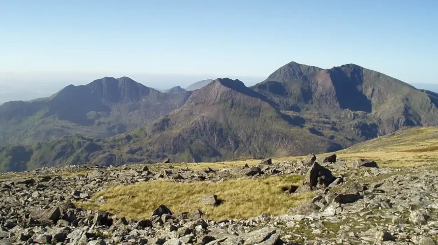
Yr Wyddfa, historically known as Snowdon, is the highest mountain in Wales and the highest point in Great Britain outside the Scottish Highlands. The peak stands at an official elevation of 1085 meters or 3560 feet above sea level. Located within Eryri National Park in Gwynedd, this geographical feature dominates the landscape of North Wales. The mountain consists of a vast massif with six distinct ridges extending from the central summit area. Geologists estimate the origin of the mountain to the Ordovician period over 400 million years ago, formed by volcanic activity and subsequent glaciation.
- What Is the Official Name of the Mountain and Why Did It Change?
- How Was Yr Wyddfa Formed Geologically?
- What Are the Main Walking Routes to the Summit?
- What Safety Measures Are Essential for Climbing the Mountain?
- What Is the History of the Snowdon Mountain Railway?
- What Unique Flora and Fauna Live on the Mountain?
- How Does Tourism Impact the Local Environment and Economy?
- Frequently Asked Questions
The summit area features a visitor center named Hafod Eryri which opens during the tourist season from late spring to early autumn. The Met Office provides dedicated mountain weather forecasts for the area due to rapid weather shifts at high altitude. Annual rainfall at the peak exceeds 4500 millimeters, making it one of the wettest places in the United Kingdom. The geographical prominence of Yr Wyddfa makes it visible from Ireland, the Isle of Man, and the Lake District under clear atmospheric conditions. Management of the summit and surrounding environment falls under the authority of Cyngor Gwynedd and Natural Resources Wales.
What Is the Official Name of the Mountain and Why Did It Change?
The official name of the mountain is Yr Wyddfa, pronounced uhr-with-vah, which translates from the Welsh language as the tumulus or burial mound. Legend links the name to the burial site of Rhitta Gawr, a mythical giant defeated by King Arthur. In November 2022, the Snowdonia National Park Authority formally voted to use the Welsh names Yr Wyddfa for the mountain and Eryri for the national park in all official communications. This administrative decision responded to a public petition containing over 5000 signatures requesting the official adoption of the original indigenous name.
The former English name Snowdon derives from the Old English words snow and dun, meaning snow hill. Historic documentation shows the name Yr Wyddfa in written records dating back to the thirteenth century. The official name restoration reflects broader Welsh Language Standards introduced under the Welsh Language Measure 2011 to protect cultural heritage. Public bodies across North Wales now exclusively utilize Yr Wyddfa on signage, publications, and digital mapping services. Visitors and international media organizations have adopted the official name in line with regional government guidance.
How Was Yr Wyddfa Formed Geologically?
Yr Wyddfa formed through complex geological processes involving ancient volcanism and massive glacial erosion over hundreds of millions of years. During the Ordovician period approximately 450 million years ago, the region lay beneath an ancient ocean known as Iapetus. Subduction processes caused violent underwater volcanic eruptions, creating layers of ash, tuff, and basaltic lava. These volcanic rocks formed the Snowdon Volcanic Group, which constitutes the main structural core of the mountain today. Fossilized marine organisms like brachiopods remain visible in sedimentary rock layers near the summit.
Subsequent tectonic movements during the Caledonian Orogeny uplifted the region, folding and faulting the volcanic rock layers into mountainous terrain. During the Last Glacial Period, which ended around 11500 years ago, massive glaciers carved deep U-shaped valleys, cwms, and sharp arêtes across the massif. The distinctive knife-edge ridge of Crib Goch and the deep glacial cirque of Cwm Llydaw formed through intense freeze-thaw weathering and ice movement. Modern geological surveys conducted by the British Geological Survey classify the terrain as an internationally significant example of glaciated volcanic landscape.
What Are the Main Walking Routes to the Summit?
Credit: Paul Glover
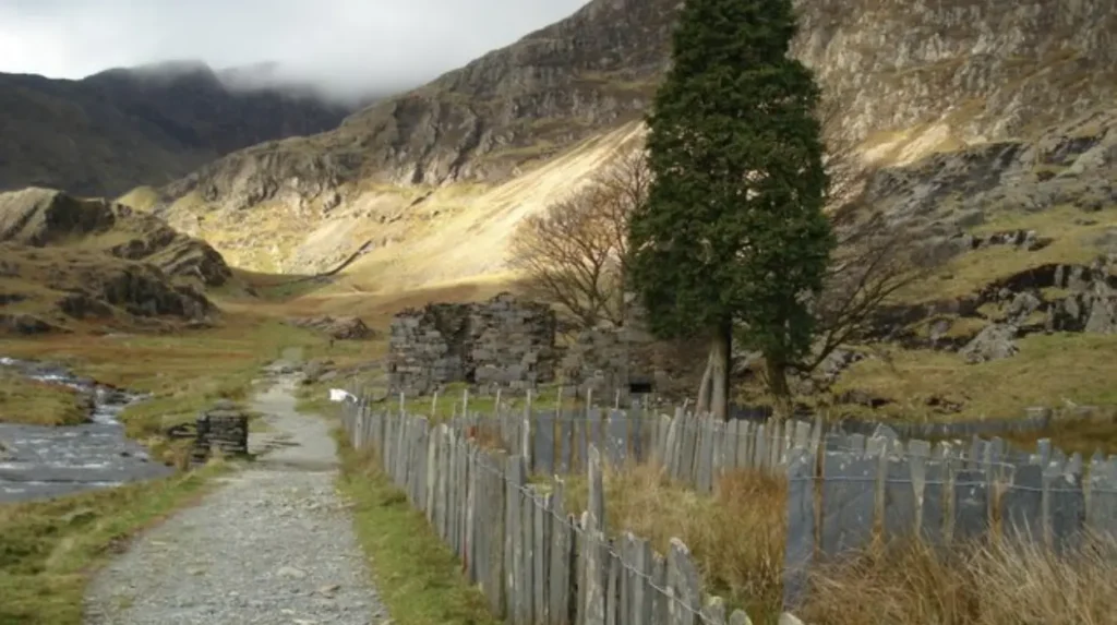
There are six principal walking paths that lead to the summit of Yr Wyddfa, each varying in distance, terrain, and technical difficulty. The Llanberis Path is the longest route at 14.5 kilometers round trip, featuring a gradual incline that follows the historic railway line. The Pyg Track covers 11 kilometers round trip, starting from Pen-y-Pass at an elevation of 359 meters and climbing steeply through Cwm Dyli. The Miners Track also begins at Pen-y-Pass, covering 13 kilometers round trip by passing the scenic lakes of Llyn Teyrn and Llyn Llydaw before merging with the Pyg Track.
The Watkin Path begins near Beddgelert at near sea level, requiring a total ascent of 1015 meters over 13.5 kilometers round trip, making it the most physically demanding path. The Rhyd Ddu Path approaches from the west over 12 kilometers round trip, offering broad views across the Nantlle Ridge over narrow rocky paths. The Snowdon Ranger Path starts at Llyn Cwellyn, spanning 13 kilometers round trip along an ancient route used by historic mountain guides. Route selection depends on personal fitness, weather conditions, and navigation skills, as all paths present mountain hazards.
What Safety Measures Are Essential for Climbing the Mountain?
Climbing Yr Wyddfa requires thorough preparation, appropriate outdoor gear, and careful monitoring of mountain weather conditions prior to departure. Llanberis Mountain Rescue Team responds to over 200 incidents on the mountain each year, making it the busiest search and rescue team in Great Britain. Hypothermia, navigation errors, and physical slips account for the majority of emergency calls handled by volunteer rescue personnel. Essential equipment includes waterproof jackets, sturdy hiking boots with ankle support, synthetic warm layers, emergency food, water, and an analog Ordnance Survey map with a magnetic compass.
Mobile phone signals remain unreliable across various valleys, cwms, and remote slopes of the mountain massif. Hikers should never rely solely on digital smartphone applications for navigation due to battery depletion in cold weather conditions. Winter conditions between November and April introduce hazardous ice and snow, requiring microspikes, crampons, and ice axes for safe travel. Park authorities recommend checking the daily local hazard forecast produced by the Mountain Weather Information Service before starting an ascent. Informing a responsible party on the ground regarding your planned route and estimated return time remains a vital safety protocol.
What Is the History of the Snowdon Mountain Railway?
The Snowdon Mountain Railway is a narrow-gauge rack-and-pinion mountain railway that has operated continuously from Llanberis to the summit since 1896. Construction of the railway began in December 1894, driven by private investor Richard Moon and local engineering teams using the Abt rack system. The line extends 7.5 kilometers in length, ascending 960 meters over an average gradient of 1 in 7.8, with the steepest section reaching 1 in 5.5. The railway construction required the excavation of two masonry viaducts and two deep rock cuttings through the mountain terrain.
On opening day, April 6 1896, locomotive number 1 Ladas suffered a derailment, resulting in the implementation of enhanced safety automatic braking systems across all rolling stock. Today, the railway operates a fleet of historic steam locomotives alongside modern diesel units engineered specifically for high-gradient mountain transport. The service carries over 140000 passengers to the summit building annually during its operating season from April through late October. The railway represents a Grade II listed historic engineering monument and remains the only public rack-and-pinion railway operating within the United Kingdom.
What Unique Flora and Fauna Live on the Mountain?
The high altitude environment of Yr Wyddfa supports rare arctic-alpine plant species and specialized wildlife adapted to harsh climatic conditions. The most famous botanical species is the Snowdon Lily, known scientifically as Lloydia serotina, an endangered arctic-alpine plant that flowers briefly in June on inaccessible rocky ledges. Other arctic-alpine plants inhabiting the cliffs include alpine saw-wort, mountain avens, and purple saxifrage, which represent remnants of the last ice age vegetation. The surrounding acidic heathland consists of ling heather, cross-leaved heath, bilberry, and specialized moss species.
Wildlife on the mountain includes hardy bird species such as the peregrine falcon, raven, ring ouzel, and northern wheatear nesting along steep rock faces. Feral goats graze the lower crags, maintaining historic herd populations that have inhabited the Gwynedd valleys for generations. The alpine lakes support populations of Arctic charr, a glacial relict fish species preserved in deep cold waters since the Pleistocene era. Conservation bodies enforce strict legal protections under the Wildlife and Countryside Act 1981 to prevent habitat degradation from trampling and unauthorized livestock grazing.
How Does Tourism Impact the Local Environment and Economy?
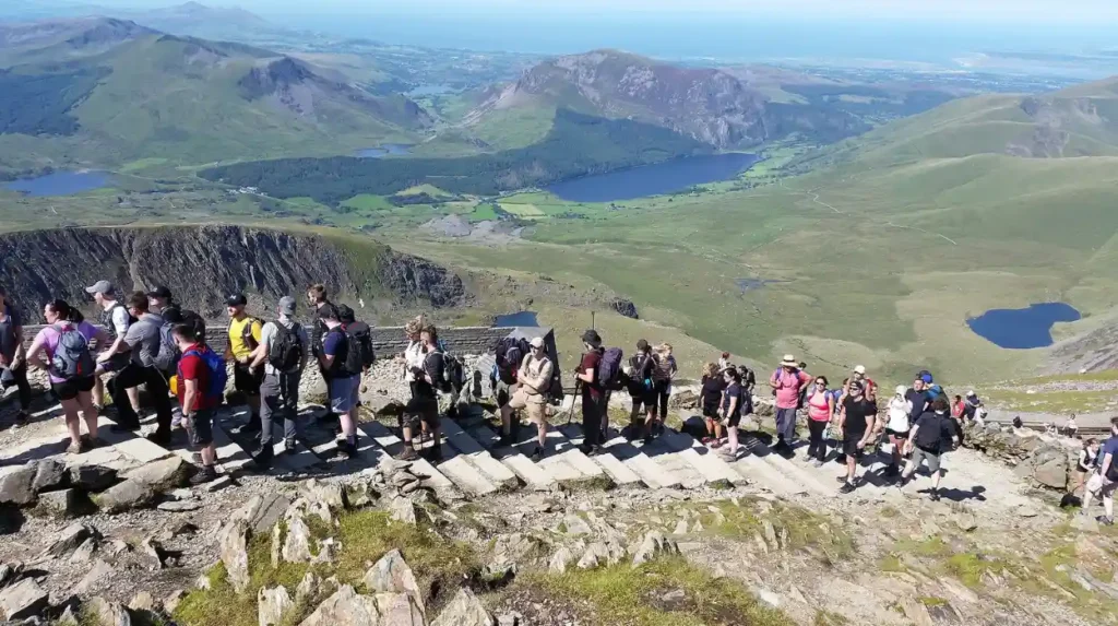
Tourism surrounding Yr Wyddfa generates substantial economic value for North Wales, supporting local hospitality, transportation, and retail sectors throughout Gwynedd. More than 600000 hikers reach the summit each year, making it one of the most heavily visited mountains in Europe. Tourism spending within Eryri National Park contributes hundreds of millions of pounds annually to regional business ecosystems and sustains thousands of local employment opportunities. Vacation rentals and accommodation services thrive in nearby settlements, including Llanberis, Beddgelert, Betws-y-Coed, and Caernarfon.
However, high visitor density creates significant environmental pressure, causing soil erosion along mountain paths, litter accumulation, and traffic congestion in narrow valleys. Parking management around key trailheads like Pen-y-Pass requires advance online reservation systems to reduce road gridlock along the A4086 highway. Conservation groups, including the Snowdonia Society, organize regular volunteer litter cleanup events to clear metric tons of waste from popular trails. Local councils reinvest parking revenues into sustainable transport links, such as the Sherpa’r Wyddfa bus service, to encourage public transit utilization.
Frequently Asked Questions
Which path is best for beginners climbing Yr Wyddfa?
The Llanberis Path is recommended for beginners due to its gradual gradient and clear terrain. It follows the railway line and offers a manageable climb over 14.5 kilometers round trip.
How long does it take to walk up and down Yr Wyddfa?
An average summit hike takes between 5 and 7 hours round trip depending on fitness levels and route choice. Weather conditions and crowd congestion near the summit can affect total walking time.
Can you take dogs on the mountain trails?
Dogs are permitted on all public paths across Yr Wyddfa but must remain under strict control or on leads. Grazing livestock and steep cliff edges present serious hazards to unrestrained animals.
Is the summit building always open to visitors?
The summit building Hafod Eryri opens only during the tourist season when the Snowdon Mountain Railway is operational. Severe weather or high winds force closure of the facility even during summer months.
Do you need to pay to climb Wales tallest mountain?
Access to all walking paths on Yr Wyddfa is completely free under public right of way laws. However, parking fees apply at major trailheads like Pen-y-Pass, Llanberis, and Rhyd Ddu.