Key Points
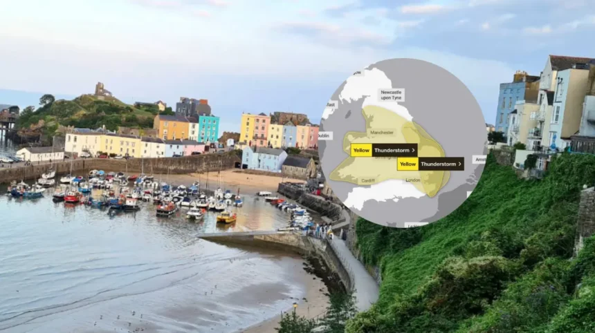
- The Met Office has issued a yellow thunderstorm warning for Wales as heavy rain and thunderstorms move north across the country.
- The warning covers Wales and wider parts of England on Thursday, August 27.
- Some areas could see 20–30mm of rain in around an hour, while isolated locations could receive more than 50mm in three hours.
- The Met Office said localised surface-water flooding, lightning and hail measuring 1–2cm are possible.
- Some showers and thunderstorms could become slow-moving during the afternoon and evening, leading to higher rainfall totals in affected areas.
- The heaviest weather could cause transport disruption, difficult driving conditions and short-term impacts for homes and businesses.
- Forecasters said the most severe conditions will not affect every area, but advised residents to follow the latest warnings and forecasts.
Wales (Wales Times) August 27, 2026 — a yellow thunderstorm warning has been issued as heavy rain and thunderstorms are forecast to move north across Wales, bringing the risk of localised flooding, lightning and hail.
- Key Points
- Which weather hazards are forecast across Wales?
- Where could flooding and disruption occur?
- How could the weather affect travel and daily activity?
- What has the Met Office said about the warning?
- Background: Why are thunderstorms developing over Wales?
- Prediction: How could the warning affect people in Wales?
The warning comes as a broad band of unsettled weather is expected to affect Wales through Thursday. The Met Office said the rainfall and thunderstorms may become slow-moving during the afternoon and evening, meaning some places could see prolonged or particularly intense downpours.
According to the national weather service, widespread rainfall totals of 20–30mm over three hours are possible in the warning area. In some places, up to 50mm could fall over 12 hours. The Met Office also said there is a small chance of more severe local totals, with more than 50mm of rain possible in three hours and more than 75mm possible over 12 hours, particularly across east-facing higher ground.
Wales247 reported that the forecast carries a risk of localised flooding, lightning and hail as the wet weather progresses northwards. Its report reflected the Met Office warning, which covers thunderstorms and heavy rain rather than a guarantee that severe conditions will affect every town or city.
The Met Office stated: “A broad band of thunderstorms and heavy rain will move north across England and Wales, perhaps becoming slow moving in the afternoon and evening.” The forecaster added that lightning and hail of 1–2cm could present further hazards.
The warning is yellow, the Met Office’s level intended to indicate that severe weather may cause disruption and that people should remain aware of forecast changes. The agency said the likelihood of impacts varies by location because thunderstorms can be highly localised, with some places missing the heaviest rain while nearby areas experience intense downpours.
Which weather hazards are forecast across Wales?
The principal risk is heavy rainfall over a short period. Surface-water flooding can develop when drains, roads and low-lying areas cannot cope with the intensity of rainfall. This can happen rapidly during thunderstorms, especially in built-up areas and in places where rain falls repeatedly over the same location.
The Met Office said rainfall of 20–30mm in less than an hour is possible in intense storms. It also warned that a few locations could receive 40–50mm in two to three hours during the earlier period of unsettled weather affecting England and Wales. Such rainfall levels can lead to flooding on roads and disruption to journeys.
Lightning is another named hazard in the warning. Thunderstorms can produce lightning with little notice, even where rainfall initially appears limited. Hail measuring between 1cm and 2cm is also possible, according to the Met Office.
In addition to rain, lightning and hail, the official forecast said a very small number of places could see strong gusts. The Met Office indicated that gusty winds were most likely to be a concern in southern England during the early part of Thursday, although changing weather conditions may affect the wider forecast picture.
The Met Office’s Wales regional forecast said rain and thunderstorms would continue moving north through the day, with a risk of localised flooding. It also linked the thunderstorms to warm and humid conditions that had increased the likelihood of heavy showers and longer spells of rain.
Where could flooding and disruption occur?
The warning applies to Wales, although its effects will not be uniform across the country. Areas beneath the most persistent or slow-moving thunderstorms face the greatest possibility of significant rainfall accumulation.
East-facing high ground was specifically identified by the Met Office as an area where exceptionally high rainfall totals were more likely. Rainfall can be enhanced in upland terrain, while run-off may then affect roads, streams and lower-lying communities.
Reporting on the warning for Gwent, the South Wales Argus said uk/local/newport/">Newport, Monmouthshire, Torfaen, Blaenau Gwent, Caerphilly and other areas in south-east Wales were included in the updated Thursday alert. The publication quoted the Met Office’s warning of 20–30mm locally in an hour, with 30–40mm more widely possible and up to 50mm in 12 hours.
Earlier reporting by WalesOnline said warnings issued across the two-day period affected 19 areas in Wales, with the warning period expanding on Thursday. That report highlighted the prospect of heavy downpours, lightning and flooding risk.
Residents should not assume that a lack of rain in the morning means their area will avoid disruption later in the day. Thunderstorms can form or intensify quickly, and the Met Office said the band of rain and storms could slow down during the afternoon and evening.
How could the weather affect travel and daily activity?
The Met Office said thunderstorms and heavy rain may lead to disruption. In practical terms, this can include longer road journeys where standing water develops, reduced visibility during intense downpours and delays to public transport if weather affects local routes or infrastructure.
Localised flooding can also affect pavements, underpasses, car parks and routes close to rivers or smaller watercourses. The potential for hail and lightning means outdoor work, sport and events may need to respond to rapidly changing conditions.
The Met Office’s public warning information advises people to monitor weather forecasts and warnings for their specific location. The agency’s warnings service covers a range of severe-weather risks, including rain, thunderstorms, wind, snow, ice, fog and lightning.
People travelling through Wales on Thursday may wish to allow additional time, check operator information before setting out and avoid attempting to drive through flooded sections of road. The risk will be greatest where storms are most intense, rather than necessarily across the whole warning area at the same time.
For households and businesses, the warning provides an opportunity to check local forecast updates, secure items that could be affected by hail or gusty winds, and remain alert to official advice if flooding develops nearby. These are precautionary measures, not an indication that all locations will experience flooding or storm damage.
What has the Met Office said about the warning?
The Met Office has emphasised the uncertainty inherent in thunderstorm forecasting. Many places may miss the heaviest storms, but locations that are affected could experience intense rainfall, lightning and hail.
In its warning, the Met Office said:
“Accumulations of 20-30 mm in three hours can be expected fairly widely and up to 50 mm in a 12 hour period can be expected in places.”
It added that there was a small chance of higher totals, particularly in east-facing high ground.
The weather service also said:
“Lightning and hail of 1-2 cm will also be hazards.”
In a weather update published on August 25, the Met Office said yellow thunderstorm warnings had been issued for parts of England and Wales as warm and humid conditions gave way to heavy rain, showers and thunderstorms.
The BBC also reported that yellow alerts had been updated as torrential downpours affected parts of England and Wales. Its weather coverage said the warning area included northern and eastern Wales, alongside north-west England, the Midlands and parts of eastern and southern England during the earlier warning period.
Background: Why are thunderstorms developing over Wales?
Thunderstorms are developing during a change from warm, humid conditions to a more unstable weather pattern. Warm and moisture-laden air can provide the conditions for heavy showers and thunderstorms when it is lifted and cools, allowing clouds to build rapidly.
The Met Office said the period of warm and humid weather was expected to give way to heavier rain and thunderstorms across parts of Wales and England. The forecast band is moving north, but its pace may slow later in the day. That matters because slow-moving showers can deposit substantial rainfall over a relatively small area.
The yellow warning does not mean severe impacts are certain across the whole of Wales. It signals a possibility of disruptive weather and identifies the hazards that could arise where thunderstorms develop or remain stationary.
Prediction: How could the warning affect people in Wales?
The warning is likely to affect commuters, road users, outdoor workers, event organisers, farmers and residents in locations vulnerable to surface-water flooding. The most immediate effects could be travel delays and local disruption where heavy rain falls in a short period.
Areas that receive persistent thunderstorms may face temporary flooding on roads and difficult driving conditions. Outdoor activities could be interrupted by lightning, hail and sudden downpours. However, because the forecast concerns localised thunderstorms, some communities may receive limited rainfall or no significant disruption.
The practical impact will depend on where the heaviest rain develops and whether storms become slow-moving during the afternoon and evening. People across Wales are likely to benefit from checking the latest Met Office warning for their area before travelling or making outdoor plans.