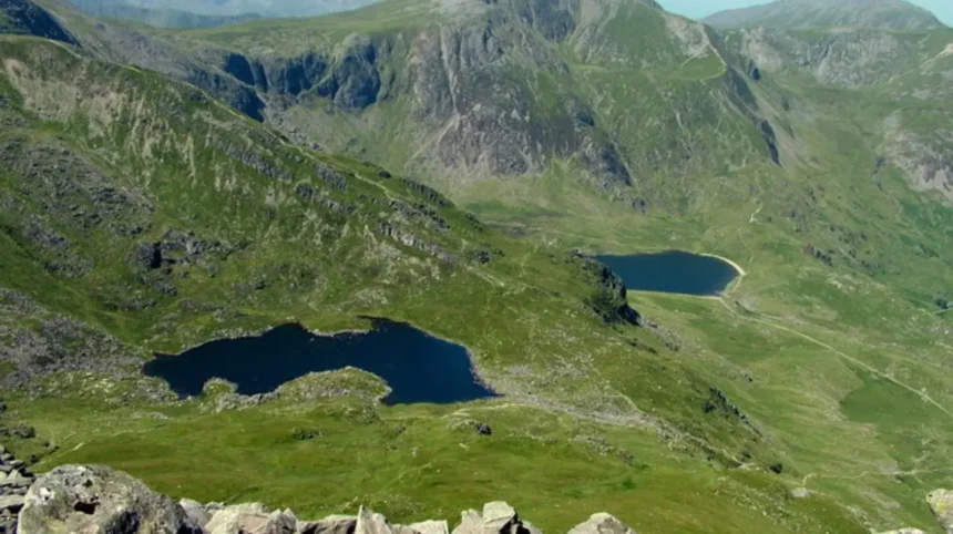
Y Garn is a mountain located in Snowdonia, North Wales, and it is a prominent part of the Glyderau mountain range. It stands at an elevation of 947 meters, which equals 3,107 feet above sea level. The name translates from Welsh to English as the cairn or the rock. It ranks as the tenth-highest peak in Wales and forms part of the prestigious Welsh 3000s challenge. The mountain features steep slopes, glacial cwms, and rocky terrain that attract hikers and geologists. Its summit provides expansive views of surrounding ranges, including Elidir Fawr and Glyder Fawr.
The geographical classification of Y Garn places it firmly within the Eryri National Park, historically known as Snowdonia, in Gwynedd. The mountain is bordered by the Ogwen Valley to the north and features prominent water bodies such as Llyn Idwal and Llyn Bochlwyd near its base. The geological composition of the Glyderau range consists largely of Ordovician volcanic rocks, formed millions of years ago through intense tectonic and volcanic activity. Glacial action during the last ice age carved out the steep amphitheaters of Cwm Idwal and Cwm Clyd, leaving behind dramatic cliffs, scree slopes, and moraines that define the current landscape.
Historical records indicate that the region has long been associated with pastoral farming, slate quarrying, and early mountaineering expeditions. Local communities utilized the lower slopes for sheep grazing, while industrial ventures in nearby Bethesda and Llanberis shaped the regional economy. Mountaineering history in the area expanded rapidly during the late nineteenth and early twentieth centuries as walking clubs mapped the Welsh peaks. The formation of the Snowdonia National Park in 1951 provided legal protection to the mountain environment, preserving its ecological and geological integrity for public recreation and conservation purposes.
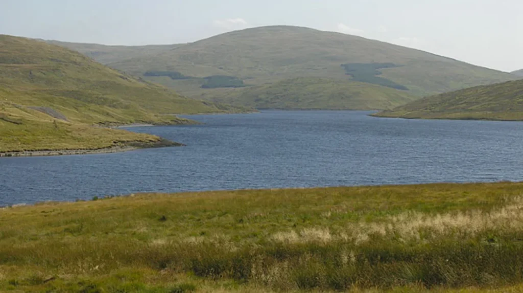
The structural characteristics of Y Garn include a broad stony summit plateau marked by a large wind shelter built from loose stones. The mountain connects via ridges to neighboring peaks such as Foel Goch to the northwest and Glyder Fawr to the southeast. Its eastern slopes drop steeply toward Llyn Idwal, creating a dramatic escarpment popular among technical walkers and scramblers. The western flanks descend more gently toward the Marchlyn Mawr reservoir, presenting a contrasting topography of smooth grassy slopes intersected by minor streams and erosion gullies.
Ecologically, the mountain supports fragile alpine and sub-alpine plant communities adapted to thin soils and harsh weather conditions. Protected flora species, including purple saxifrage, dwarf willow, and various high-altitude mosses, thrive in the sheltered crevices around Cwm Idwal. Bird species such as the peregrine falcon, raven, and occasional ring ouzel inhabit the rocky crags and cliffs. Conservation initiatives managed by Natural Resources Wales aim to combat habitat degradation caused by heavy foot traffic and grazing pressure, ensuring the survival of rare arctic-alpine vegetation remnants.
What Are The Primary Hiking Routes To The Summit Of Y Garn?
The primary hiking routes to the summit of Y Garn include the direct ascent from Ogwen Cottage via Twll Du and the longer circular trail incorporating the Marchlyn Mawr reservoir.
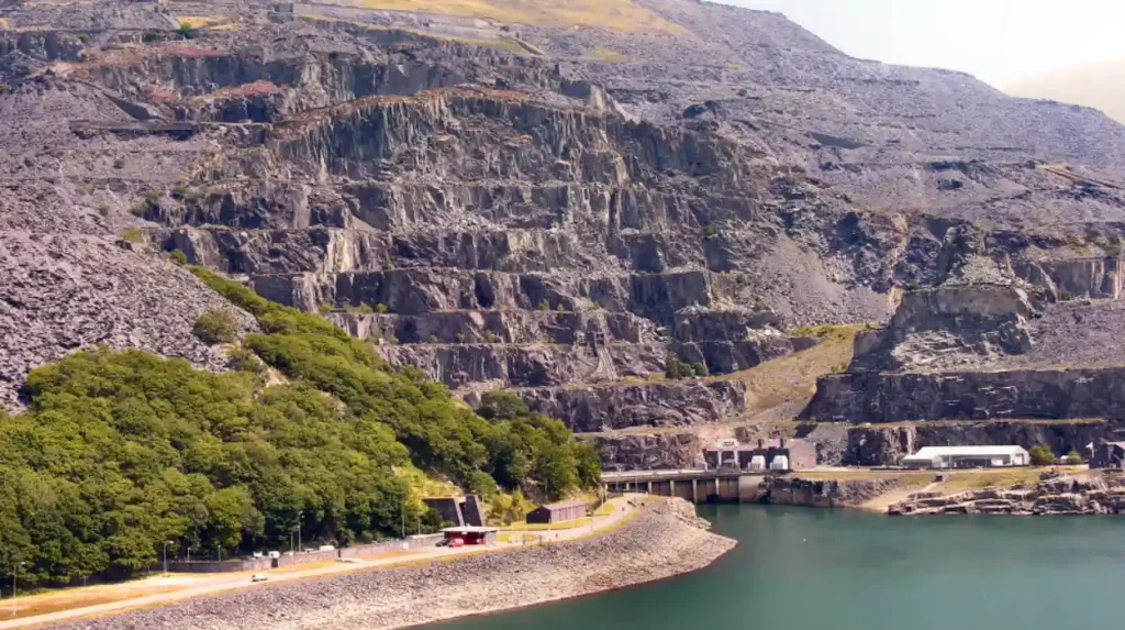
Hikers frequently choose the popular route starting near Ogwen Cottage by Llyn Ogwen, ascending alongside the gorge of Twll Du, also known as Devils Kitchen. This path involves a steep climb over rocky steps and pitched stone paths, requiring a solid level of physical fitness and appropriate footwear. Walkers pass the shores of Llyn Idwal before tackling the steep gully that leads directly onto the ridge connecting to the summit plateau. This route covers approximately four miles round trip and typically takes between three to four hours to complete under normal weather conditions.
An alternative route begins near the Marchlyn Mawr reservoir access road above Gerlan, offering a more gradual ascent up the western slopes of the mountain. This path minimizes early technical climbing by following farm tracks and grassy ridges before meeting the broad upper spine of Y Garn. The western approach provides sweeping views toward the Carneddau range and Anglesey on clear days, appealing to walkers seeking a less congested path. Both routes demand careful navigation skills, as mist and low cloud cover frequently descend upon the higher elevations with little warning.
Winter conditions introduce significant hazards to these routes, particularly on the east-facing slopes where snow and ice accumulate from October through May. Snow cornices frequently form along the ridgelines, creating unstable overhangs that require mountaineering axes, crampons, and winter navigation experience. Historical incidents in the area underline the necessity of respecting winter weather warnings issued by mountain rescue teams stationed in Bethesda and Llanberis. Walkers must check meteorological forecasts specifically tailored for the Welsh peaks before attempting any ascent during colder months.
Logistical planning for a hike up Y Garn involves considering parking availability at designated spaces along the A5 road near Llyn Ogwen or designated car parks further down the valley. Public transport options include seasonal Eryri Sherpa bus services connecting regional transport hubs like uk/local/bangor/">Bangor and Betws-y-Coed to the Ogwen Valley. Essential equipment guidelines recommend waterproof jackets, sturdy hiking boots, spare warm layers, navigation tools, and adequate provisions of food and water. Respecting the Countryside Code ensures that visitors close gates, take litter home, and avoid disturbing livestock or ground-nesting birds.
How Does Y Garn Fit Into The Wider Geography Of The Glyderau Range?
Y Garn fits into the wider geography of the Glyderau range as its western anchor, linking the dramatic central rocky peaks to the broader rolling hills of northern Snowdonia.
The Glyderau range comprises several iconic summits, including Glyder Fach, Glyder Y Felin, Tryfan, and Elidir Fawr, characterized by chaotic boulder fields and jagged rock formations. Y Garn contrasts slightly with its immediate neighbor Glyder Fawr by offering a smoother grassy western approach, yet shares the same dramatic, cliff-lined eastern aspect. The saddle between Y Garn and Glyder Fawr forms a high mountain pass situated above Llyn y Cwn, serving as a central crossroads for hikers traversing the multiple peaks of the range.
Geomorphological studies highlight that the Glyderau mountains were shaped by intense glacial erosion during the Devensian glaciation period. Glaciers carved deep valleys and deposited extensive morainic material across the valley floors, creating distinct ribbon lakes like Llyn Ogwen and Llyn Idwal. The rock strata underlying Y Garn consist mainly of acidic volcanic lavas and tuffs, which weather slowly and produce the characteristic stony soils found across the higher elevations of North Wales. These physical features contribute to the rugged aesthetic that distinguishes the region from neighboring mountain groups.
The relationship between Y Garn and adjacent watersheds dictates local hydrological patterns, channeling rainwater into major river systems such as the Afon Ogwen. Runoff from the western slopes feeds into the Marchlyn Mawr reservoir, which plays a crucial role in regional water management and hydroelectric power generation via the Dinorwig power station. Environmental monitoring agencies track water quality and flow rates in these mountain streams to protect aquatic habitats supporting native brown trout and Atlantic salmon further downstream in the primary river channels.
Regional conservation designations overlap across the Glyderau range, placing Y Garn within a designated Site of Special Scientific Interest and a Special Area of Conservation. These legal frameworks protect the unique geological outcrops and rare plant assemblages from industrial encroachment and unmanaged recreational development. Land management agreements between public authorities, National Park wardens, and private landowners balance public access rights with environmental preservation. Educational programs run by conservation charities utilize the area to promote awareness of upland ecology and responsible outdoor recreation.
What Safety Measures Are Essential When Climbing Y Garn?
Essential safety measures for climbing Y Garn include monitoring weather forecasts, carrying physical navigation backups, wearing proper footwear, and preparing for sudden temperature drops.
Mountain weather in Eryri changes rapidly, requiring hikers to carry waterproof garments, thermal base layers, hats, and gloves regardless of the season. Relying entirely on smartphone battery power for navigation poses a risk, making a paper Ordnance Survey map and a magnetic compass mandatory items for every excursion. Mountain rescue organizations in North Wales frequently respond to callouts involving lost walkers who encountered sudden fog, freezing rain, or injuries on steep descents. Registering planned routes with a reliable contact onshore adds an extra layer of personal security during remote backcountry hikes.
Physical conditioning is crucial due to the sustained steepness of the ascent routes, which can induce fatigue and increase the likelihood of missteps on loose scree. Walkers should pace themselves appropriately, maintain hydration, and consume high-energy food items throughout the duration of the trip. Trekking poles provide valuable stability when navigating uneven terrain, reducing stress on knee joints during the descent from the 947-meter summit. Group leaders must ensure that all members possess adequate physical stamina and gear to cope with unexpected delays or worsening environmental conditions.
Emergency preparedness involves knowing how to summon assistance if an accident occurs in remote areas lacking reliable cellular network coverage. Walkers should dial emergency services and ask for mountain rescue, providing accurate grid references or location coordinates whenever possible. Carrying a fully charged power bank, a whistle, a bivy bag, and a first aid kit enables hikers to manage minor injuries or shelter in place while waiting for professional rescue teams. Familiarity with standard distress signals ensures effective communication with overhead rescue helicopters or ground search parties.
Risk awareness extends to recognizing natural hazards such as loose rockfalls, steep drop-offs near cliff edges, and icy surfaces during colder months. Avoiding shortcuts down unstable scree slopes prevents erosion and minimizes the risk of dislodging rocks onto hikers positioned further down the trail. Respecting wildlife and livestock ensures that animals remain undisturbed, reducing potential conflicts during lambing seasons or periods of intense weather stress. Adhering to these established safety protocols guarantees a rewarding and secure mountain experience for all participants.
Frequently Asked Questions
What is the height of Y Garn in North Wales?
Y Garn stands at an elevation of 947 meters, which equals 3,107 feet above sea level. It is officially recognized as the tenth-highest mountain peak in Wales.
Where is Y Garn located geographically?
Y Garn is situated within Eryri National Park, formerly known as Snowdonia, in North Wales. It forms an integral part of the prominent Glyderau mountain range.How long does it take to hike Y Garn?
A standard circular walk up Y Garn from the Ogwen Valley takes approximately three to four hours to complete. The total duration depends on weather conditions, fitness levels, and chosen routes.
Is Y Garn difficult to climb for beginners?
The mountain features steep ascents and rocky terrain that require a good level of physical fitness and basic navigation skills. Beginners should prepare adequately with proper gear and check forecasts beforehand.
What mountain range does Y Garn belong to?
Y Garn belongs to the Glyderau mountain range in North Wales. It acts as a western anchor for the range, linking to neighboring peaks via high mountain ridges.