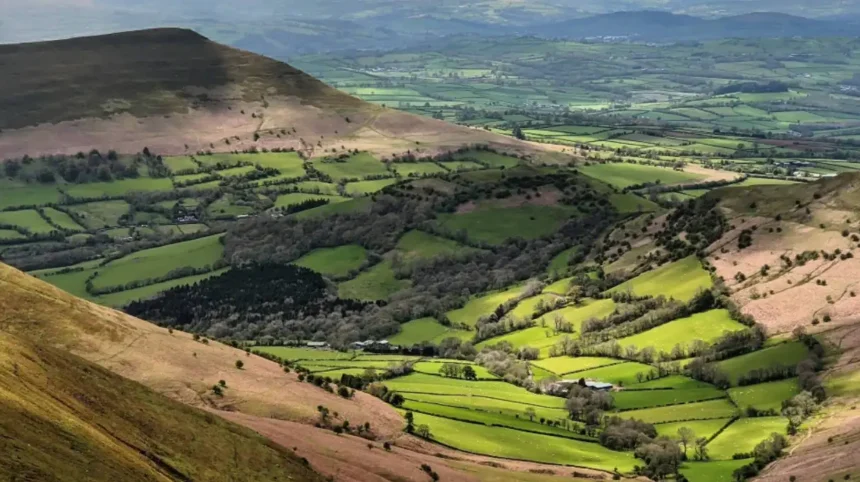
The Black Mountains form a prominent upland region positioned in the eastern sector of Bannau Brycheiniog National Park, extending across the border counties of Powys, Monmouthshire, and Herefordshire. This distinct mountain range features long linear ridges, deep glacial valleys, ancient red sandstone geology, and vast heather moorlands, offering outdoor enthusiasts exceptional hiking routes and historic sites.
The physical geography of the Black Mountains features a plateau structure carved by Devonian Old Red Sandstone deposits. Glacial erosion during the Last Glacial Maximum shaped parallel north-south valleys including Vale of Ewyas and Grwyne Fechan. The range covers approximately 80 square miles across the Welsh and English borderland. The central ridge system supports extensive acid grassland, blanket bog, and upland heath ecosystems. The highest summits rise above 800 meters, creating a distinct skyline visible across the Severn Estuary region. Hydrological networks feed major rivers including the River Usk and River Wye. Environmental designations classify large portions of the terrain as Sites of Special Scientific Interest and Special Areas of Conservation. Ancient woodland parcels remain preserved within sheltered lower valley floors.
The human history of the region extends back to the Mesolithic and Neolithic eras through documented archaeological structures. Bronze Age communities constructed stone circles, cairns, and burial mounds along high ridge routes. Iron Age tribes established hilltop fortresses including the settlement at Llanthony Camp. Medieval religious institutions transformed valley land management during the twelfth century. Prior to modern conservation initiatives, agricultural grazing patterns defined the landscape. Industrial expansion in adjacent South Wales valleys increased demand for upland timber and stone quarries. The establishment of the National Park in 1957 protected the landscape from excessive development. Modern land management balances active hill farming with conservation and sustainable tourism infrastructure.
What Is the Geography and Location of the Black Mountains Wales?
The Black Mountains sit in south east Wales and western England, spanning the county borders of Powys, Monmouthshire, and Herefordshire within the eastern section of Bannau Brycheiniog National Park.
The mountain range is bounded by major river valleys that delineate its geographical limits. The River Wye forms the northern boundary near the town of Hay-on-Wye. The River Usk defines the southern edge near Abergavenny and Crickhowell. The eastern boundary merges into the rural landscape of Herefordshire near Golden Valley. The western boundary is defined by the valley of the Afon Llynfi. Geologically, the region comprises Old Red Sandstone formations deposited during the Silurian and Devonian geological periods. Glacial movements carved deep valleys, creating characteristic flat-topped ridges known locally as ridges or spurs. The topography varies from gentle agricultural slopes to steep sandstone escarpments. Climatic conditions present higher precipitation rates and lower mean temperatures compared to surrounding lowlands.
The region supports distinct vegetation belts defined by altitude and soil hydrology. Lower valley slopes feature oak, ash, and hazel woodlands alongside managed pasture lands. Mid-altitude zones host bracken and dry heathland species including calluna vulgaris. High plateau areas support wet blanket bog ecosystems containing sphagnum moss and cotton grass. Wildlife species include birds of prey such as red kites, peregrine falcons, and buzzards. Ground-nesting species like red grouse and skylarks inhabit upper moorland habitats. Mammal populations feature otters in river corridors and wild ponies on common land. Acidic soils limit agricultural production primarily to extensive livestock grazing systems. Environmental stewardship programs protect these habitats from degradation caused by overgrazing or visitor pressure.
What Are the Highest Peaks and Topography in the Region?
Waun Fach stands as the highest peak in the Black Mountains Wales, reaching an elevation of 811 meters above sea level, surrounded by secondary summits including Pen y Gadair Fawr and Lord Hereford’s Knob.
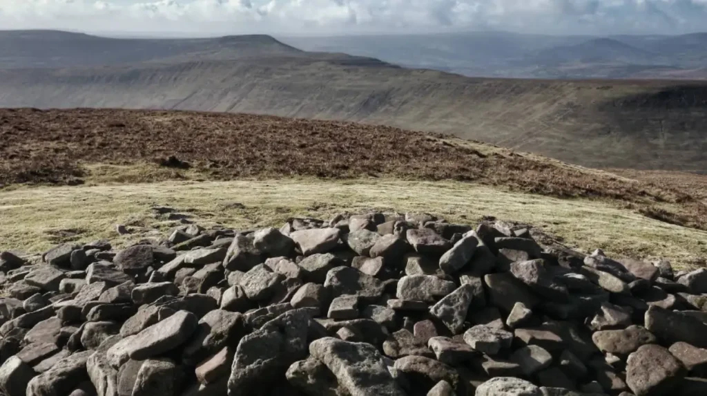
Waun Fach forms the central topographic high point of the range, offering wide views over the surrounding landscape. Pen y Gadair Fawr reaches an altitude of 800 meters, serving as the second highest point along the main ridge line. Rhyd y Grib achieves an elevation of 740 meters on the northern ridge system. Waun Leffen Castell stands at 713 meters, while Pen Cerrig-calch rises to 701 meters near Crickhowell. Hay Bluff reaches 677 meters, marking the prominent northern terminus overlooking the Wye Valley. Pen y Fan, located in the neighboring Central Beacons range, reaches 886 meters and serves as the highest point in South Wales. The tableland structure features steep escarpment faces facing north and west, with long gentle slopes running southward. Glacial corries, locally called cwms, indent several eastern slopes.
The physical terrain requires specific navigation skills due to rapid weather changes and featureless plateau areas. High ridges experience strong winds and persistent mist, lowering visibility across peat bog terrain. Upland paths consist of natural stone, exposed sandstone bedrock, and peat channels. Soil erosion control projects maintain key access routes to protect delicate vegetation. Slope gradients exceed thirty degrees along escarpment edges like Hay Bluff. Watercourses carve narrow gullies down sandstone faces, feeding into lower drainage basins. Summit plateaus retain standing water during wet seasons, forming blanket bogs. Mountain rescue teams log numerous callouts annually due to sudden weather shifts and navigational errors. Proper topographic maps and compass navigational tools remain essential equipment for all upland traversals.
What Historical Sites and Cultural Heritage Exist in the Region?
The region contains ancient historical landmarks including the twelfth-century Llanthony Priory, Neolithic burial tombs like Capel-y-ffin, and Iron Age hillforts scattered along elevated ridges.
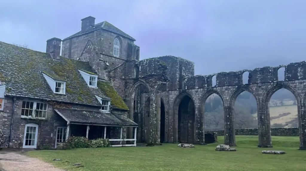
Llanthony Priory stands in the Vale of Ewyas as a Augustinian priory established in 1118. The site features original early English Gothic architectural ruins constructed from local sandstone. Tretower Court and uk/local/swansea/castle/">Castle showcases medieval residential architecture spanning the fourteenth through fifteenth centuries. Castell Dinas sits at an elevation of 450 meters, representing the highest castle site in Wales with Iron Age and Norman fortifications. Capel-y-ffin features an eighteenth-century church alongside ties to artist Eric Gill and modern monastic communities. Partrishow Church houses a preserved fifteenth-century carved oak rood screen and ancient holy well. Craswall Priory presents ruined structures of the rare Grandmontine monastic order near the English border. Hillforts like Crug Hywel dominate local spurs, showing strategic military planning from pre-Roman eras.
Cultural traditions link the landscape to Welsh folklore, literary heritage, and traditional land management techniques. The legendary physician traditions of Meddygon Myddfai connect regional botany with historical medicine. Authors including Bruce Chatwin set notable literary works like On the Black Hill within these border valleys. The Welsh language maintains strong cultural roots, reflected in local topographic place names. Commoners retain ancient grazing rights, pasturing sheep and Welsh mountain ponies on open hilltops. Local agricultural shows celebrate traditional livestock breeds and rural crafts annually. Religious heritage includes Quaker burial grounds and nonconformist chapels built during the eighteenth century. Historic trackways like the Gospel Pass served as medieval trading and pilgrimage corridors. Modern conservation efforts document these cultural sites to prevent structural decay from environmental exposure.
What Are the Best Hiking Trails and Outdoor Activities?
The Offa’s Dyke Path National Trail and the Beacons Way offer premier long-distance hiking routes through the mountain range, alongside popular day walks up Hay Bluff and Sugar Loaf mountain.
Offa’s Dyke Path covers 177 miles along the border, with a scenic section running along the eastern ridge of the range. The Beacons Way spans 99 miles across the entire national park, crossing major peaks including Waun Fach. The circular walk up Sugar Loaf mountain near Abergavenny spans 4.5 miles and ascends to 596 meters. The Llanthony Priory to Waun Fach loop measures approximately 10 miles, navigating steep valley ascents and open ridge lines. The Dragons Back route from Talgarth covers 7 miles along a series of dramatic grassy mounds leading to Castell Dinas. Hay Bluff summit walks cover 3 miles from the Gospel Pass car park, presenting accessible upland views. The Grwyne Fawr Reservoir route offers a 9-mile walk through remote pine forestry and open valley terrain.
Outdoor recreation extends beyond hillwalking to include mountain biking, horseback riding, trail running, and gliding. Mountain biking networks near Talgarth and Crickhowell feature designated bridlewys and technical single-track trails. The Black Mountains Gliding Club operates from airfield sites near Talgarth, utilizing ridge soaring wave winds. Horse riding centers in the Vale of Ewyas provide guided trekking along ancient green lanes and bridle paths. Rock climbing sites exist on small limestone and sandstone outcrops along lower valley borders. Wild camping guidelines require explicit landowner permission, though official campsites operate in major valleys. Stargazing is popular due to dark sky reserve status granted to Bannau Brycheiniog National Park in 2013. Winter conditions allow for winter walking when snow covers high ridges.
How to Plan a Visit to the Region?
Visiting the Black Mountains Wales requires planning around seasonal weather patterns, selecting suitable base towns such as Hay-on-Wye or Crickhowell, and arranging vehicle or public transit options.
Hay-on-Wye sits at the northern edge, renowned globally as a literary town with extensive accommodations and services. Crickhowell rests on the southern boundary along the River Usk, offering access to southern peaks and trails. Abergavenny provides major rail connections via the Welsh Marches Line and serves as a gateway town. Talgarth provides access to western ridges and features historical restored watermills. Transport options include the A40 trunk road connecting eastern and western transit corridors. Local bus services link main market towns, though rural valley access requires private vehicles or taxis. The Gospel Pass provides a paved mountain road link between Hay-on-Wye and Llanthony Valley, reaching 549 meters. Accommodation options range from historic inns and bed and breakfasts to rural campsites and holiday cottages.
Seasonal weather requires specific packing and safety preparations for all outdoor activities. Summer months bring longer daylight hours and mild temperatures averaging 18 to 22 degrees Celsius. Winter conditions bring freezing temperatures, ice, heavy rainfall, and occasional deep snow on summits. Essential gear includes waterproof jackets, sturdy hiking boots, thermal layers, and detailed OS Explorer Map OL13. Mobile phone coverage remains patchy or nonexistent in deep valleys like Grwyne Fechan. Visitors must observe the Countryside Code by closing gates, keeping dogs under control, and packing out trash. Emergency assistance is requested by dialing 999 and asking for Mountain Rescue. Local tourist information centers in Hay-on-Wye and Crickhowell provide updated weather bulletins and trail conditions. Sustainable travel initiatives encourage electric vehicle use through expanding valley charging stations.
Frequently Asked Questions
What is the difference between the Black Mountain and the Black Mountains?
The Black Mountains refer to the extensive mountain range in the eastern sector of Bannau Brycheiniog National Park. The Black Mountain refers to a single, distinct upland massif located in the far western sector of the national park.
Where is the best place to park for hiking in the region?
Popular parking areas include the Gospel Pass car park near Hay Bluff, the Llanthony Priory car park in the Vale of Ewyas, and the Sugar Loaf car park near Abergavenny. These locations provide direct trail access to major summits.
Are dogs allowed on hiking trails in the region?
Dogs are permitted on public rights of way throughout the range, but owners must keep them under close control or on leads. Open moorlands contain free-roaming sheep, mountain ponies, and ground-nesting birds vulnerable to disturbance.
Can you drive through the mountain pass?
Drivers can travel through the Gospel Pass, which is the highest pass in Wales with an elevation of 549 meters. The narrow single-track road features passing places and links Hay-on-Wye directly to the Llanthony Valley.
What is the closest train station to the area?
Abergavenny train station serves as the primary rail gateway to the southern border of the range. Regular train services connect Abergavenny to Cardiff, Newport, Manchester, and London via Hereford.