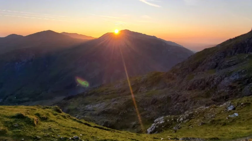
Yr Wyddfa is the highest mountain peak in Wales, measuring 1,085 meters above sea level within Eryri National Park in Gwynedd. The summit features dramatic glacial landforms, steep ridgelines, and high sub-alpine weather exposure.
Yr Wyddfa, historically designated as Mount Snowdon, serves as the central topographic mass of the Snowdon massif in North Wales. Eryri National Park surrounds this peak, protecting over 820 square miles of mountainous terrain. Glacial erosion shaped the mountain during the last Ice Age, forming deep cirques and sharp arêtes such as Crib Goch. The geological composition consists primarily of Ordovician volcanic ash, slate, and basaltic lava flows. This combination creates rugged cliff faces and nutrient-poor soil zones across the high elevations. More than 600,000 visitors make the ascent to the peak annually, making it one of the most frequented summits in the United Kingdom.
The mountain environment maintains a complex sub-alpine ecosystem with protected native plant species like the Snowdon Lily. High precipitation rates average over 4,500 millimeters annually across the upper slopes, feeding major glacial lakes including Llyn Llydaw and Llyn Glaslyn. Temperature lapses average a drop of 1 degree Celsius per 100 meters of elevation gained. Peak weather conditions remain unpredictable year-round, frequently generating severe gale winds, heavy cloud covers, and freezing rain. The mountain ecosystem requires strict conservation measures managed by the Eryri National Park Authority to prevent soil erosion along popular access corridors.
What historical routes and milestones define human activity on the mountain?
Human usage of Yr Wyddfa spans centuries, evolving from copper and slate mining operations into early Victorian tourism and modern alpine mountaineering. Historical landmarks include 19th-century industrial ruins, early guidebook paths, and railway infrastructure.
Industrial resource extraction shaped the early human footprint across the mountain slopes. Copper mining operations began in the 18th century, concentrating around Cwm Dyli and Llyn Llydaw. Miners constructed engineered stone tracks to haul ore down the mountain using horse-drawn carts. The Miners Track retains these historic structures, including stone crushing mills and abandoned incline planes. Victorian tourism accelerated during the 1800s following the release of regional travel guidebooks. Early tourists hired local guides to navigate the mountain paths on foot or on pony back.
Sir Edward Watkin opened the Watkin Path in 1892 as a purpose-built tourist track, marking a key milestone in public outdoor access. Prime Minister William Gladstone officially opened this trail, addressing a crowd of over 2,000 people at Gladstone Rock. The Snowdon Mountain Railway began operations in 1896, running a rack-and-pinion steam train system from Llanberis to the summit station. Modern conservation projects focus on path maintenance to protect historic heritage while managing environmental degradation. The National Park Authority continually restores stone pitching along high-traffic routes to preserve historical pathways against heavy foot traffic.
What are the six main walking paths to the summit?
Six established footpaths lead to the summit of Yr Wyddfa, each varying in distance, total elevation gain, technical difficulty, and starting location. These primary routes include Llanberis Path, Pyg Track, Miners Track, Watkin Path, Rhyd-Ddu Path, and Snowdon Ranger Path.
The Llanberis Path is the longest route, spanning 14.5 kilometers round trip with an elevation gain of 975 meters. It follows a gradual gradient parallel to the mountain railway, making it the most accessible path for beginner hikers. The Pyg Track covers 11 kilometers round trip, starting from Pen-y-Pass at an initial elevation of 359 meters. This path involves rough, rocky terrain and 726 meters of vertical ascent. The Miners Track starts from Pen-y-Pass, following a wide flat path past glacial lakes before climbing steeply to join the Pyg Track below the summit ridge.
The Watkin Path begins near Nant Gwynant at 60 meters above sea level, presenting the largest elevation gain at 1,015 meters over 13 kilometers. Its final section consists of a steep, loose scree slope requiring careful foot placement. The Rhyd-Ddu Path ascends from the western side over 13 kilometers round trip, gaining 890 meters along a narrow exposed ridge called Bwlch Main. The Snowdon Ranger Path starts at Llyn Cwellyn, covering 13 kilometers with 936 meters of ascent via a series of wide zig-zags over grassy slopes. Grade scrambles like Crib Goch exist as advanced technical mountaineering routes separate from the six main walking paths.
What equipment and preparations are required for a safe ascent?
Safe mountain navigation requires specialized hiking boots, layered weather-resistant clothing, accurate physical maps, reliable navigation devices, and adequate nutrition. Inadequate preparation remains the leading cause of search and rescue deployments on the mountain.
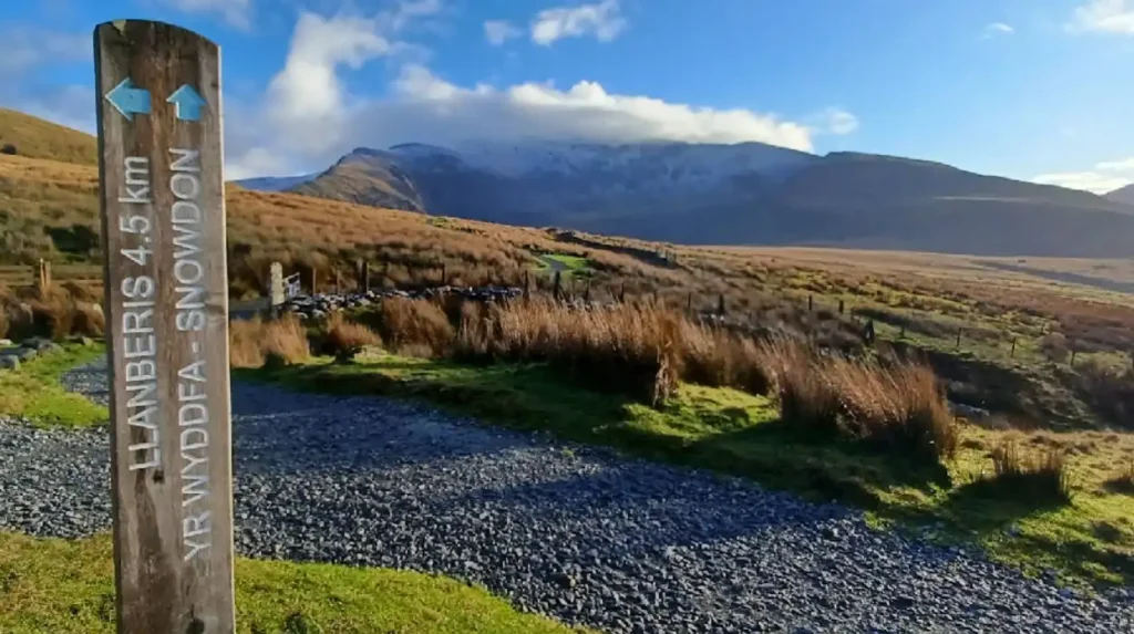
Footwear must consist of structured hiking boots featuring deep lugged soles and ankle support. Standard athletic sneakers lack grip on wet slate and offer zero protection against ankle sprains on loose rock scree. The layering system requires a moisture-wicking base layer, an insulating fleece mid-layer, and a fully waterproof, windproof outer shell jacket and trousers. Cotton garments retain moisture and accelerate hypothermia risks, making synthetic or merino wool materials mandatory. Synthetic insulation helps regulate body temperature as physical exertion fluctuates during steep climbs.
Navigation tools must include a physical Ordnance Survey map (OS Explorer OL17) alongside a magnetic compass. Digital navigation applications serve as secondary aids, as low temperatures rapid-drain mobile device batteries, and steep cliff terrain degrades satellite signals. Physical preparation involves building cardiovascular endurance through hill walking or step training. Hikers must pack a minimum of 2 liters of water per person, alongside high-energy food items containing complex carbohydrates and electrolytes. A 200-lumen headlamp, a whistle, a fully charged mobile phone, and a first-aid kit form the baseline safety gear required in every backpack.
How do seasonal weather patterns impact climbing conditions?
Seasonal variations drastically alter mountain conditions, shifting the summit environment from mild summer trekking to hazardous winter mountaineering. Weather systems change rapidly due to the mountain’s coastal proximity to the Irish Sea.
Summer months between June and August bring long daylight hours and average temperatures ranging from 10 to 16 degrees Celsius at lower elevations. Summit temperatures remain significantly lower, often accompanied by dense cloud cover that reduces visibility to under 10 meters. High foot traffic during summer creates heavy congestion along narrow trail sections. Autumn introduces frequent Atlantic rain fronts, bringing sustained high-velocity winds exceeding 50 miles per hour across exposed ridgelines like Bwlch Main and Crib Goch. Waterlogged trails, slippery rock slabs, and stream crossings become standard hazards during this period.
Winter conditions from November through April transform the upper sections into alpine environments requiring specialized ice axes, crampons, and winter mountaineering skills. Snow packs freeze into solid ice fields along steep slopes, particularly on the upper section of the Pyg Track and the Watkin Path scree. Temperatures on the summit frequently drop below freezing, with wind chill factors pushing real-feel values below minus 10 degrees Celsius. Avalanche risks occasionally develop on eastern-facing slopes after heavy snowfall events. Beginner hikers should avoid winter ascents unless accompanied by a certified mountain leader.
What transport options and parking systems support mountain visitors?
Transportation infrastructure includes managed car parking facilities, local public bus services, and regional train connections designed to control traffic congestion. Pre-booking systems operate at high-demand trailheads to regulate vehicle access.
Pen-y-Pass car park serves as the starting point for the Pyg Track and Miners Track. Drivers must pre-book parking spaces online weeks in advance during peak season between April and October. Parking spaces without reservations are unavailable at this location. Llanberis offers extensive long-stay pay-and-display car parks, serving as the main transportation hub for the mountain. Park and Ride services operate continuously from nearby villages, including Nant Peris, transporting walkers directly to Pen-y-Pass via dedicated shuttle networks.
The Snowdon Sherpa bus network links all primary path starting points, local villages, and regional railway stations. Bus routes S1, S2, and S3 connect Llanberis, Betws-y-Coed, Beddgelert, and Pen-y-Pass on regular daily schedules. The Transport for Wales rail network delivers passengers to nearby stations such as uk/local/bangor/">Bangor or Caernarfon, where connecting bus lines provide direct access to the national park. Utilizing public transit reduces carbon emissions within the national park and mitigates illegal roadside parking, which causes severe traffic disruptions along narrow mountain passes.
What safety protocols and emergency procedures must hikers follow?
Emergency management requires calling mountain rescue via local police services, providing precise location data, and executing proper casualty management. Prevention through risk assessment remains the primary safety defense on the mountain.
Before starting an ascent, hikers must check the specialized Mountain Weather Information Service forecast for the summit region. If weather conditions deteriorate beyond safe operating limits, turn around immediately. Should an emergency arise, dial 999 or 112, ask for the Police, and then request Mountain Rescue. Hikers should utilize the What3words application or grid references from an Ordnance Survey map to supply exact coordinates to emergency dispatchers. Stay with the injured party, place them on insulation pads or spare clothing to prevent ground hypothermia, and deploy a storm shelter if available.
The Llanberis Mountain Rescue Team operates as a voluntary emergency organization handling rescue operations across the massif. Common callouts involve lost hikers in low visibility, slip-and-fall injuries on wet rock, hypothermia cases from improper clothing, and stranded individuals on technical ridges. The International Mountain Distress Signal consists of six rapid blasts on a whistle or six flashes with a headlamp, repeated at one-minute intervals. Understanding personal physical limits and staying on marked paths prevents most search and rescue incidents.
Frequently Asked Questions
Which path up Yr Wyddfa is easiest for beginners?
The Llanberis Path is considered the easiest route due to its wide footprint and gradual incline. It covers 14.5 kilometers round trip, following a clear track alongside the railway. While physically demanding due to distance, it avoids technical scrambling or dangerous drop-offs.
How long does it take to hike to the summit and back down?
A standard round-trip hike takes between 5 and 7 hours depending on the chosen route, weather conditions, and personal fitness levels. Shorter, steeper routes like the Pyg Track take around 5 to 6 hours. The longer Llanberis Path usually requires 6 to 7 hours total walking time.
Can I climb the mountain without a guide or previous experience?
Yes, beginners can climb without a guide during clear summer conditions by using well-marked paths like Llanberis. However, proper footwear, waterproof layers, map reading skills, and physical endurance are strictly required. Winter conditions or technical routes like Crib Goch require advanced experience or a professional guide.
Do I need to pay a fee or book a permit to climb?
No permit or fee is required to walk up the mountain, as public rights of way provide free access year-round. However, parking at popular trailheads like Pen-y-Pass requires advance paid reservations. Transport costs apply if using the Snowdon Sherpa bus or the mountain railway.
Are dogs allowed on the walking paths?
Dogs are permitted on all six main paths up the mountain, but they must remain under strict control or on a lead. The terrain contains steep drops, sharp slate, and grazing livestock across open fields. Owners must bring sufficient water for their dogs, as upper trail sections lack water sources.