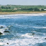
Y Felinheli is a coastal village situated along the eastern shore of the Menai Strait in the county of Gwynedd, North Wales. The settlement sits midway between the historic town of Caernarfon and the cathedral city of uk/local/bangor/">Bangor. Historically known in English as Port Dinorwic, the village spans an area of roughly 2.28 square miles. Its position along the saltwater strait created a natural anchorage that shaped its strategic economic development.
- How Did Industrial Slate Transport Shape the Infrastructure of the Village?
- What Maritime Features Define the Modern Marina and Waterway Environment?
- What Architectural and Heritage Sites Are Preserved in the Settlement?
- What Administrative Structures and Demographic Metrics Characterize the Village?
- What Role Does Tourism and Recreation Play in the Modern Local Economy?
- Frequently Asked Questions
According to official UK census figures, the village registered a population of 2,284 residents in 2011 and increased to 2,330 in 2021. Etymologically, the name derives from Welsh words where “y” means the, “melin” means mill, and “heli” translates to brine or saltwater. This name directly references a watermill built near the tidal reaches in 1633. The village grew from two distinct hamlets, Tafarngrisiau and Aberpwll, into a unified maritime transport node. Modern Felinheli remains an important focal point for Welsh linguistic heritage, regional tourism, and leisure sailing along the Menai Strait.
How Did Industrial Slate Transport Shape the Infrastructure of the Village?
The Industrial Revolution transformed Felinheli into one of the major slate-exporting ports in Northern Europe during the nineteenth century. Industrialists from the Vaynol Estate, led by the Assheton-Smith family, developed the local harbor around 1793 to service the nearby Dinorwic Quarry. The quarry owners constructed specialized transport routes to link the slate mountain at Llanberis directly to the docks. The Dinorwic Railway opened in 1824 and was later upgraded to the narrow-gauge Padarn Railway in 1843. Trains delivered thousands of tons of high-grade roofing slate annually directly onto waiting cargo ships.
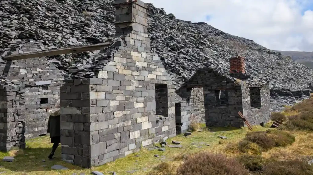
Engine sheds, workshops, and dry docks were built to maintain the locomotives and ocean-going vessels. The village adopted the commercial name Port Dinorwic to reflect its status as an international export point. Maritime traffic peaked between 1880 and 1910, exporting building materials across the British Empire, Europe, and the Americas. Industrial activity declined sharply after the Second World War as global demand shifted toward alternative roofing materials. Commercial slate operations at the port permanently ceased in the 1960s, initiating a major urban transition.
What Maritime Features Define the Modern Marina and Waterway Environment?
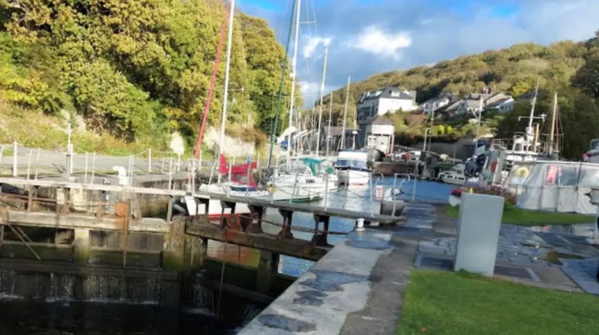
Following the end of industrial shipping, Port Dinorwic underwent extensive re-development to become a modern yachting harbor and residential marina. Marine developers repurposed the nineteenth-century slate docks, lock gates, and timber quays for recreational boating. Today, Port Dinorwic Marina features a sheltered dock system controlled by a tidal lock gate that protects berthed vessels from severe weather. The marina provides over 150 berths equipped with power, water, and specialized boatyard support facilities. Shipyards in the village feature one of the largest private slipways in North Wales, built originally to construct landing craft during World War II.
The Menai Strait presents unique navigational conditions due to strong tidal currents that reach speeds up to 8 knots in narrow channels. Sailors must carefully calculate tide tables to navigate the shallow banks and rocky ledges surrounding the village. The Port Dinorwic Sailing Club actively organizes regular dinghy races, regattas, and maritime safety courses for regional sailors. Maritime businesses operational in the harbor include specialized sailmakers, marine engineers, rigging technicians, and hull repair specialists.
What Architectural and Heritage Sites Are Preserved in the Settlement?
The physical layout of Felinheli displays preserved architectural assets reflecting its agricultural and Victorian industrial past. The Slate Quay area contains Grade II listed stonework structures built specifically for dock workers and harbor masters. Row houses along Beach Road exhibit local Welsh slate construction techniques featuring heavy masonry and slate roofing tiles. St Mary’s Church sits near the site of the early hamlet of Tafarngrisiau and contains historical records dating back centuries.
The Vaynol Estate boundary walls surround nearby woodlands, denoting the territorial reach of the historic landowners who controlled regional industry. Former railway embankments from the Padarn Railway have been repurposed into public walking paths and cycle tracks along the coast. The Victorian dock infrastructure retains original iron bollards, sluice gates, and stonework mechanisms engineered in the nineteenth century. Historic public houses like the Garddfon Inn have operated along the waterfront since the mid-nineteenth century, catering to dockworkers and mariners. These structures form an integral part of the UNESCO World Heritage site designation granted to the Slate Landscape of Northwest Wales.
What Administrative Structures and Demographic Metrics Characterize the Village?
Felinheli operates within the local government authority of Cyngor Gwynedd, serving as part of the Bethel a’r Felinheli electoral ward. At the community level, the Y Felinheli Community Council oversees local amenities, public spaces, and civic planning reviews. The community spans 2.28 square miles with a population density of approximately 1,022 people per square mile. Demographic data shows high levels of Welsh language fluency, with over 65 percent of residents speaking Welsh regularly. Parliamentary representation places the village within the Dwyfor Meirionnydd constituency for the UK House of Commons.
In the Senedd Cymru, the village forms part of the Gwynedd Maldwyn electoral district. Primary educational needs are met locally by Ysgol Y Felinheli, a Welsh-medium primary school serving local children. Secondary students commute to comprehensive schools in nearby Caernarfon or Bangor. Public transport connectivity relies on the A487 bypass road, which diverts regional traffic away from narrow village streets. Regular bus routes link the settlement to Bangor railway station, providing national rail access across the North Wales coast line.
What Role Does Tourism and Recreation Play in the Modern Local Economy?
The economic foundation of Felinheli relies on maritime leisure, domestic tourism, independent retail, and service sector enterprise. The Menai Strait coastal path attracts walkers, birdwatchers, and cyclists traveling the Wales Coast Path network. Holiday rentals, boutique apartments, and bed-and-breakfast properties accommodate thousands of seasonal visitors each year. Visitors utilize the village as a base to explore nearby destinations like Snowdonia National Park and Anglesey. Watersports activities dominate local recreational offerings, including paddleboarding, kayaking, powerboating, and sea angling.
Waterfront restaurants, cafes, and bistros utilize marine views to attract regional diners throughout the calendar year. Marine engineering firms based at the marina generate skilled local employment in vessel repair and maintenance. Environmental protection initiatives monitor water quality in the strait to protect marine biodiversity, including local seals and seabird populations. Modern infrastructure development balances housing demands with strict conservation guidelines imposed on historic coastal zones.
Frequently Asked Questions
How do you pronounce Y Felinheli correctly in Welsh?
The Welsh pronunciation of Y Felinheli is phonetic, pronounced roughly as “Uh Veh-lin-heh-lee.” The double ‘f’ in Welsh makes a ‘v’ sound, while the ‘h’ is clearly voiced.
Why is Felinheli sometimes called Port Dinorwic on maps?
Port Dinorwic was the Victorian name given to the village after docks were built to export slate from the Dinorwic Quarry. While the official name reverted to the original Welsh Y Felinheli, Port Dinorwic is still used in nautical charts and marina branding.
Can you sail or kayak through the Menai Strait from Felinheli?
Yes, but the Menai Strait experiences powerful tidal currents and dangerous shallow sections like the Swellies. Watercraft operators must check local tide tables carefully or consult the Port Dinorwic Sailing Club before launching.
Is there a public walking path along the waterfront in Felinheli?
A dedicated section of the Wales Coast Path runs through the village along the Menai Strait and old railway lines. It offers clear views across to Anglesey and connects directly toward Bangor and Caernarfon.
How far is Felinheli from Snowdonia and Caernarfon Castle?
Felinheli is located roughly 4 miles north of Caernarfon Castle along the A487 road. The western boundary of Eryri (Snowdonia National Park) is less than a 15-minute drive away at Llanberis.