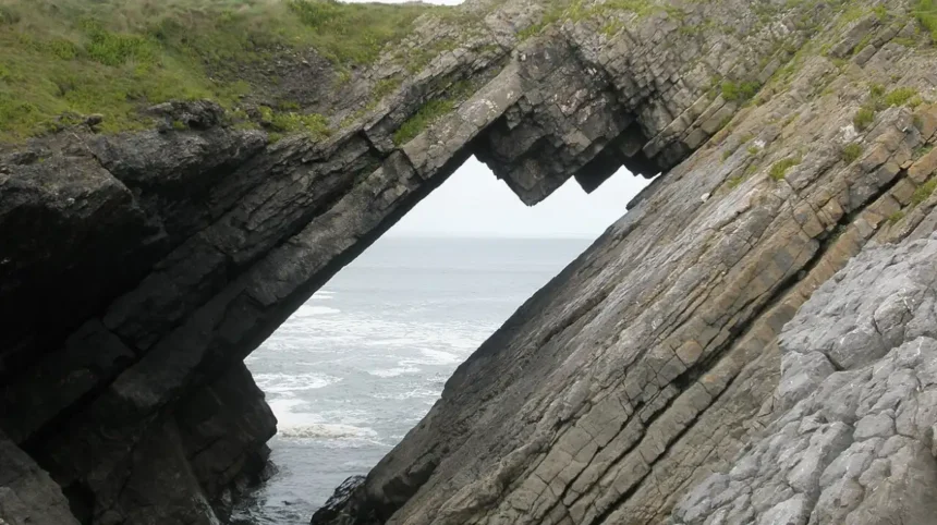
Rhossili Bay, located on the southwestern tip of the Gower Peninsula, holds the highest ranking among Welsh coastal environments. This three-mile expanse of golden sand, Atlantic waves, and limestone cliffs consistently outperforms competing shores in environmental quality and visitor metrics.
- What makes Rhossili Bay the top coastal location in Wales?
- How does the geography of Rhossili Bay support coastal wildlife?
- Why is Worms Head a significant feature of the Welsh coastline?
- What surf conditions and water sports options exist at Rhossili Bay?
- How do you access and navigate Rhossili Bay efficiently?
- What historical landmarks and shipwrecks are located at Rhossili Bay?
- How does Rhossili Bay compare to other famous Welsh beaches?
- Frequently Asked Questions
Rhossili Bay sits within the Gower Area of Outstanding Natural Beauty, designated in 1956 as the first protected landscape in the United Kingdom. The beach spans three miles (4.8 kilometers) from the tidal island of Worms Head in the south to Burry Holms in the north. Marine geologists classify Rhossili as a high-energy macro-tidal beach, characterized by dynamic wave patterns and sweeping sand dunes supported by carboniferous limestone geology.
The geographic footprint of Rhossili Bay offers distinct advantages over other Welsh coastal destinations like Barafundle Bay, Llanddwyn Island, or Tenby uk/local/swansea/castle/">Castle Beach. While Barafundle Bay offers enclosed cove geography, Rhossili provides uninterrupted exposure to Atlantic swell lines, creating ideal conditions for coastal biodiversity and water sports. The area features historic sites including the 1887 shipwreck of the Helvetia, exposed at low tide, and Rhossili Down, rising 193 meters (633 feet) above sea level.
The reputation of Rhossili Bay as the top shoreline in Wales is supported by global travel industry rankings. The beach earned top placement in the TripAdvisor Travellers Choice Awards for the United Kingdom, while ranking third in Europe and ninth globally. Environmental monitoring by Marine Conservation Society standards confirms high water quality, while its open orientation minimizes localized pollution buildup common in sheltered estuaries.
What makes Rhossili Bay the top coastal location in Wales?
Rhossili Bay achieves its top status through an exceptional combination of spatial scale, untouched natural environment, geological variety, and high water quality metrics. The shoreline features three miles of contiguous sand uninterrupted by commercial structures.
The spatial expanse of Rhossili Bay ensures distinct functional zones along its three-mile arc. The southern section near Rhossili village features dramatic carboniferous limestone headlands that rise sharply above the water. The central section transitions into an extensive sand dune system known as The Warren, which provides critical stabilizing habitats for flora and fauna. The northern expanse merges into Llangennith Sands, where open Atlantic swells deliver consistent surf breaks.
Natural preservation remains absolute across the Rhossili coast due to protective ownership management. The National Trust manages the coastal headlands and surrounding fields, preventing urban development along the beach perimeter. Unlike traditional seaside resorts with concrete promenades and commercial amusements, Rhossili retains its natural shoreline profile, supporting rare wildlife including grey seals, choughs, and various migratory seabirds.
The site serves as a prime study area for coastal geomorphology due to its high-energy wave climate and tide ranges exceeding 10 meters. The macro-tidal regime exposes extensive intertidal flats during low tide, revealing historic features like the wooden ribs of the Helvetia brigantine, which ran aground in November 1887. This intertidal movement creates ideal conditions for coastal research and recreation alike.
How does the geography of Rhossili Bay support coastal wildlife?
Rhossili Bay supports diverse coastal wildlife through its varied ecosystems including intertidal mudflats, sand dune networks, marine waters, and high limestone cliffs. These physical zones provide stable breeding, foraging, and roosting grounds for numerous species.
The oceanography of Rhossili Bay sustains a rich marine food web powered by Atlantic currents entering Bristol Channel. Grey seals regularly haul out onto the rocky edges of Worms Head, a two-mile tidal island extending off the southern headland. Harbor porpoises and bottlenose dolphins forage in the deep tidal channels offshore, utilizing the nutrient-rich waters caused by strong tidal mixing.
The terrestrial habitats inland from the sand dunes harbor protected bird and insect populations. The maritime heathlands of Rhossili Down host red-listed avian species like the red chough, which nests in the steep cliff crevices and feeds on soil invertebrates along coastal fields. The sand dunes contain stabilized marram grass ecosystems that shelter rare insects, including the sand wasp and various rare ground beetles.
Plant life demonstrates high ecological specialization across the salt spray zones along the bay. The National Trust manages fields above the cliffs, planting arable crops and rotationally farming sunflower fields that support thousands of seed-eating birds during autumn migrations. Rare flora such as the yellow whitlow-grass thrives on the limestone cliffs, benefiting from microclimates protected from intensive agricultural runoff.
Why is Worms Head a significant feature of the Welsh coastline?

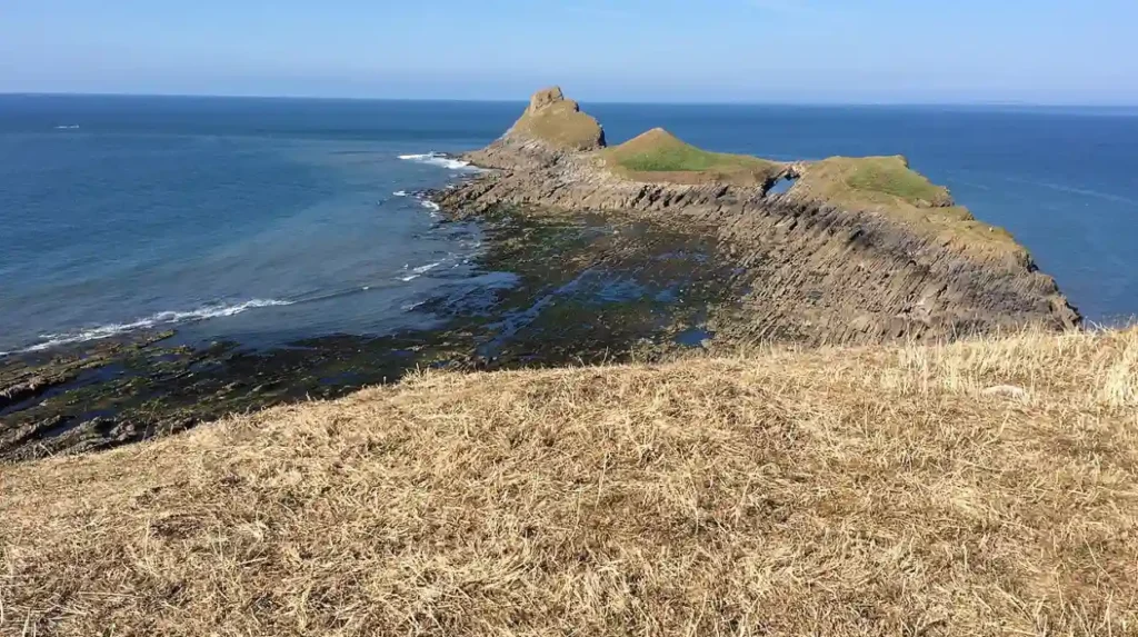
Worms Head forms a prominent mile-long carboniferous limestone promontory extending westward into the sea from Rhossili Point, acting as a natural landmark and barrier. Its unique causeway structure creates a distinct tidal island ecosystem.
The structure of Worms Head comprises three distinct sections: the Inner Head, the Middle Head, and the Outer Head, reaching a maximum elevation of 56 meters (184 feet). The island is separated from the mainland by a rocky causeway exposed for approximately two and a half hours on either side of low tide. The name originates from the Viking word “Wurm,” meaning dragon or serpent, describing its physical profile rising out of the sea.
Navigational safety across the Worms Head causeway requires strict adherence to tidal timings due to powerful currents sweeping through the sound. When the tide rises, water submerges the causeway under several meters of fast-moving sea, isolating the headland. Visitors exploring the island must calculate tide windows precisely to avoid getting stranded on the outer headland sections.
The biological significance of Worms Head centers on its isolated nesting sites for pelagic seabirds. The sheer sea cliffs on the northern face offer protected ledges for common guillemots, razorbills, and black-legged kittiwakes during spring breeding seasons. The surrounding intertidal rockpools contain rich kelp beds that support juvenile fish species, crustaceans, and anemones in undisturbed marine conditions.
What surf conditions and water sports options exist at Rhossili Bay?
Rhossili Bay offers premier surfing and water sports conditions due to its exposure to Atlantic ocean swells and varying wind protection along its arc. The beach delivers consistent break patterns across multiple tide levels.
The surf dynamics at Rhossili change significantly along its three-mile sand strip. The northern section at Llangennith receives raw Atlantic swells, creating consistent beach breaks that operate across low to high tides. Waves here range from gentle 2-foot rollers during summer months to powerful 10-foot barrels during autumn and winter groundswells, drawing surfers across the United Kingdom.
Wind directions dictate wave quality across the bay structure throughout the calendar year. Prevailing southwesterly winds blow onshore across the central beach, creating choppy water conditions ideal for kitesurfing and windsurfing. Easterly winds blow offshore over the cliffs, grooming wave faces into smooth surfaces preferred by traditional surfers and bodyboarders.
Safety variables require consideration due to strong rip currents operating along the shifting sandbars. Rhossili Bay lacks seasonal RNLI lifeguard patrols, requiring water sport participants to assess ocean conditions independently before entering the sea. Rip currents form rapidly near the exposed wreckage of the Helvetia and along the rocky flanks of Worms Head during falling tides.
How do you access and navigate Rhossili Bay efficiently?
Accessing Rhossili Bay involves traveling via the A4118 or B4271 roads across the Gower Peninsula to Rhossili village at postcode SA3 1PP. Vehicle access terminates at the village car park managed by the National Trust.
The primary pedestrian route from the village car park down to the sand consists of a steep, winding gravel path with over 100 concrete steps. This elevation change makes access physically demanding and renders direct beach descent unsuitable for wheelchair users or visitors with mobility restrictions. The lookout point near the National Trust Visitor Centre provides accessible views across the bay without requiring beach descent.
Public transport links connect Rhossili to Swansea via the 118 bus service, operating regularly from Swansea Bus Station. The journey covers approximately 18 miles and takes roughly 60 minutes, dropping passengers near the village center. Parking facilities at the headland accommodate several hundred vehicles, though capacity fills early during summer weekends.
Walking trails extend directly from Rhossili village along the headland paths. The Wales Coast Path passes through the area, linking Rhossili to Fall Bay and Mewslade Bay toward the south, and Llangennith Sands toward the north. These elevated cliff paths offer stable terrain, clear signage, and vantage points for viewing marine wildlife.
What historical landmarks and shipwrecks are located at Rhossili Bay?
Rhossili Bay contains prominent historical landmarks spanning prehistoric burials, medieval agricultural layouts, and modern maritime shipwrecks. These features preserve physical evidence of human interaction with the Gower coast over several millennia.
The most visible maritime artifact on Rhossili beach is the oak frame of the Helvetia. On November 1, 1887, this Norwegian brigantine caught a storm while carrying a cargo of timber from Campbellton, New Brunswick, to Swansea. The vessel lost its anchor and ran aground on the sandbanks, where its structural timbers remain embedded in the intertidal sand today.
Above the cliffs lies “The Vile,” an intact medieval strip-farming field system managed by the National Trust. This agricultural layout preserves ancient land management practices, featuring long, narrow strip fields separated by earthen banks. The farming system continues active crop production, demonstrating historic sustainable agriculture directly above the marine coastline.
The high ridge of Rhossili Down features prehistoric monuments dating to the Neolithic and Bronze Age periods. The Beacon, standing at 193 meters, is topped by ancient cairns and burial mounds. Additionally, the megalithic tomb known as Arthur’s Stone sits nearby on Cefn Bryn heathland, reinforcing the deep historical settlement patterns across this Welsh headland.
How does Rhossili Bay compare to other famous Welsh beaches?
Rhossili Bay compares favorably against other top Welsh shores due to its large physical scale, natural protection, and absence of commercial development. Distinct features separate Rhossili from rival coastal destinations in West and North Wales.
Barafundle Bay in Pembrokeshire offers a small, pine-backed limestone cove accessible via a half-mile walk from Stackpole Quay. While Barafundle provides sheltered swimming conditions, its small beach area leads to crowding during peak summer days. Rhossili Bay spans three miles, absorbing large visitor numbers without compromising open space or wild scenery.
Tenby Castle Beach in Pembrokeshire provides urban resort amenities, historical harbor walls, and direct town access. However, Tenby relies heavily on commercial tourism infrastructure like seaside cafes and rentals. Rhossili Bay maintains an undeveloped, wilderness character protected by National Trust ownership, prioritizing habitat conservation over commercial development.
Llanddwyn Beach on Anglesey features forestry backdrop trails and views toward Snowdonia, but experiences complex tidal cutoffs around Newborough Warren. Rhossili combines open sea exposure, high cliff vantage points, easy trail navigation, and consistent surf metrics, cementing its standing as the primary coastal destination in Wales.
Frequently Asked Questions
Is Rhossili Bay suitable for swimming all year round?
Rhossili Bay permits swimming, but water conditions feature powerful currents and swell lines without lifeguard coverage. Water temperatures range from 8°C in winter to 16°C in late summer. Swimmers should remain near shore and avoid swimming near Worms Head or during falling tides due to strong offshore rips.
Are dogs allowed on Rhossili Bay throughout the year?
Rhossili Bay maintains a dog-friendly policy across its entire three-mile expanse 365 days a year without seasonal bans. Owners must keep dogs under close control near grazing livestock along headland paths. Waste disposal bins sit at the main village parking site.
How long does it take to walk across to Worms Head?
Walking across the causeway to Worms Head takes roughly 2.5 hours for a round trip from the rocky path at Rhossili Point. The causeway opens only 2.5 hours before low tide and closes 2.5 hours after. Check local tide tables at the Coastguard lookout before attempting the crossing.
Where is the best spot to view sunflowers at Rhossili?
The National Trust sunflower fields sit along “The Vile” strip-farming fields directly behind Rhossili village. The flowers typically bloom from late July through August. Designated walking paths allow visitors to view the yellow fields against the blue coastal backdrop without damaging agricultural crops.
What facilities and parking options are available at Rhossili Bay?
Rhossili village offers a large pay-and-display car park, public toilets, a visitor center, and several local food venues. Parking fees apply daily, with free parking for National Trust members. All facilities sit at cliff level, 400 meters from the sand descent path.