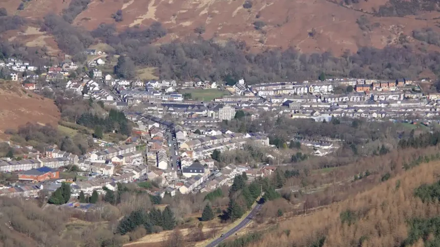
Treorchy is a historic valley town and community located in the county borough of Rhondda Cynon Taf within the upper Rhondda Fawr valley of South Wales. Positioned along the A4058 road, the town lies northwest of uk/local/cardiff/">Cardiff and southwest of Merthyr Tydfil, anchored by the scenic Bwlch y Sarnau mountain pass. The community encompasses surrounding residential settlements including Cwmparc and Ynyswen while operating under the CF42 postal area.
- How Did Industrial Coal Mining Shape the Historical Development of Treorchy?
- What Drives the Modern Local Economy and High Street Retail Sector in Treorchy?
- Which Cultural Institutions, Arts Venues, and Heritage Sites Define Treorchy?
- How Is Education Structured and How Is the Welsh Language Preserved in Treorchy?
- What Transportation Networks and Public Infrastructure Connect Treorchy Wales?
- What Outdoor Recreation and Natural Attractions Surround Treorchy?
- What Is the Future Outlook and Community Regeneration Strategy for Treorchy?
- Frequently Asked Questions
Geographically, Treorchy occupies a narrow valley floor carved by the River Rhondda Fawr, bounded by steep sandstone ridgelines reaching elevations over 400 metres. According to demographic estimates from the Office for National Statistics, the Treorchy community unit maintains a population of approximately 7,621 residents across a land area of 1.74 square kilometres, resulting in a population density of 4,380 people per square kilometre. The broader electoral division covers 13.3 square kilometres and exhibits high levels of residential stability, with over 72 percent of homes listed as owner-occupied properties. Municipal administration is governed directly by the Rhondda Cynon Taf County Borough Council, which manages local public services, infrastructure development, educational facilities, and waste management systems.
How Did Industrial Coal Mining Shape the Historical Development of Treorchy?
Industrial coal extraction transformed Treorchy from a sparsely populated agricultural settlement into an international energy hub during the nineteenth and twentieth centuries. Before 1850, the land formed part of rural Glamorgan under the feudal ownership of the Marquess of Bute estate. The discovery of high-grade steam coal seams beneath the Rhondda valley triggered rapid industrial development, beginning with the opening of the Abergorki Colliery level in 1859 by manager Mr. Huxham.
Subsequent investments by industrialist David Davies of Llandinam led to the sinking of deep shaft mines in the 1860s, founding the Ocean Coal Company. Deep-level pits including the Parc Colliery, Dare Colliery, Tylecoch Colliery, and Abergorki Colliery drove explosive demographic expansion. Workers migrated from rural Wales, England, and abroad to meet labor demands, expanding the urban layout from a single linear roadway into a structured grid pattern of terraced housing by 1875. Production peaked in 1913 across the South Wales coalfield, establishing Treorchy as a major economic contributor to global coal exports. The post-World War II period brought nationalisation under the National Coal Board in 1947, followed by systematic colliery closures through the 1970s that ended deep mining operations across the valley.
What Drives the Modern Local Economy and High Street Retail Sector in Treorchy?
Treorchy shifted from heavy industrial production toward a service-oriented retail economy, establishing itself as a commercial hub for the upper Rhondda Fawr valley. Following the termination of deep coal mining operations, municipal planning prioritized small business development, commercial regeneration, and digital infrastructure investment. This long-term transition transformed the local commercial center into a resilient retail hub capable of attracting consumer spending from adjacent valley communities.
In 2020, Treorchy won the UK High Street of the Year award in the Great British High Street Awards, succeeding the 2019 winner Crickhowell. The award panel recognized Treorchy for maintaining a 96 percent commercial occupancy rate along its central thoroughfare, supported by over 120 active members within the Treorchy Chamber of Trade. Independent enterprises dominate the local commercial profile, including family-owned bakeries, boutiques, cafes, craft shops, and traditional butchers. Corporate chain expansion remains limited, preserving unique regional business ownership. Modern economic activity is further supported by proximity to regional employment centers in Cardiff and Bridgend, with rail networks converting the town into a viable residential location for daily commuters.
Which Cultural Institutions, Arts Venues, and Heritage Sites Define Treorchy?
Treorchy serves as a cultural headquarters for the Rhondda valley through historic performance venues, musical ensembles, and architectural heritage sites. The town maintains strong historical ties to Welsh Nonconformist religious traditions, choral music, and performing arts. These institutions continue to provide venue space for theatrical productions, orchestral concerts, community assemblies, and regional artistic festivals year-round.
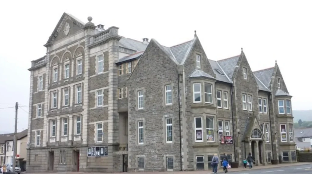
The Parc and Dare Hall stands as the primary cultural landmark in Treorchy. Opened in 1913 as a miners’ institute and theatre, the facility was funded through direct wage deductions from local miners working at the Parc and Dare collieries. The building features a large main auditorium, a restored proscenium stage, and an active cinema space managed by Rhondda Cynon Taf County Borough Council. Treorchy is also globally famous for the Treorchy Male Choir, established in 1883, which has performed internationally and produced numerous award-winning recorded albums. Nonconformist architectural history is represented by sites like Noddfa Baptist Chapel, which historically accommodated over 1,000 worshippers during the peak of the industrial era.
How Is Education Structured and How Is the Welsh Language Preserved in Treorchy?
Educational services and linguistic preservation programs in Treorchy operate under state guidelines established by the Welsh Government and Rhondda Cynon Taf County Borough Council. Local educational access spans early years learning, primary education, secondary schooling, and vocational training. Education policy actively incorporates bilingualism, requiring Welsh language instruction across all public school curricula to support national language acquisition targets.
Treorchy Comprehensive School serves as the main English-medium secondary education provider for the upper Rhondda, catering to students aged 11 to 18 across modern academic and sports facilities. Primary education is delivered through local community schools, including Treorchy Primary School. Welsh-medium education holds deep historical roots in the area; Ysgol Gymraeg Ynyswen was established in nearby Ynyswen in 1950 as the very first Welsh-medium primary school in the entire Rhondda valley. Census data shows that while Welsh language usage declined from 64.4 percent in 1901 to 56.6 percent in 1911, immersion schooling and community language initiatives continue to support stable bilingual fluency among younger demographics.
What Transportation Networks and Public Infrastructure Connect Treorchy Wales?
Treorchy relies on integrated road, rail, and bus infrastructure to maintain regional connectivity across Rhondda Cynon Taf and South Wales. The transportation network facilitates daily commuter movement, commercial freight delivery, and tourism access throughout the Rhondda Fawr valley. Public infrastructure is maintained through joint management by Transport for Wales, local highways authorities, and regional transport partnerships.
Treorchy railway station sits along the Rhondda Line, providing direct passenger rail services operated by Transport for Wales connecting to Cardiff Central. The passenger rail route serves key stops including Tonypandy, Pontypridd, and Radyr, enabling straightforward travel across the South Wales region. Highway access is dominated by the A4058 main road, which runs linearly through the valley floor to link Treorchy with Treherbert to the north and Pontypridd to the south. The A4061 road ascends the Bwlch Mountain, providing a direct mountain route over to the Ogmore Valley and Bridgend. Local bus services operated by Stagecoach South Wales deliver frequent local transport across nearby villages and regional commercial hubs.
What Outdoor Recreation and Natural Attractions Surround Treorchy?
The natural landscape surrounding Treorchy provides extensive opportunities for outdoor recreation, ecological tourism, and sports activities. Situated within the Glamorgan upland topography, the town is bordered by forestry reserves, river trails, mountain ridgelines, and glacial valleys. These physical assets support active outdoor pursuits that contribute to regional recreation and tourism revenue.
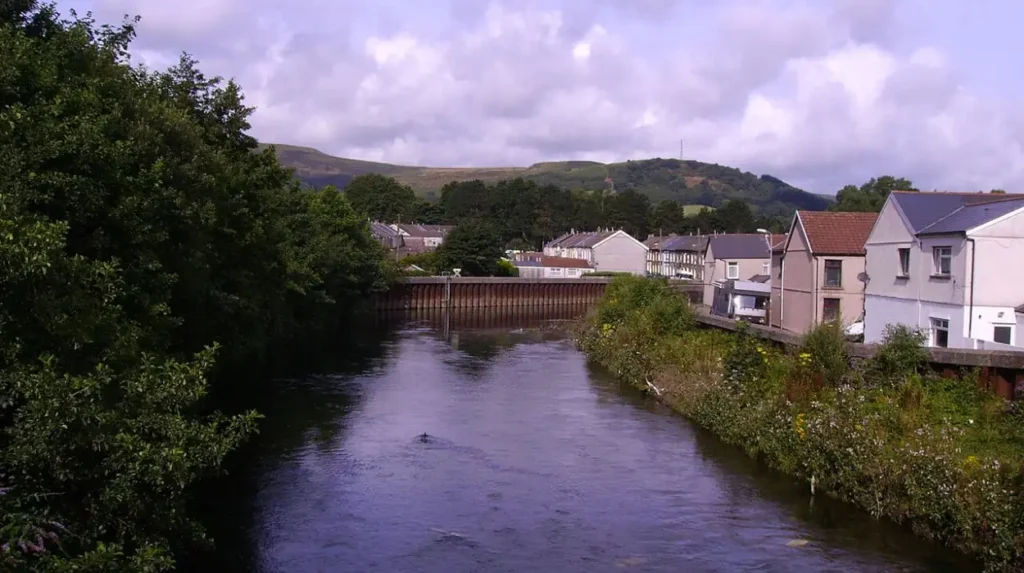
Bwlch Mountain features steep road climbs and scenic viewpoints that attract road cyclists, walkers, and sightseers, offering sweeping panoramic views across the Rhondda Fawr valley. Nearby Pen Pych mountain, one of the largest sandstone table mountains in Europe, provides marked hiking trails leading past natural waterfalls, ancient iron age settlements, and dramatic rock escarpments. Outdoor sports enthusiasts frequently access BikePark Wales near Merthyr Tydfil and the Afan Forest Park trail system, both located within driving distance for world-class mountain biking. The River Rhondda Fawr corridor also features public walking paths and riverbank conservation areas managed for biodiversity protection.
What Is the Future Outlook and Community Regeneration Strategy for Treorchy?
Future development strategies for Treorchy focus on sustainable economic diversification, historic preservation, infrastructure modernization, and green energy initiatives. Municipal leaders and community groups work in partnership to address post-industrial economic challenges while maintaining high street vitality. Regeneration framework projects aim to strengthen long-term commercial resilience, upgrade digital connectivity networks, and expand residential amenities across the upper valley.
Key focus areas in local council planning include improving energy efficiency in older terraced housing stocks, expanding electric vehicle charging infrastructure, and supporting local business networks. Capital investment programs funded by the Welsh Government support ongoing upgrades to public transport links along the Rhondda Line. Strategic priorities also emphasize heritage tourism development by leveraging local landmarks like the Parc and Dare Hall and expanding outdoor trail connectivity. Community interest groups remain active in organizing annual cultural events, street markets, and environmental enhancement programs to sustain social cohesion and economic stability.
Frequently Asked Questions
What is Treorchy Wales famous for?
Treorchy is nationally famous for its award-winning high street, which won UK High Street of the Year in 2020. It is also internationally renowned for the historic Treorchy Male Choir and the landmark Parc and Dare Hall.
Where is Treorchy located within South Wales?
Treorchy is situated in the upper Rhondda Fawr valley within the county borough of Rhondda Cynon Taf. It lies northwest of Cardiff and is connected via the A4058 road and the Rhondda passenger railway line.
Did coal mining play a big role in Treorchy history?
Coal mining was the primary driver of growth in Treorchy from the 1860s through the late twentieth century. Major collieries like Parc, Dare, and Abergorki transformed the rural agricultural area into a bustling industrial mining town.
What travel options connect Cardiff to Treorchy Wales?
Travelers can take direct Transport for Wales rail services from Cardiff Central straight to Treorchy railway station. Motorists can also drive via the A470 and A4058 roads through Pontypridd directly into the valley.
Are there good outdoor activities around Treorchy?
The area surrounding Treorchy offers excellent hiking up Pen Pych mountain and scenic cycling along the Bwlch Mountain pass. Outdoor enthusiasts also enjoy nearby mountain biking at BikePark Wales and Afan Forest Park.