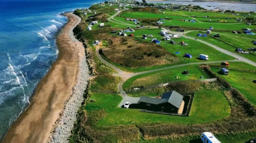
Shell Island is a coastal peninsula situated in Gwynedd on the edge of Snowdonia National Park. The site covers over 450 acres of coastal land, sand dunes, and pristine estuary shores along Cardigan Bay. Known locally as Mochras, the peninsula becomes completely cut off from the Welsh mainland during high tide.
- How does the tidal causeway work at Shell Island?
- What is the history of Mochras and Shell Island?
- What makes the ecology of Shell Island unique?
- What are the rules for camping at Shell Island?
- What facilities and activities are available for visitors?
- How can visitors reach Shell Island safely?
- Frequently Asked Questions
- Can you drive across the Shell Island causeway at high tide?
- Are electric hookups available for campers on Shell Island?
- Can you bring dogs to Shell Island beaches and camping fields?
- What is the best time of year to collect shells on the island?
- Are campfires and open ground fires allowed on Shell Island?
The primary feature of Shell Island is its status as one of the largest camping destinations in Europe. Visitors access the land via a causeway built across the Artro Estuary. The area is globally famous for its diverse selection of marine seashells washed ashore during tidal cycles.
Historically, Shell Island functioned as farmland and a small coastal community for generations. The land has been managed as a dedicated holiday park and natural reserve since the mid-twentieth century. The site remains a protected ecosystem that supports dozens of native bird species and marine invertebrates.
Today, the island operates under strict environmental guidelines to preserve its natural state. It attracts thousands of campers, hikers, and nature enthusiasts every season. The peninsula offers views of Cardigan Bay, Harlech uk/local/swansea/castle/">Castle, and the surrounding mountains of the Eryri range.
How does the tidal causeway work at Shell Island?
The causeway at Shell Island is a submerged road that operates according to daily ocean tides. Tides in Cardigan Bay rise and fall twice every twenty-four hours, completely covering the low-lying access road. Driven by lunar gravitational forces, these waters cover the tarmac road twice a day for approximately four hours each cycle.
Vehicular passage is impossible when the water level rises over the road surface. Management publishes daily tidal charts to ensure safe travel across the Artro Estuary. Drivers must cross strictly within the safe operational time windows to prevent vehicle submerged damage or stranding.
During high tides, emergency medical access is maintained via specialized high-clearance vehicles or emergency coordination. Standard road cars attempting to cross flooded sections face extreme hazards from strong salt-water currents. Planning arrivals around tidal tables is essential for every visitor arriving by automobile.
Tidal water levels fluctuate throughout the year based on spring and neap tide conditions. Spring tides create the highest water levels, leaving the road covered longer than average. Neap tides result in shorter closure windows, giving drivers extended travel frames across the main access channel.
What is the history of Mochras and Shell Island?
Mochras was originally an isolated farming estate surrounded by marshland and tidal channels. The modern landscape was altered significantly during the nineteenth century when local land developments modified the flow of the River Artro. These alterations diverted the river south, forming a defined channel and turning Mochras into a peninsula.
For centuries, local agricultural families grazed livestock on the salt marshes and sand dunes. Farming remained the primary economic activity until the mid-1900s, when tourism began to increase along the Welsh coast. The transition from agricultural land to public recreational space started officially during the post-war development era.
In 1958, the site was opened to public camping, marking its transition into a popular resort destination. Infrastructure developments were added over the following decades to handle higher visitor volumes. Simple amenities replaced rustic farm facilities while maintaining the natural terrain of the surrounding coastal environment.
The peninsula retains historical agricultural structures, including traditional farmhouses and stone boundary walls. These structural remains showcase the historical land use prior to modern tourism. Today, historical management protocols focus heavily on balancing public access with historical conservation and habitat protection.
What makes the ecology of Shell Island unique?
Shell Island is designated as a Site of Special Scientific Interest due to its fragile ecosystem. The site features sand dune systems, intertidal mudflats, and undisturbed salt marshes. These varying habitats support diverse flora and fauna, including rare plant species like orchids and sea holly.
The intertidal zone creates a ideal habitat for marine invertebrates and mollusks. Over two hundred species of natural shells wash onto the shores annually, giving the peninsula its popular modern name. The surrounding waters of Cardigan Bay support populations of bottlenose dolphins, grey seals, and harbor porpoises.
Avian life thrives across the salt marshes and estuary channels throughout every season. Wading birds, including oystercatchers, curlews, and egrets, feed along the mudflats during low tide. The sand dunes offer essential nesting ground for specialized coastal species during the spring and summer months.
Environmental conservation laws protect the physical landscape from destructive human activity. Dune stabilization projects prevent soil erosion caused by wind and high foot traffic. Visitors are required to stick to designated pathways to avoid damaging sensitive vegetation and coastal animal habitats.
What are the rules for camping at Shell Island?
Camping at Shell Island follows an open-pitch model spread across four hundred acres of land. Visitors are permitted to choose their own location without allocated pitch lines. Campers must maintain a minimum distance of fifteen meters between adjacent tent setups for safety.
Open campfires on the grass pitches are strictly forbidden to protect against wildfires. Raised fire bins or designated beach campfires are permitted when clear of vegetation. Charcoal barbecues must be elevated off the ground to avoid scorching the underlying grass pitches.
Noise regulations require all sound equipment and radios to be turned off by ten at night. Generators are completely banned on site to maintain low sound levels across camping fields. Dogs must remain on leads at all times, except within marked free-run exercise zones.
Waste management rules dictate that all trash must be deposited in centralized recycling skips. Leaving rubbish outside tents is prohibited to prevent wild seabirds from scattering litter. Cutting or damaging standing trees for firewood results in immediate site eviction and legal prosecution.
What facilities and activities are available for visitors?
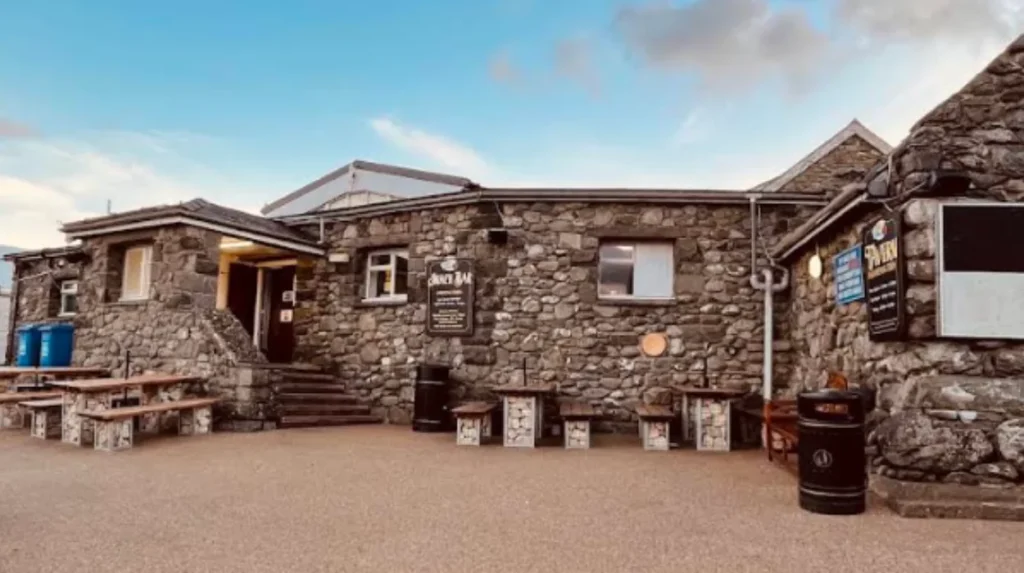
Shell Island features centralized facilities to support long-term and day visitors. The main hub includes a fully stocked supermarket, a camping equipment shop, and a gift shop. Food options range from an on-site snack bar to a family-friendly tavern.
Sanitary infrastructure includes six toilet blocks situated across the main camping areas. Shower blocks feature hot water facilities, laundrettes, and accessible utility units. Drinking water taps are situated throughout the fields for filling storage containers.
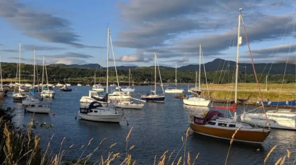
Recreational activities focus heavily on outdoor coastal exploration, beachcombing, and crabbing. Anglers fish along the outer shores for species such as bass, flounder, and mackerel. The tidal estuary offers safe conditions for kayaking, stand-up paddleboarding, and light water sports.
Day visitors can access the island between eight in the morning and eight at night. Entry depends on current site capacity and tidal causeway clearance times. Parking zones near the main beach allow easy access to walking paths and coastline views.
How can visitors reach Shell Island safely?
Traveling to Shell Island requires driving toward the village of Llanbedr along the A496 coastal route. Drivers must turn onto the designated marsh road following signs for Mochras. The final leg of the journey crosses the Artro Estuary via the tidal causeway.
Before setting off, drivers must consult updated local tide tables for Gwynedd. The causeway remains underwater for up to four hours during every high tide window. Attempting to cross while water covers the road risks severe mechanical damage from salt-water corrosion.
Public transport users can travel by train along the Cambrian Coast Line to Llanbedr Station. From the station, the entrance gate is located roughly two miles away on foot or by taxi. Walking along the marsh road requires caution due to narrow lanes and passing campervan traffic.
The site entrance gate charges a day-visit or camping entrance fee upon arrival. Staff monitor tidal conditions continuously to guide incoming and outgoing vehicles safely. Following operational instructions at the gate ensures a smooth transition onto the peninsula.
Frequently Asked Questions
Can you drive across the Shell Island causeway at high tide?
No, you cannot drive across the causeway during high tide because the road is submerged under several feet of sea water. Crossing when covered causes severe mechanical damage, engine failure, and salt-water corrosion. Drivers must check the official daily tide tables to cross safely during low tide windows.
Are electric hookups available for campers on Shell Island?
Shell Island operates entirely as an unallocated, non-electric campsite across its four hundred acres. Campers bring off-grid power solutions like solar panels or portable power stations. Charging stations for small electronic devices and electric cars are available near the main reception area.
Can you bring dogs to Shell Island beaches and camping fields?
Can you bring dogs to Shell Island beaches and camping fields?
Dogs are permitted on Shell Island, provided they are kept on a lead in main camping and beach areas. Designated dog exercise areas are provided where pets can run freely off-lead. Owners must clean up after their pets and follow specific field restriction signs.What is the best time of year to collect shells on the island?
The best time for beachcombing is during autumn and winter after high spring tides or coastal storms. Strong ocean currents wash thousands of whole shells onto the western shoreline during these periods. Early morning visits at low tide offer the best selection before heavy foot traffic arrives.
Are campfires and open ground fires allowed on Shell Island?
Open ground fires are strictly prohibited across all grass pitches to protect the landscape and prevent grass fires. Campers can use raised fire bins or fire pits that elevate flames off the ground. Beach campfires are permitted on the main beach if fully extinguished and cleaned up afterward.