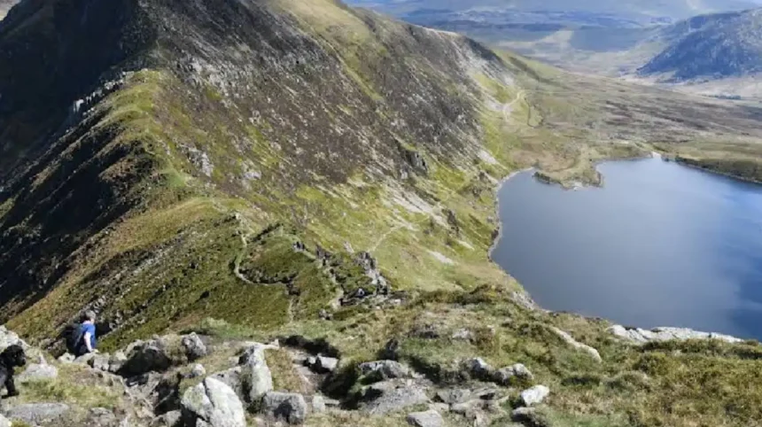
Yr Wyddfa, historically known as Mount Snowdon, is the highest peak in Wales with an official elevation of 1,085 meters above sea level. It is located within Gwynedd in the northwest region of the country.
Yr Wyddfa serves as the central mountain mass of the Snowdon range inside Eryri National Park. The British Isles feature no higher elevations south of the Scottish Highlands. Ordnance Survey topographical surveys record the summit grid reference as SH 60989 54379. The mountain mass covers approximately 20 square miles and contains six major valleys carved by ancient glaciers. The geographical isolation of the summit spans 368 kilometers to its parent peak, Ben Nevis in Scotland. The promontory ranks third in the United Kingdom for topographical prominence, standing at 1,039 meters above the surrounding terrain.
The physical landscape features steep cliff walls, narrow knife-edge arêtes, and deep glacial cirques known locally as cwms. Cwm Dyli contains Llyn Llydaw, a glacial lake spanning 110 acres at an altitude of 440 meters. Higher up the eastern flank sits Glaslyn, a lake located at 600 meters above sea level with a depth of 39 meters. The mountain borders the neighbouring peaks of Garnedd Ugain at 1,065 meters, Crib Goch at 923 meters, and Y Lliwedd at 898 meters. Together, these connected landforms constitute the famous Snowdon Horseshoe mountain circuit.
The mountain experiences severe maritime weather patterns due to its proximity to the Irish Sea. Summit conditions regularly include wind speeds exceeding 60 miles per hour, thick cloud cover, and heavy precipitation exceeding 4,500 millimeters annually. Winter conditions bring ice, snowpack, and sub-zero temperatures from November through April.
How Did the Geological Structure of Yr Wyddfa Form over Time?
Yr Wyddfa formed through Ordovician volcanic eruptions 450 million years ago, followed by severe tectonic compression and extensive glacial erosion during the Last Glacial Period. These natural processes created the steep basalt cliffs, deep valleys, and sharp arêtes visible today.
During the Ordovician period, intense subduction activity beneath the ancient Iapetus Ocean generated underwater volcanoes. Subsequent explosive eruptions deposited massive layers of ash, pumice, and basaltic lava across the seabed. Marine sediments accumulated between volcanic events, embedding fossils of prehistoric rhynchonellid brachiopods into the upper slate layers of the peak. Tectonic forces during the Caledonian Orogeny compressed these volcanic rocks, folding the terrain into a massive syncline structure. The collapse of the central volcanic caldera created a hardened caldera complex that resisted surrounding weathering forces over millions of years.
Glacial activity during the Pleistocene epoch shaped the final surface topography of the mountain mass. Heavy ice sheets covered the region between 20,000 and 11,500 years ago during the Devensian glaciation. Moving ice carved out deep U-shaped valleys and gouged steep-sided hollows into the mountain walls. As neighboring glaciers eroded opposite sides of rock ridges, they left behind narrow rock edges like Crib Goch.
Glacial melting deposited thick moraine debris across valley floors and formed natural rock basins that filled with water. These natural basins formed glacial tarns such as Llyn Llydaw and Glaslyn. The exposed rock faces consist of fine-grained slate, tuff, and quartz porphyry. These exposed rock layers remain primary subjects of geological research regarding prehistoric volcanism in the United Kingdom.
What Is the Historical and Cultural Significance of the Peak?
The summit holds historical significance as a medieval boundary marker, a site of ancient Welsh folklore, and a developmental proving ground for early British alpine mountaineering. Local heritage links the peak directly to King Arthur legends and ancient Welsh burial traditions.
The Welsh name Yr Wyddfa translates directly to “The Tomb” or “The Cairn” in modern English. Welsh folklore identifies the summit cairn as the burial place of Rhita Gawr, a legendary giant defeated by King Arthur. The English name Snowdon derives from Old English words “snew” and “dun,” translating to “snow hill.” In 1682, early surveyors conducted the first mathematical elevation measurement, calculating the height at 3,720 feet. Thomas Pennant documented the flora, fauna, and geology of the mountain during his famous tour of Wales in 1773.
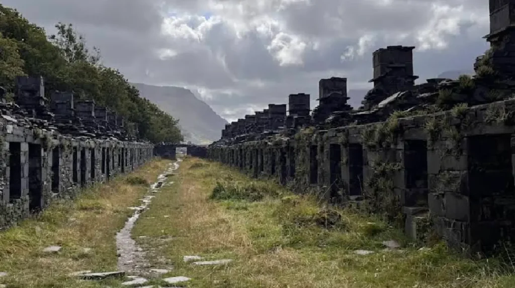
Victorian industrial expansion transformed the peak into a major mining operation and tourist destination during the 19th century. Copper, lead, and slate mining operations established industrial infrastructure along the lower slopes and valleys. Miners constructed paved access tracks, causeways, and crushed-stone inclines to haul raw copper ore down to processing mills. The Llanberis Slate Quarry operated on neighboring slopes, becoming one of the largest industrial slate quarries in world history.
Mountaineers began using the steep cliffs of Clogwyn Du’r Arddu for advanced technical rock climbing practice during the early 20th century. Brigadier John Hunt selected the peak as a primary cold-weather training site for the 1953 British Mount Everest Expedition. Expedition members Edmund Hillary and Tenzing Norgay tested specialised equipment and endurance along the mountain ridges prior to their successful Everest ascent. In November 2022, the Eryri National Park Authority officially mandated the exclusive use of the native Welsh name Yr Wyddfa in official documents to protect local language heritage.
Which Routes Allow Hikers to Reach the Summit safely?
Six official public hiking trails lead to the summit of Yr Wyddfa, ranging from gradual walking paths to steep, challenging mountain climbs. Each path varies in length, total elevation gain, technical difficulty, and starting trailhead location.
The Llanberis Path is the longest route, measuring 14.5 kilometers round trip with an elevation gain of 975 meters. It follows the line of the mountain railway and offers a gradual, steady gradient suitable for beginners. The Pyg Track covers 11 kilometers round trip, starting from the high point of Pen-y-Pass at 359 meters elevation. This start reduces total vertical climbing to 726 meters, though the terrain consists of rough, rocky ground. The Miners’ Track begins at Pen-y-Pass, passing Llyn Llydaw before joining the Pyg Track via a steep scree slope.
The Watkin Path is physically demanding, starting near sea level at Nant Gwynant. It covers 13 kilometers round trip with a total ascent of 1,015 meters across steep slate scree. The Rhyd Ddu Path spans 13 kilometers round trip from the west, taking hikers along the narrow, exposed Bwlch Main ridge. The Snowdon Ranger Path measures 13 kilometers round trip, ascending smoothly from the banks of Llyn Cwellyn along the western slopes.
| Trail Name | Round Trip Distance | Elevation Gain | Starting Location |
| Llanberis Path | 14.5 km | 975 m | Llanberis Village |
| Pyg Track | 11.0 km | 726 m | Pen-y-Pass Car Park |
| Miners’ Track | 13.0 km | 726 m | Pen-y-Pass Car Park |
| Watkin Path | 13.0 km | 1,015 m | Pont Bethania |
| Rhyd Ddu Path | 13.0 km | 890 m | Rhyd Ddu Car Park |
| Snowdon Ranger Path | 13.0 km | 936 m | Llyn Cwellyn |
For non-hikers, the Snowdon Mountain Railway provides mechanical access to the peak. Operational since 1896, this rack-and-pinion railway runs 7.5 kilometers from Llanberis to the summit visitor center, Hafod Eryri. The center sits at 1,065 meters elevation and opens seasonally from late spring to early autumn.
What Unique Flora and Fauna Inhabit the Mountain Environment?
Yr Wyddfa hosts a delicate arctic-alpine ecosystem that supports rare plant species, specialized mountain birds, and protected wildlife within a national nature reserve. The high elevation provides a refugium for species remnant from the last ice age.
The mountain is famous for the Snowdon Lily, known scientifically as Gagea serotina. This endangered arctic-alpine plant survives in the United Kingdom exclusively on steep, inaccessible rock ledges within Eryri National Park. The species features delicate white flowers with pink stripes that bloom briefly during late spring. Other rare plant species include the Purple Saxifrage (Saxifraga oppositifolia), Alpine Meadow-grass, and Alpine Saw-wort. These arctic-alpine plants depend on cold temperatures, damp acidic soils, and shading from direct sunlight on north-facing cliffs.
Avian wildlife includes specialized high-altitude species adapted to rocky mountain habitats. The red-billed chough, a rare member of the crow family, nests among the high cliff faces and feeds along surrounding pastures. Peregrine falcons hunt along the steep crags of Clogwyn Du’r Arddu, while ravens maintain regular territories across the summit ridges. Ring ouzels migrate to the upper slopes every summer to nest among scree fields.
The mountain environment faces environmental pressure from land use and tourism. More than 600,000 visitors walk to the summit every year, making it the busiest mountain in the United Kingdom. Heavy foot traffic causes trail erosion, soil compaction, and damage to fragile alpine vegetation. Conservation groups, including the National Trust and Eryri National Park Authority, maintain stone paths to minimize habitat degradation.
Frequently Asked Questions
What is the easiest route to climb the highest peak in Wales?
The Llanberis Path is considered the easiest route due to its wide path and gradual gradient. It starts in Llanberis village and follows the railway line to the summit. The trail measures 14.5 kilometers round trip and requires around five to six hours to complete.
How long does it take to hike up and down Yr Wyddfa?
A standard summit hike takes between five and seven hours round trip depending on the chosen trail, fitness level, and weather. Shorter routes like the Pyg Track take around five hours, while longer paths like the Watkin Path require up to seven hours.
Can you take a train to the summit of the mountain?
Yes, the Snowdon Mountain Railway operates from Llanberis to the summit visitor center, Hafod Eryri, during seasonal months. The rack-and-pinion train ride takes approximately one hour each way. Tickets must be booked in advance due to high seasonal demand.
What is the best time of year to climb Yr Wyddfa?
The best time to climb is between May and October when weather conditions are generally milder and daylight hours are longer. Winter months from November to April bring extreme cold, ice, and heavy snow, requiring technical mountaineering equipment like crampons and ice axes.
Do you need a permit or fee to hike to the summit?
No permit or entrance fee is required to hike up Yr Wyddfa, as public footpaths remain open year-round. However, parking at popular trailheads like Pen-y-Pass requires advance booking and parking fees, particularly during peak tourist months.