
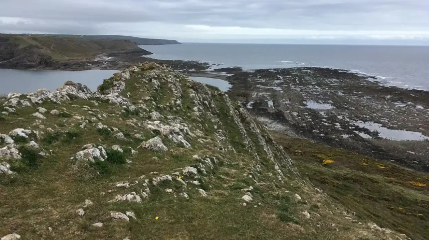
Worms Head is a prominent tidal island situated at the western tip of the Gower Peninsula in South Wales, marking the westernmost point of the City and County of uk/local/swansea/">Swansea. The headland extends approximately 1.5 miles into the Bristol Channel and is separated from the mainland cliffs of Rhossili by a narrow channel known as the Inner Head and Outer Head passage. Geographically, the site comprises three distinct sections known as the Inner Head, the Middle Head, and the Outer Head, which connect during low tide via a rocky causeway that remains passable for precisely 2.5 hours before and after low water.
The surrounding marine environment forms part of the South Gower Coast Site of Special Scientific Interest, protecting diverse coastal habitats, maritime grasslands, and critical breeding grounds for coastal bird species. The land is managed and preserved by the National Trust, which oversees conservation efforts, visitor safety management, and public access protocols across the entire Rhossili headland estate. The region experiences significant tidal variations, with tidal ranges reaching up to 10 meters during spring tides, making precise timing an absolute requirement for any visitor attempting to cross the tidal causeway safely.
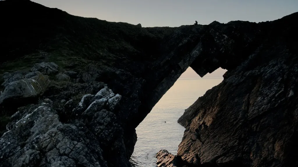
Visitors to this coastal landmark must register at the National Trust watch station before embarking on the crossing to ensure they are fully informed about safe crossing windows and current weather conditions. The physical layout of the island features rugged limestone cliffs, wave cut platforms, and steep maritime slopes that demand sturdy footwear and a high level of physical fitness from anyone attempting the full traverse. The nearest major urban center is the city of Swansea, located approximately 20 miles to the east, providing road access via the A4118 and B4171 routes through the picturesque Gower countryside. The location is bounded to the north by Llangennith Sands and to the south by Mewslade Bay, creating an isolated peninsula characterized by high exposure to Atlantic weather systems, strong winds, and rapid meteorological shifts. Understanding the exact geographic boundaries and tidal constraints of this Welsh landmark prevents hazardous situations and ensures compliance with local conservation bylaws designed to protect sensitive wildlife populations. The landscape has been shaped over millions of years by continuous wave action, marine erosion, and geological faulting, exposing complex stratigraphy that attracts geologists and researchers from academic institutions across the United Kingdom.
How Does the Tidal Causeway Work at Worms Head?
The tidal causeway at Worms Head is a submerged rocky ledge that connects the mainland to the inner head for approximately five hours during each twice daily tidal cycle. The safe crossing window opens precisely 2.5 hours before low tide and closes exactly 2.5 hours after low tide, leaving a narrow operational window that requires strict adherence by all hikers and explorers. If visitors fail to cross back before the tide covers the causeway, they become stranded on the island for the duration of the high tide cycle, which typically lasts for more than seven hours in duration.
Rescue operations managed by the Her Majesty’s Coastguard and the Royal National Lifeboat Institution respond to numerous stranding incidents each year, particularly during peak summer months when tourist numbers reach their highest levels. The tidal flow moves with deceptive speed across the shallow flats surrounding the causeway, creating strong currents and rising water levels that can quickly cut off escape routes to the mainland cliffs.
Local safety signage posted prominently at the head of the path details the exact daily crossing times calculated from astronomical tide tables for the Swansea and Mumbles coastal monitoring stations. Visitors must consult these official timetables and verify local conditions before descending the cliff path toward the causeway entrance, as weather conditions can also influence water levels. The rocky surface of the causeway is covered in slippery seaweed, barnacles, and jagged limestone formations that slow walking speeds and increase the physical effort required for the crossing. Crossing with children, heavy backpacks, or pets requires extra caution and additional time, which must be factored into the 5-hour total window to avoid accidental entrapment on the rising tide. The National Trust strongly advises turning back immediately if the tide has already begun to cover the lowest points of the causeway, regardless of how close the island appears from the mainland approach.
What Historical and Cultural Significance Does Worms Head Hold?
Worms Head derives its unusual name from the Old English word wyrm, meaning dragon or sea serpent, reflecting the imaginative perception of Anglo-Saxon and Viking sailors who navigated the treacherous Bristol Channel waters centuries ago. Archaeological surveys of the Gower Peninsula reveal human activity dating back tens of thousands of years, with nearby Paviland Cave yielding the famous Red Lady of Paviland burial from the Upper Paleolithic period. Maritime history records numerous shipwrecks along the jagged coastline surrounding the headland, where hidden rocks and fierce Atlantic gales posed extreme hazards to sailing vessels prior to modern navigation aids. The poet Dylan Thomas, who lived in nearby Cwmdonkin Drive in Swansea and later in Laugharne, frequently visited Rhossili and drew profound inspiration from the dramatic coastal landscapes and sweeping ocean vistas. The literary connection remains a vital part of the cultural identity of the area, drawing poetry enthusiasts and writers who seek to experience the raw natural beauty that influenced mid twentieth century Welsh literature.
Historical records from the nineteenth century document the operation of a coastguard lookout station near the headland, established to monitor maritime traffic and coordinate rescue efforts for distressed ships traversing the Bristol Channel shipping lanes. During the Second World War, the Gower coastline was heavily fortified with pillboxes, radar installations, and anti-invasion defenses, some of which remain visible as concrete ruins along the cliff tops near Rhossili. The preservation of these historical layers allows historians and visitors to understand the strategic military importance of the Welsh coastline during periods of national conflict and maritime dominance. Cultural heritage programs managed by local authorities and charitable trusts ensure that archaeological sites are protected from erosion and unauthorized artifact collection by amateur metal detectorists or visitors. The enduring mystique of the serpent shaped island continues to feature in Welsh folklore, local legends, and regional art exhibitions that celebrate the rugged character of the Gower peninsula.
What Wildlife and Ecological Features Exist on Worms Head?
Worms Head supports a thriving ecosystem of marine mammals, seabirds, and rare coastal plant species that have adapted to the harsh salt spray and high winds of the outer Bristol Channel environment. A resident colony of Atlantic grey seals utilizes the secluded coves and rocky beaches surrounding the island for hauling out, resting, and raising their pups during the autumn breeding season. Seabird populations including fulmars, shags, razorbills, and guillemots nest along the sheer limestone cliffs, providing critical breeding habitats protected under national wildlife conservation legislation. Maritime vegetation such as sea thrift, rock samphire, and wild carrot carpets the upper slopes of the headland, surviving in shallow soils enriched by guano and sea salt deposition. The surrounding waters form part of an important marine protected area where porpoises, dolphins, and occasional basking sharks can be observed by patient wildlife watchers equipped with binoculars.
Conservation initiatives led by Natural Resources Wales and the National Trust focus on mitigating the impact of human foot traffic on sensitive nesting sites and fragile dune ecosystems located near the mainland approach. Visitors are strictly required to keep dogs on leashes, avoid disturbing resting seals on the shoreline, and refrain from leaving any litter that could harm local wildlife or marine organisms. The ecological richness of the area makes it a premier location for biological field studies, university research projects, and amateur birdwatching expeditions throughout the spring and summer migration periods. Monitoring programs track population trends among seabird colonies to assess the broader health of the marine food web in the Bristol Channel and identify potential threats from climate change or pollution. Understanding these ecological dynamics highlights the delicate balance required to maintain public recreational access while preserving the unique natural heritage of this Welsh coastal treasure.
How Can Visitors Plan a Safe and Successful Trip to Worms Head?
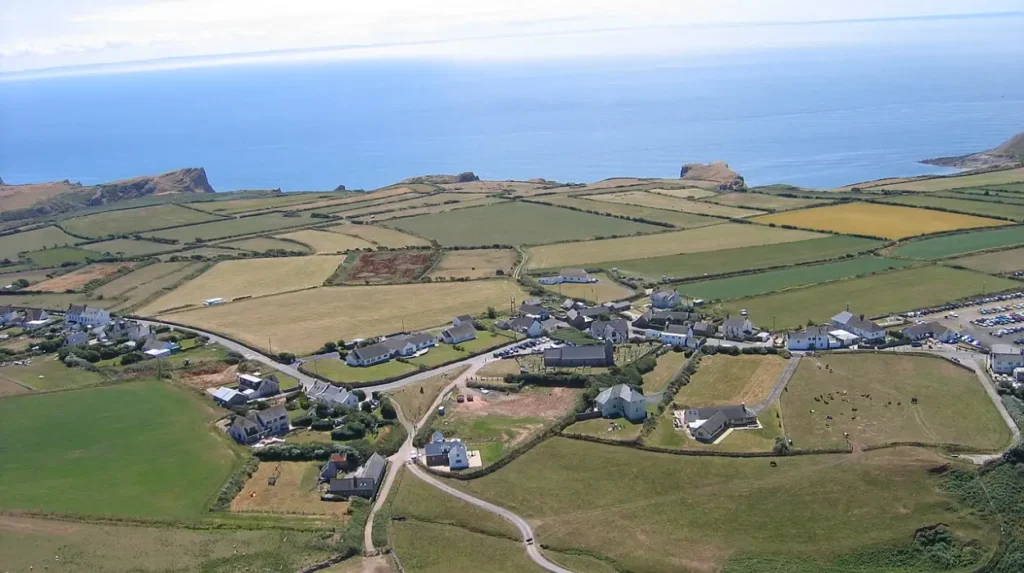
Planning a successful trip to Worms Head requires careful preparation regarding clothing, footwear, weather monitoring, and exact adherence to local tidal timetables published by conservation authorities. Visitors should wear sturdy hiking boots with aggressive tread to handle the slippery rocks, steep inclines, and uneven terrain encountered along both the causeway and the island trail. Essential gear includes windproof and waterproof outer layers, adequate drinking water, high energy snacks, and a fully charged mobile phone for emergency communication if unexpected situations arise. Public parking is available at the National Trust car park in Rhossili village, from which visitors walk a short half mile path across the cliff top down to the watch station. The total walking distance from the mainland car park to the end of the outer head is approximately four miles round trip, requiring roughly three to four hours of steady hiking.
Emergency contact protocols require visitors to dial 999 and ask for the Coastguard immediately if they observe someone in distress, trapped by the tide, or injured on the remote sections of the headland. Local accommodation options range from traditional country pubs and bed and breakfasts in Rhossili to modern holiday cottages and campsites distributed throughout the wider Gower Peninsula region. Public transport services operate seasonal bus routes connecting Swansea bus station directly to Rhossili village, allowing travelers without private vehicles to access the stunning coastal landscape sustainably. Weather forecasts should always be checked prior to departure, as high winds, thick fog, or heavy rain can make the exposed cliff paths and rocky causeway hazardous even during safe tidal windows. Adhering to these practical guidelines ensures an enjoyable, educational, and completely safe exploration of one of Wales’ most iconic natural landmarks.
Frequently Asked Questions
Can you walk all the way to the end of Worms Head?
Yes, visitors can walk the entire length of Worms Head during low tide by crossing the rocky causeway and traversing the Inner, Middle, and Outer heads. This hike requires strict timing to avoid being stranded by the incoming tide, which covers the causeway twice daily. Sturdy footwear and good physical fitness are essential due to the rugged and uneven terrain.
How long is the safe crossing window at Worms Head?
The safe crossing window opens precisely 2.5 hours before low tide and closes exactly 2.5 hours after low tide, giving explorers a total window of approximately five hours. Visitors must consult official tide timetables at the National Trust watch station before attempting the crossing. Failing to return within this window results in being stranded on the island until the next low tide.
What wildlife can be seen at Worms Head?
Visitors frequently observe colonies of Atlantic grey seals resting in the coves, as well as numerous nesting seabirds such as fulmars, shags, and guillemots along the cliffs. The surrounding marine protected area also supports porpoises and dolphins in the Bristol Channel. Conservation guidelines require visitors to maintain a respectful distance to avoid disturbing nesting birds and marine mammals.
Is parking available near Worms Head?
Public parking is available at the National Trust car park located in Rhossili village, just a short walk from the headland path. During peak summer months and weekends, the car park fills up quickly, so arriving early in the morning is highly recommended. Additional parking signage and facilities are managed locally to accommodate visitors traveling to the Gower Peninsula.
What should I wear when visiting Worms Head?
Visitors should wear sturdy hiking boots with good grip to navigate slippery seaweed, wet rocks, and steep cliff paths safely. Bringing waterproof and windproof jackets is essential because the exposed headland experiences strong Atlantic winds and rapid weather changes. Carrying a backpack with water, snacks, and a charged mobile phone ensures preparedness for the coastal hike.