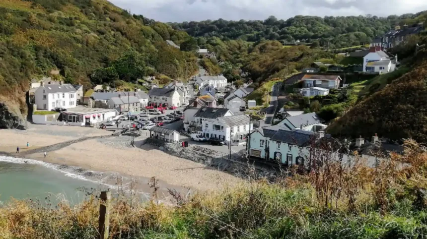
The coastal environment of Wales contains over 500 distinct beaches situated along 870 miles of continuous mainland coastline. Natural landforms range from expansive sandy bays to rocky coves shaped by Atlantic swells. Marine ecosystems in these areas support diverse wildlife populations, including grey seals and bottlenose dolphins. Environmental management programs enforce clean water standards across the region. Regional tourism infrastructure provides managed parking, lifeguard supervision, and public transport connections. Understanding local coastal geography helps visitors select optimal destinations for swimming, water uk/sports/">sports, and ecological tourism.
- What Makes Coastal Topography and Marine Geography Unique in Wales?
- Which Beaches in South Wales Offer Premier Coastal Recreation?
- How Do Pembrokeshire Beaches Provide World-Class Natural Environments?
- What Features Define the Remote Beaches of Ceredigion and Mid Wales?
- Why Are North Wales and Anglesey Beaches Major Coastal Destinations?
- How Are Environmental Quality and Safety Managed Across Welsh Beaches?
- Frequently Asked Questions
- What are the top-rated beaches in Wales for families?
- Which beaches in Wales allow dogs throughout the entire year?
- How do visitors check water quality and safety before visiting Welsh beaches?
- Where can surfers find the best waves along the coast of Wales?
- What is the best time of year to visit beaches in Wales?
What Makes Coastal Topography and Marine Geography Unique in Wales?
Wales features an extensive marine boundary surrounded by the Irish Sea, St George’s Channel, and the Bristol Channel. Glacial erosion and oceanic currents shaped the coastal landscape over millions of years, creating distinct headlands, salt marshes, and deep estuary channels. The Wales Coast Path covers 870 miles of continuous walking trails along this perimeter. High tidal ranges, particularly along the Severn Estuary, regularly alter beach surface areas. Local geological formations include Carboniferous limestone cliffs in the south and ancient Precambrian rock complexes in the northwest region.
Natural forces continue to influence shoreline stability through coastal erosion and sediment transport processes. Windward coasts experience high-energy wave impacts that form dramatic sea arches, stacks, and isolated rocky inlets. Leeward areas gather fine sand deposits that establish expansive intertidal zones. Sand dune systems, such as Kenfig National Nature Reserve and Merthyr Mawr, protect inland habitats from storm surges. These coastal structures host rare plant species, including fen orchids and sea holly, alongside protected bird communities.
Marine hydrodynamics along the Welsh coastline create clear environmental divisions between regional maritime zones. Northern coastal waters remain relatively shallow, supported by gentle shelf slopes that temper wave impact. Western and southern waters face directly into open Atlantic weather systems, producing strong ocean currents. Coastal management authorities monitor shoreline retreat rates using non-intrusive surveying tools. Local biological surveys verify that intact coastal habitats mitigate inland flooding while preserving distinct littoral ecosystems for native marine organisms.
Which Beaches in South Wales Offer Premier Coastal Recreation?
South Wales features major coastal destinations along the Glamorgan Heritage Coast, Gower Peninsula, and Carmarthenshire coastline. Rhossili Bay, situated on the western tip of the Gower Peninsula, spans 3 miles of continuous golden sand backed by steep limestone cliffs. Port Eynon Beach and Oxwich Bay provide sheltered waters suitable for sea kayaking, paddleboarding, and coastal swimming. The Glamorgan Heritage Coast includes Dunraven Bay at Southerndown, known for stratified limestone beds and rich fossil deposits. Maritime accessibility remains strong via regional road networks.

Public safety measures operate across major South Wales beaches during peak summer seasons. RNLI lifeguard teams patrol designated swimming zones at Cefn Sidan, a 8-mile sand expanse within Pembrey Country Park. Water testing initiatives ensure high bathing quality standards under Environmental Agency Wales criteria. Regional authorities maintain public amenities, including accessible boardwalks, visitor information centres, and pay-and-display parking facilities. Coastal transport routes connect major urban centers like Swansea and Cardiff directly to primary seaside locations.
Recreational marine activities in South Wales generate measurable local economic output through structured water sports sectors. Porthcawl’s Rest Bay serves as a major regional center for professional surfing instruction due to consistent Atlantic swell patterns. Langland Bay and Caswell Bay offer accessible family environments with dedicated beach hut rentals and public dining services. Conservation protocols restrict vehicular access on sensitive foreshores to protect native dune vegetation. Coastal path networks allow pedestrians to travel between adjacent bays without disturbing fragile marine habitats.
How Do Pembrokeshire Beaches Provide World-Class Natural Environments?
Pembrokeshire Coast National Park contains over 50 beaches across 186 miles of protected coastal landscape. Barafundle Bay, accessible via a half-mile cliff path from Stackpole Quay, features soft golden sand and calm, sheltered waters framed by pine trees. Broad Haven South and Freshwater West present exposed environments with notable sand dune networks and strong ocean waves. Barafundle Bay, Freshwater West, and Tenby Castle Beach represent key locations within the national park. The region holds numerous environmental awards reflecting strict water quality management.
Marine conservation zones surrounding the Pembrokeshire coastline safeguard critical habitats for migratory marine mammals and seabirds. Skomer Island and Ramsey Island host vast breeding colonies of Atlantic puffins, Manx shearwaters, and grey seals. Local water sports operators must adhere to strict codes of conduct to prevent disturbing wildlife populations during breeding seasons. Tenby’s four distinct beaches—North, South, Castle, and Harbour—offer varied marine exposure, catering to both tranquil swimming and active coastal sailing.
Sustainable tourism management balances high visitor volumes with ecological preservation across Pembrokeshire’s sensitive coastal sites. Tenby Castle Beach and Whitesands Bay routinely achieve Blue Flag status due to rigorous water safety standards, clear environmental education, and high-quality facility upkeep. Pembrokeshire County Council operates organized coastal bus services, including the Poppit Rocket and Puffin Coastal Bus, reducing personal vehicle traffic on narrow rural roads. These structural protections preserve pristine coastal ecosystems while maintaining full public access.
What Features Define the Remote Beaches of Ceredigion and Mid Wales?
Ceredigion features a dramatic coastline along Cardigan Bay, characterized by steep cliffs, secluded coves, and sweeping sandy stretches. Aberporth Beach consists of two sheltered sandy bays equipped with rock pools that expose diverse littoral fauna during low tide. Mwnt Beach features a secluded sand cove beneath the iconic conical hill of Foel y Mwnt. Llangrannog Beach sits within a narrow coastal ravine, providing direct access to the Ceredigion Coast Path. Cardigan Bay hosts the largest resident population of bottlenose dolphins in the United Kingdom.
Coastal marine monitoring programs operate throughout Cardigan Bay to track local dolphin, porpoise, and grey seal movements. Dedicated boat tours depart regularly from New Quay Harbour, following strict marine conservation guidelines to minimize engine disruption. Borth Beach features an expansive 3-mile sand and shingle spit that reveals an ancient petrified forest during exceptionally low tides. This submerged forest consists of fossilized oak, pine, and birch stumps dating back over 4,500 years to the Bronze Age.
Mid Wales beaches offer low-density coastal environments ideal for ecological tourism, birdwatching, and quiet outdoor recreation. The Dyfi Estuary, an officially designated UNESCO Biosphere Reserve, forms a major ecological boundary between Ceredigion and Gwynedd. Sand dune systems at Ynyslas preserve complex botanical habitats that host specialized invertebrates, lizards, and ground-nesting birds. Clear educational displays inform visitors about fragile foreshore ecosystems. Controlled footpaths direct pedestrian traffic away from sensitive dune vegetation, ensuring sustainable long-term environmental conservation.
Why Are North Wales and Anglesey Beaches Major Coastal Destinations?
North Wales and the Isle of Anglesey host a diverse shoreline along the Irish Sea, featuring sheltered straits, expansive sand bays, and rocky islets. Newborough Beach on Anglesey connects to Llanddwyn Island, offering views of the Snowdonia mountain range alongside historic geological formations. Benllech Beach and Red Wharf Bay display wide intertidal zones with shallow waters suitable for family wading. The Llyn Peninsula contains Abersoch Beach and Porth Oer, also known as Whistling Sands due to its unique acoustic quartz grains.
Geological variations across North Wales create contrasting coastal microclimates and distinct recreational conditions. Porth Oer earns its Whistling Sands moniker because rounded quartz grains squeak underfoot when compressed, a phenomenon found in only two European beaches. Black Rock Sands near Porthmadog features a broad, low-gradient intertidal zone that permits managed vehicle access directly onto the beach foreshore. Environmental wardens enforce speed limits and parking restrictions to prevent habitat degradation along adjacent sand dune margins.
Regional coastal management programs in North Wales prioritize sustainable recreation alongside coastal defense infrastructure. Colwyn Bay and Llandudno feature constructed promenade structures and beach nourishment projects that prevent coastal erosion while boosting public tourism capacity. Anglesey’s Area of Outstanding Natural Beauty protects 125 miles of coastline, ensuring that residential developments do not encroach upon sensitive littoral habitats. Regular marine sampling verifies high water purity levels across major resort towns throughout the summer season.
How Are Environmental Quality and Safety Managed Across Welsh Beaches?
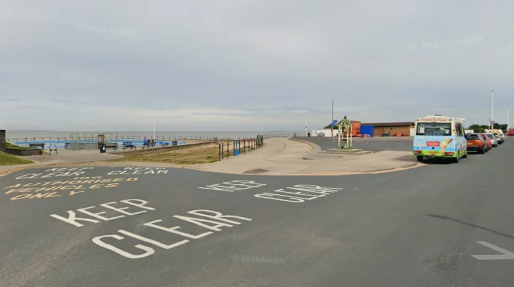
Keep Wales Tidy coordinates environmental assessment programs across the Welsh coast, administering international Blue Flag, Green Coast, and Seaside Awards. Criteria evaluate water cleanliness, safety provisions, environmental education, and overall site accessibility. Natural Resources Wales conducts routine bacterial sampling at designated bathing waters between May and September each year. Results categorize site performance as Excellent, Good, Sufficient, or Poor under strict European Union Bathing Water Directives. Local authorities display real-time safety advisories at primary access points.
Royal National Lifeboat Institution lifeguard teams patrol over 30 major beaches across Wales during peak seasonal periods. Lifeguards set up red and yellow flags to denote supervised swimming zones, while black and white chequered flags mark craft-only areas. Rip currents represent a primary natural hazard along exposed surf beaches like Freshwater West and Rest Bay. Educational signage details emergency procedures, local tide schedules, and hazard awareness. Dialing 999 and asking for the Coastguard connects visitors directly to maritime search and rescue services.
Public infrastructure adaptations ensure that Welsh beaches maintain accessible facilities for visitors with mobility impairments. Selected coastal sites provide all-terrain beach wheelchairs, stable access ramps, and dedicated accessible washrooms. Local councils enforce seasonal dog restrictions between May 1st and September 30th across high-density resort beaches to maintain hygienic conditions. Waste management programs promote zero-trace principles, providing clear recycling bins and organized beach cleanup kits. These coordinated municipal strategies protect coastal ecological integrity while preserving broad public accessibility.
Frequently Asked Questions
What are the top-rated beaches in Wales for families?
Top family beaches include Tenby Castle Beach, Saundersfoot, Benllech, and Oxwich Bay. These coastal areas feature shallow waters, soft sand, seasonal lifeguard coverage, and close proximity to public amenities. Accessible parking facilities and nearby dining venues make them convenient options for multi-generational visits.
Which beaches in Wales allow dogs throughout the entire year?
Rhossili Bay, Freshwater West, Jackson’s Bay, and Borth Beach welcome dogs year-round without seasonal restrictions. Many other developed resort beaches enforce partial dog bans between May 1st and September 30th. Visitors should check local council signage at beach entrances for specific boundary rules.
How do visitors check water quality and safety before visiting Welsh beaches?
Natural Resources Wales publishes regular bathing water quality ratings online throughout the summer season. Keep Wales Tidy highlights sites holding Blue Flag or Seaside Awards based on strict safety criteria. RNLI lifeguard status maps confirm active seasonal patrols and local hazard warnings.
Where can surfers find the best waves along the coast of Wales?
Rest Bay in Porthcawl, Freshwater West in Pembrokeshire, and Hell’s Mouth on the Llyn Peninsula offer the most consistent surf breaks. These locations face open Atlantic swells and provide reliable wave conditions for all skill levels. Local surf schools operate nearby, offering equipment rentals and structured safety instruction.
What is the best time of year to visit beaches in Wales?
June through August offers the warmest weather, active lifeguard patrols, and full access to coastal amenities. Spring and early autumn provide mild conditions, lower visitor density, and excellent opportunities for coastal walking and wildlife observation. Winter visits suit experienced walkers seeking dramatic coastal views and strong sea breezes.