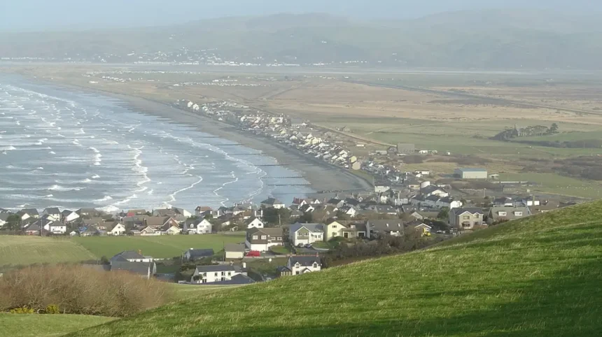
Borth Beach Wales is a prominent coastal coastline located along Cardigan Bay in Ceredigion, West Wales, positioning it as Ceredigion’s longest expanse of sand. It spans approximately three miles from the southern cliffs of Craig yr Wylfa to the northern sand dune system of Ynyslas.
- How Was the Ancient Submerged Forest at Borth Beach Formed?
- What Is the Historical Significance and Mythology Behind Cantre’r Gwaelod?
- What Coastal Hazards and Safety Features Exist at Borth Beach Wales?
- How Does the Ecological System of the Ynyslas Sand Dunes Function?
- What Water Sports and Outdoor Recreational Activities Are Available at Borth Beach Wales?
- What Are the Environmental Protections and Water Quality Standards at Borth Beach Wales?
- How Can Visitors Access Borth Beach Wales and What Amenities Are Available?
- Frequently Asked Questions
The beach features a distinct two-tier physical layout characterized by a steep upper shingle bank that transitions into a gently sloping expanse of golden sand at low tide. Geographically, the village of Borth sits directly behind sea defenses that shield residences from coastal storms. The northern terminus links to the Dyfi National Nature Reserve and Dyfi Estuary. Shallow, shelving waters dominate the shoreline, creating an extensive intertidal zone. The beach faces northwest into Cardigan Bay, exposing it to Atlantic swells while keeping water shallow.
How Was the Ancient Submerged Forest at Borth Beach Formed?
The ancient submerged forest at Borth Beach Wales formed approximately 4,000 to 6,000 years ago during the Bronze Age, as sea levels rose and preserved tree roots in peat deposits.
Rising post-glacial sea levels gradually inundated the low-land forested coastal plain that once stretched across Cardigan Bay. Saltwater intrusion killed dense woodlands of oak, pine, birch, alder, and hazel trees, leaving their root systems intact. The accumulation of waterlogged, anaerobic peat layers prevented oxygen exposure, stopping the decay of the timber. Tidal scouring and severe storms periodically strip away the surface sand to reveal preserved petrified tree stumps along the intertidal zone. These ancient remains serve as geological evidence of prehistoric landscapes and environmental changes across the Welsh coast.
What Is the Historical Significance and Mythology Behind Cantre’r Gwaelod?
Cantre’r Gwaelod represents the mythical lost sunken kingdom of Welsh folklore, traditionally believed to have been located directly beneath the modern waters of Cardigan Bay.
Legend states that Cantre’r Gwaelod was a fertile, low-lying realm protected from the sea by a complex network of dykes, sluice gates, and coastal embankments. Mythic accounts attribute its catastrophic flooding to Seithenyn, a careless guardian who left the sea gates open during a violent storm. The exposed petrified tree stumps at Borth Beach provide tangible physical support for these oral storytelling traditions. Modern researchers evaluate the tale as a cultural memory of rapid post-glacial sea level rise. Folklore holds that church bells from the drowned land ring out beneath the waves during times of danger.
What Coastal Hazards and Safety Features Exist at Borth Beach Wales?
Borth Beach Wales maintains designated RNLI lifeguard patrols during the peak summer months to oversee safe public bathing across its three-mile stretch of coastline.
The shallow, gently shelving shore creates safe swimming conditions for families and inexperienced waders during low tide. High tides reduce the sandy area significantly and force water up against the steep, unstable shingle sea wall. Rip currents form near the southern rocky headland of Craig yr Wylfa and close to the estuary channels at Ynyslas. Safety signage clearly marks zoned areas dedicated to specific water uk/sports/">sports like windsurfing and kitesurfing. Visitors must monitor local tide timetables to avoid becoming cut off by fast-incoming tides along the northern point.
How Does the Ecological System of the Ynyslas Sand Dunes Function?
The Ynyslas Sand Dunes function as a complex coastal ecosystem protected under the management of Natural Resources Wales within the Dyfi National Nature Reserve.
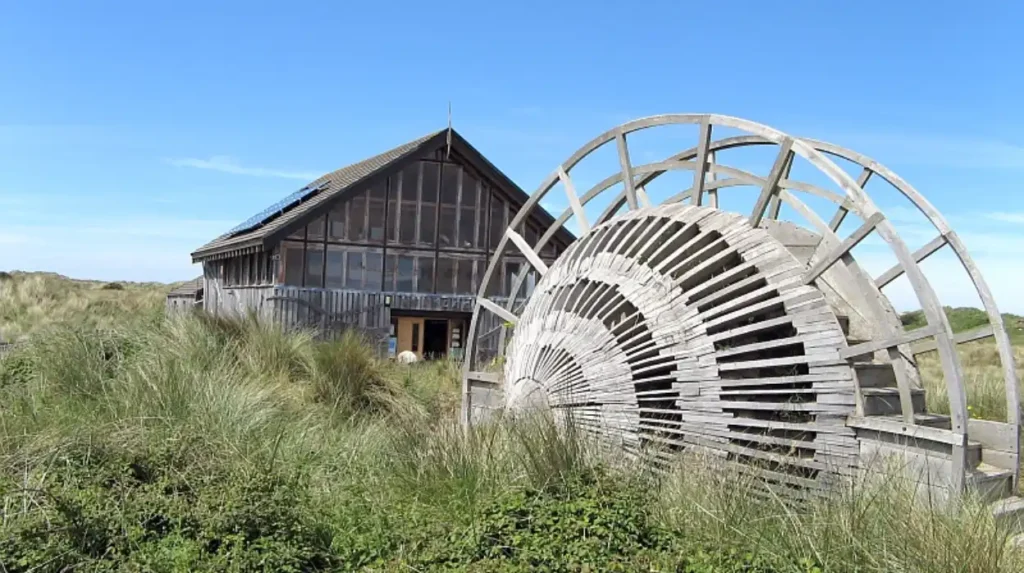
Wind action deposits marine sand along the high-water line, where specialized pioneer plant species like marram grass anchor shifting dunes. Root networks stabilize mobile sand hills, allowing diverse habitats like dune slacks and damp hollows to form behind protective ridges. Rare wildlife populations thrive within these dunes, including sand lizards, rare orchids, and breeding shorebirds. Strict conservation policies protect the fragile dune systems from erosion caused by heavy foot traffic. Boardwalk paths and designated access routes guide visitors safely through the reserve while protecting fragile vegetation.
What Water Sports and Outdoor Recreational Activities Are Available at Borth Beach Wales?
Borth Beach Wales offers diverse recreational options, including windsurfing, kitesurfing, stand-up paddleboarding, sea kayaking, surf fishing, and coastal walking along Ceredigion paths.
Consistent offshore winds and open Atlantic exposure generate suitable wave conditions for windsurfing and kitesurfing enthusiasts. The flat, three-mile sandy expanse provides ideal space for land yachting and beach walking at low tide. Beach anglers regularly catch sea bass, flounder, and dab from the shore during high tide periods. The Ceredigion Coast Path runs directly through Borth, connecting hikers north to Ynyslas and south to Aberystwyth. Local equipment hire shops and training schools operate seasonally along the primary seafront promenade.
What Are the Environmental Protections and Water Quality Standards at Borth Beach Wales?
Borth Beach Wales consistently earns Blue Flag Beach and Seaside Award designations based on high environmental standards, water cleanliness, and coastal management practices.
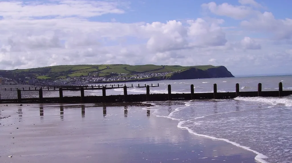
Regular water quality sampling conducted by Natural Resources Wales monitors bacterial levels to ensure safe conditions for recreational bathers. The surrounding waters fall under the Pen Llyn and Sarnau Special Area of Conservation, protecting marine life like bottlenose dolphins and grey seals. Seasonal dog restrictions apply to designated central sections of the beach from May 1 to September 30. Local environmental initiatives focus on preserving native habitats, reducing plastic marine litter, and managing visitors responsibly. Wastewater treatment facilities in Ceredigion maintain strict discharge controls to safeguard the water quality.
How Can Visitors Access Borth Beach Wales and What Amenities Are Available?
Visitors access Borth Beach Wales via the A487 road, public bus routes, or direct rail service on the Cambrian Line stopping at Borth Railway Station.
The village features multiple public parking areas, including free spaces along the promenade and paid lots near the community hall. Essential amenities located nearby include public restrooms, baby changing stations, disabled access ramps, cafes, chip shops, and traditional pubs. The central seafront offers immediate access to convenience stores, seaside shops, and local holiday accommodation options. The adjacent Ynyslas Visitor Centre provides educational displays, tide charts, and guidance on navigating the nearby nature reserve. Clear access ramps make it easy for visitors with mobility equipment to reach the shoreline.
Frequently Asked Questions
Can you see the submerged forest at Borth Beach all the time?
The submerged forest is visible only during low tide, particularly after severe winter storms scour away surface sand.
Is Borth Beach Wales safe for families and children?
Yes, the shallow, gently shelving waters and seasonal RNLI lifeguard patrols make it very safe for children.
Are dogs allowed on Borth Beach Wales?
Dogs are allowed year-round on parts of the beach, but restricted on central sections from May 1 to September 30.
What is the best time of year to visit Borth Beach Wales?
Summer brings warm weather and lifeguards, while autumn and winter offer better views of the submerged forest.