
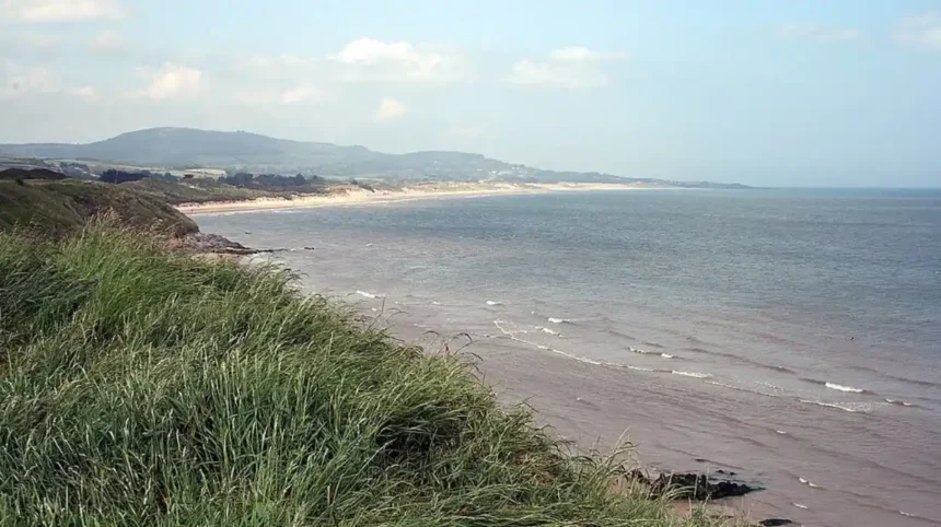
The Irish Sea serves as the primary maritime boundary separating the eastern coast of Ireland from the western coast of Wales. This body of water spans approximately 210 kilometers in length and varies in width from 75 to 200 kilometers between the two landmasses. The geographic proximity has governed transport, trade, and geopolitical interactions between both nations for millennia. Major Irish ports including Dublin and Rosslare align directly across the water from major Welsh ports including Holyhead, Fishguard, and Pembroke Dock. This nautical corridor provides crucial infrastructure connecting the Republic of Ireland directly to the United Kingdom and continental Europe.
- How Did Early Celtic Migration and Language Development Connect Ireland and Wales?
- What Impact Did Christian Saints and Early Medieval Monasticism Have on Both Regions?
- How Did Medieval Pilgrimage Routes Form Early Transport Corridors Between Wales and Ireland?
- How Did Anglo-Norman Expansions Use Wales as a Staging Ground for the Invasion of Ireland?
- What Structural Similarities Exist Between Medieval Welsh and Irish Castle Architecture?
- Which Ferry Routes and Ports Handle the Primary Freight Traffic Across the Irish Sea?
- How Has the UK Landbridge Route Evolved for Irish-Welsh Trade Logistics?
- What Shared Renewable Energy Initiatives Unite Ireland and Wales in the Irish Sea?
- How Does the Greenore-Anglesey Marine Conservation Framework Protect Celtic Sea Ecosystems?
- Frequently Asked Questions
The bathymetry of the Irish Sea features a deep central trench known as the Beauforts Dyke region, reaching depths of over 200 meters. The shallow coastal shelves along both the Leinster coast in Ireland and the Holyhead basin in Wales facilitate extensive maritime commercial activity. Strategic geographical points, such as the St Georges Channel in the south and the North Channel in the north, anchor the perimeter of this shared marine environment. Environmental management and marine navigation within these waters require cooperative frameworks managed jointly by Irish and UK maritime authorities. These natural geographic structures have dictated trade lanes, migratory patterns, and defense strategies since early antiquity.
How Did Early Celtic Migration and Language Development Connect Ireland and Wales?
The historical migration of Celtic tribes across the Irish Sea established the foundation for linguistic development in northern Europe. Insular Celtic speech diverged into two distinct linguistic branches known as Goidelic and Brittonic during the early first millennium. The Goidelic branch evolved directly into Irish, Scottish Gaelic, and Manx, while the Brittonic branch formed Welsh, Cornish, and Breton. Archaeological evidence shows sustained cross-channel trade in the Bronze Age and Iron Age that facilitated continuous dialectal exchange. Despite distinct phonological shifts, shared lexical items demonstrate a common ancestral linguistic structure across both populations.
Linguistic studies confirm that ancient maritime contact allowed bilingualism to persist along coastal trading ports in western Britain and eastern Ireland. Early Celtic settlers established trade colonies along the coastlines of Gwynedd, Dyfed, and Anglesey during the late Roman period. These coastal settlements introduced early Irish influences directly into the western British mainland, while Brittonic traders settled along the Irish coast. Inscriptions recorded in early stone monuments display the structural similarities and transitional vocabulary present during this phase of Celtic language development.
What Role Did Ogam Inscriptions Play in Trans-Irish Sea Historical Records?
Ogam inscriptions provide physical evidence of Irish settlements across western Wales during the fifth and sixth centuries. Over 35 Ogam stones exist across Pembrokeshire, Carmarthenshire, and Anglesey, frequently featuring bilingual text written in both Primitive Irish and Latin. These monuments marked land ownership, territorial boundaries, and ancestral burials for Irish dynasties operating within Welsh territories. The presence of these stones confirms settled, governance-level interactions rather than temporary raiding expeditions across the Irish Sea.
The Dynasties of Dyfed in southwest Wales trace their lineage directly to the Irish Uí Liatháin and Déisi tribes who migrated east in the late fourth century. Historical manuscripts verify that these Irish rulers integrated completely into Welsh nobility, establishing royal lineages that lasted for generations. The stone monuments constructed by these dynasties showcase a hybrid cultural identity combining Irish orthography with Roman-British administrative styles. This physical epigraphic record confirms a deep structural integration of early medieval Irish and Welsh societies.
What Impact Did Christian Saints and Early Medieval Monasticism Have on Both Regions?
Early medieval Christianization further strengthened the structural bonds between Ireland and Wales through shared monastic networks. Saint Patrick, the patron saint of Ireland, was born in Roman Britain, with strong historical consensus placing his origins in western Britain near the Welsh border. Irish scholars and monks established religious schools in Wales, while Welsh saints founded monasteries along the Leinster coastline. Saint David, the patron saint of Wales, maintained direct correspondence and spiritual alliances with Irish monastic leaders throughout the sixth century.
Monastic foundations such as St Davids in Pembrokeshire and Ferns in County Wexford operated as linked centers of learning, scripture, and diplomacy. Welsh monks trained under Irish scholars in theology, while Irish pilgrims regularly passed through Welsh ports on journeys to continental Europe. Manuscripts produced in these shared scriptoria displayed identical Insular art styles, combining intricate Celtic knotwork with early Christian iconography. This network created a unified cultural and intellectual corridor across the Irish Sea that survived throughout the Early Middle Ages.
How Did Medieval Pilgrimage Routes Form Early Transport Corridors Between Wales and Ireland?
Pilgrimage to religious sites established formal maritime routes that functioned as early commercial transport infrastructure. Welsh monks traveled to Glendalough and Kildare, while Irish pilgrims frequented St Davids Cathedral, which Pope Calixtus II declared equivalent in spiritual merit to Rome. These regular journeys required standardized ferry crossings and harbor facilities along both coastlines. Local coastal economies developed around these pilgrimage nodes, providing lodging, supplies, and maritime transport for travelers crossing the channel.
The infrastructure created by these religious journeys established the exact maritime routes used by modern commercial transport networks. Ports such as Pembrokeshire and Wexford grew from seasonal monastic landing sites into permanent urban centers equipped with docks and warehouses. Maritime law in the early medieval era evolved to protect religious travelers crossing the Irish Sea, establishing early protocols for international passage. These historical routes established the operational foundation for centuries of continuous bilateral movement.
How Did Anglo-Norman Expansions Use Wales as a Staging Ground for the Invasion of Ireland?
How Did Richard de Clare Launch the 1169 Invasion From Welsh Strongholds?
The Anglo-Norman invasion of Ireland in 1169 originated directly from military bases established in western Wales. Richard de Clare, known as Strongbow, organized his knightly forces and military supply lines within the marcher lordships of Pembrokeshire and Chepstow. King Diarmait Mac Murchada of Leinster sought military assistance from Norman lords in Wales after being deposed from his throne. The proximity of Welsh ports allowed Anglo-Norman commanders to assemble fleets and transport heavy cavalry, archers, and supplies across the Irish Sea.
Military garrisons located in Pembroke and Milford Haven served as key operational hubs for cross-channel force projection into Wexford and Waterford. The invading forces consisted of a mix of Norman commanders, Flemish settlers, and Welsh foot soldiers recruited from the Marcher regions. This military campaign altered the political trajectory of Ireland permanently, establishing the Anglo-Norman Lordship of Ireland. The administrative systems, castles, and fortresses constructed in Ireland directly mirrored those previously developed in the Welsh Marches.
What Structural Similarities Exist Between Medieval Welsh and Irish Castle Architecture?
The fortification strategies deployed by Norman rulers in Ireland directly replicated architectural designs tested during the conquest of Wales. Major castles constructed in Ireland, such as Pembroke-inspired fortifications at Kilkenny and Pembroke-style keeps at Hook Head, demonstrate shared engineering standards. Defensive walls, gatehouses, and curtain wall configurations were designed by military architects who worked interchangeably across both territories. These stone castles served as administrative seats, military barracks, and economic centers controlling the surrounding agricultural hinterlands.
Comparative structural analysis shows identical stone masonry techniques and defensive features in coastal castles along both sides of the Irish Sea. Caernarfon and Conwy castles in North Wales shared strategic supply logistics with Dublin Castle and Trim Castle in Leinster. The coastal placement of these fortresses ensured they could receive supplies directly by sea from allied ports across the channel. This shared defensive network allowed Anglo-Norman rulers to maintain military control over trade routes traversing the Irish Sea.
Which Ferry Routes and Ports Handle the Primary Freight Traffic Across the Irish Sea?
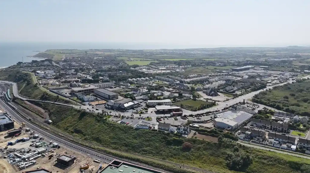
Modern trade and passenger transit between Ireland and Wales rely on high-capacity commercial ferry routes operating across the Irish Sea. The Northern corridor links Holyhead in Anglesey directly to Dublin Port, carrying the highest volume of vehicular freight and roll-on/roll-off cargo. The Southern corridor connects Fishguard and Pembroke Dock in Pembrokeshire to Rosslare Harbour in County Wexford. These maritime routes handle millions of tonnes of industrial goods, agricultural products, and consumer merchandise annually, forming a crucial supply chain link.
Port infrastructure investments in Holyhead and Dublin have expanded deep-water berthing, automated cargo handling, and green energy vessel refueling capabilities. Advanced logistics networks ensure rapid transport times, with modern ferries completing the Holyhead to Dublin transit in approximately three hours and fifteen minutes. Freight operators utilize these routes as a landbridge option, linking Irish supply chains directly to the UK road network and European continent. Continuous multi-million-pound upgrades guarantee the resilience and efficiency of these critical maritime trade arteries.
How Has the UK Landbridge Route Evolved for Irish-Welsh Trade Logistics?
The UK landbridge route historically served as the fastest and most cost-effective freight path connecting Irish exporters to mainland European markets through Welsh ports. Heavy goods vehicles leaving Irish ports traveled via Holyhead or Fishguard across the UK road infrastructure to reach English Channel ports. Recent shifts in international customs protocols and border control procedures have modified trade flows, prompting logistics operators to adapt routing schedules. Despite regulatory changes, the geographical efficiency of crossing from Leinster to North Wales keeps this corridor central to bilateral commerce.
Advanced customs pre-lodgement software, dedicated freight lanes, and expanded border control posts at Holyhead have streamlined transit processing times. Economic data demonstrates that high-value time-sensitive exports, including pharmaceuticals, fresh food, and electronics, rely heavily on Welsh port infrastructure. Joint supply chain strategies between Irish and Welsh trade bodies continue to optimize these freight corridors to minimize delays. The economic interdependence between Dublin and Welsh transport hubs remains a foundational component of regional trade policy.
What Shared Renewable Energy Initiatives Unite Ireland and Wales in the Irish Sea?
The Irish Sea presents optimal environmental conditions for large-scale offshore wind energy generation, featuring high average wind speeds and suitable seabed depths. Ireland and Wales have initiated collaborative energy frameworks to develop fixed-bottom and floating offshore wind farms within their respective maritime zones. Projects such as the Awel y Môr offshore wind farm off the North Wales coast and proposed developments off the Leinster bank aim to generate gigawatts of clean electricity. These projects form a central pillar of regional decarbonization strategies aimed at achieving net-zero carbon emissions.
Technical partnerships between Irish and Welsh academic institutions and marine engineering firms focus on optimizing floating wind turbine technology. Deepwater regions within the Irish Sea require floating foundations anchored to the seabed, presenting complex engineering requirements met through shared research. Shared port facilities in Wales and Ireland serve as manufacturing, assembly, and deployment bases for turbine components and maintenance vessels. This coordinated energy strategy enhances grid stability and energy security for both nations.
How Does the Greenore-Anglesey Marine Conservation Framework Protect Celtic Sea Ecosystems?
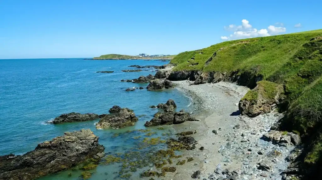
Cooperative environmental management frameworks exist to preserve biodiversity, fish stocks, and marine habitats across the shared waters of the Irish Sea. The Greenore to Anglesey marine conservation corridor establishes protected monitoring zones for marine mammals, including harbor porpoises, grey seals, and migratory seabirds. Joint research initiatives conducted by Welsh and Irish environmental protection agencies monitor water quality, microplastic pollution, and invasive marine species. These environmental protocols ensure sustainable resource management while permitting necessary commercial shipping and fishing activities.
Oceanographic mapping projects utilize sonar and satellite telemetry to track changing water temperatures and currents across the St Georges Channel. Marine scientists from Bangor University in Wales and University College Dublin collaborate to collect long-term ecological data sets. These initiatives inform environmental policy, guiding coastal development, port expansions, and renewable energy installations without compromising fragile marine ecosystems. The unified management of the Irish Sea marine environment underscores the ecological interdependence of both coastlines.
Related Content & Recommended Reading Blocks
To improve dwell time and reduce bounce rates, insert callout boxes throughout the article structure:
Related Article:
For insights into major capital investments near South Wales transport links, explore thefinal design revealed for Cardiff’s £60m County Hall replacement.
Read More:
Learn more about sustainability and community energy projects across Welsh regions via the report onLoughor RFC receiving energy grants in Swansea.
Frequently Asked Questions
What language was spoken in ancient Ireland and Wales?
Ancient Ireland spoke Primitive Irish, a Goidelic Celtic language, while ancient Wales spoke Common Brittonic, a Brittonic Celtic language. Both languages originated from a shared Insular Celtic root but developed distinct phonological and grammatical structures over time through geographical separation and regional trade patterns.
How long does the ferry take from Ireland to Wales?
The ferry crossing from Dublin to Holyhead takes approximately three hours and fifteen minutes on standard passenger vessels. Southern routes from Rosslare to Fishguard or Pembroke Dock take between three and a half to four hours, depending on sea conditions, vessel type, and specific ferry operator schedules.
Are Irish and Welsh Celtic languages mutually intelligible?
Irish and Welsh are not mutually intelligible in spoken or written forms due to early branch divergence between Goidelic and Brittonic dialects. While they share core vocabulary, grammatical concepts, and sentence structures, sentence pronunciation and vocabulary differ significantly, requiring formal study for speakers of one language to understand the other.
Why did Norman invaders launch their conquest of Ireland from Wales?
Norman invaders used Wales as a staging ground due to its geographic proximity to Leinster and established castle infrastructure in Pembrokeshire and Chepstow. Welsh ports provided ideal harbors for assembling fleets, knights, horses, and supply lines needed to cross the Irish Sea efficiently during the 1169 invasion campaigns.
What is the narrowest point of the sea between Ireland and Wales?
The narrowest distance between Ireland and Wales spans approximately 75 kilometers across the St Georges Channel, connecting the southwestern tip of Wales at Pembrokeshire to the southeastern coast of Ireland at County Wexford. This maritime corridor has hosted continuous trade, migration, and naval transport throughout recorded history.