
North Wales is a geographic region of Wales bordered by the Irish Sea to the north and England to the east. The territory encompasses six principal council areas, including Gwynedd, Conwy, Denbighshire, Flintshire, uk/local/wrexham/">Wrexham, and the Isle of Anglesey. According to Welsh Government tourism statistics, North Wales attracts over 3.3 million overnight domestic trips and 25 million day visits annually. Visitors travel to the region to examine three distinct geographic zones, which are the Eryri mountain range, the Menai Strait coastline, and the Dee Valley. These landscapes preserve 450-million-year-old volcanic geology, thirteenth-century military fortresses, and nineteenth-century slate quarries. Understanding the layout of these sites enables travelers to plan efficient routes across northern coastal and upland corridors.
- What Natural Landmarks Define Eryri National Park?
- Yr Wyddfa and the Snowdon Mountain Railway
- Ogwen Valley and Llyn Idwal
- Aber Falls and the Northern Foothills
- Which Medieval Castles Form the UNESCO World Heritage Site in North Wales?
- What Are the Top Coastal Destinations and Islands in North Wales?
- Llandudno and the Great Orme
- Isle of Anglesey and South Stack Cliffs
- Portmeirion and the Llyn Peninsula
- How Did Industrial Engineering Shape the Landmarks of North Wales?
- The Slate Landscape of Northwest Wales
- Pontcysyllte Aqueduct and Llangollen Canal
- Zip World Penrhyn Quarry and Underground Caverns
- What Practical Details Should Visitors Know Before Touring North Wales?
- Transport Corridors and Public Transit
- Welsh Language and Cultural Heritage
- Climate and Safety in Mountain Environments
- Frequently Asked Questions About Places to See in North Wales
What Natural Landmarks Define Eryri National Park?
Eryri National Park, designated in 1951 and covering 2,130 square kilometers, contains the highest mountain peaks and deepest glacial lakes in Wales. The park protects nine mountain ranges, including Yr Wyddfa, the Glyderau, and the Carneddau, alongside 37 miles of coastline.
Yr Wyddfa and the Snowdon Mountain Railway
Yr Wyddfa rises to 1,085 meters above sea level in Gwynedd, standing as the highest summit in England and Wales. Ordovician submarine volcanic activity formed the mountain approximately 450 million years ago, and Devensian glaciation carved its steep cwms and ridges. Over 600,000 hikers ascend the peak annually via six primary footpaths, such as the Llanberis Path, the Pyg Track, and the Watkin Path. Travelers also reach the Hafod Eryri summit visitor center aboard the Snowdon Mountain Railway, which has operated narrow-gauge rack-and-pinion trains since 1897. The railway climbs 7.5 kilometers from Llanberis station along a maximum gradient of 1 in 5.5. Natural Resources Wales manages the surrounding 1,671-hectare Snowdon National Nature Reserve to protect rare arctic-alpine plants.
Ogwen Valley and Llyn Idwal
The Ogwen Valley runs along the A5 trunk road between Bethesda and Capel Curig, separating the Glyderau and Carneddau mountain ranges. Glacial erosion formed Cwm Idwal, a hanging valley cradling Llyn Idwal at an elevation of 370 meters. In 1831, naturalist Charles Darwin studied the fossilized marine shells and moraines in Cwm Idwal to prove the theory of past glaciation in Britain. Surrounding peaks include Tryfan at 917 meters and Glyder Fawr at 1,001 meters, which features the wind-eroded rock formations of Castell y Gwynt. The National Trust manages the 3,000-hectare Carneddau and Glyderau estate to maintain stone footpaths and prevent upland soil erosion. Visitors access the valley floor directly from the Ogwen Cottage visitor center.
Aber Falls and the Northern Foothills
Aber Falls, known in Welsh as Rhaeadr Fawr, plunges 37 meters over a sill of igneous rock in the foothills of the Carneddau range. Located two miles south of the coastal village of Abergwyngregyn, the waterfall marks the point where the Afon Goch drops from the uplands toward the Menai Strait. A four-kilometer gravel footpath leads from the Bont Newydd car park through ancient oak woodlands and Bronze Age settlement remains. During winter months, heavy rainfall across the northern plateaus increases water discharge over the cliff face. The surrounding Coedydd Aber National Nature Reserve supports breeding pied flycatchers, wood warblers, and dense bryophyte communities.
Which Medieval Castles Form the UNESCO World Heritage Site in North Wales?
King Edward I constructed a ring of stone fortresses across North Wales between 1283 and 1330 to consolidate English rule over the Principality of Wales. UNESCO inscribed four of these fortresses onto the World Heritage List in 1986 under the Castles and Town Walls of King Edward in Gwynedd designation.
Conwy Castle and Town Walls
Conwy Castle occupies a coastal rock ridge overlooking the Conwy Estuary, built between 1283 and 1287 under master mason James of Saint George. The royal treasury spent 15,000 pounds on the fortress, which incorporates eight cylindrical towers rising 21 meters high and two fortified barbicans. A continuous circuit of medieval town walls measuring 1.3 kilometers long and containing 21 towers still encloses the historic town center. Inside the castle bailey stand the stone foundations of the Great Hall, private royal chambers, and a thirteenth-century chapel. Cadw maintains the monument and provides direct staircase access to the upper wall walks overlooking the Conwy Suspension Bridge.
Caernarfon Castle
Caernarfon Castle stands at the southern entrance of the Menai Strait where the River Seiont meets the sea. Edward I began construction in 1283, modeling the banded masonry and polygonal towers after the Walls of Constantinople to assert imperial authority. The fortress features the massive Eagle Tower, which measures 18 meters in diameter and displays three carved stone eagles atop its turrets. In 1301, Edward I invested his son Edward of Caernarfon as the first English Prince of Wales within the castle grounds. Today, the King’s Gate houses exhibition galleries detailing Welsh royal history and the Royal Welch Fusiliers Regimental Museum.
Beaumaris and Harlech Castles
Beaumaris Castle sits on the Isle of Anglesey, representing the final fortress commissioned by Edward I in 1295. Designed on a concentric walls-within-walls plan, the structure features a water-filled moat, twelve outer gatehouse towers, and symmetrical defensive lines. Financial shortages halted construction in 1330, leaving the inner curtain walls shorter than originally planned. Further south along Tremadog Bay, Harlech Castle perches atop a 60-meter vertical cliff overlooking the Irish Sea. Built between 1283 and 1289, Harlech withstood a seven-year siege during the Wars of the Roses from 1461 to 1468. Both sites operate under Cadw stewardship as intact examples of medieval military architecture.
What Are the Top Coastal Destinations and Islands in North Wales?
The North Wales coastline stretches from the Dee Estuary to the Llyn Peninsula, encompassing the Isle of Anglesey across the Menai Strait. Seaside resorts, limestone headlands, and marine nature reserves characterize this coastal corridor.
Llandudno and the Great Orme
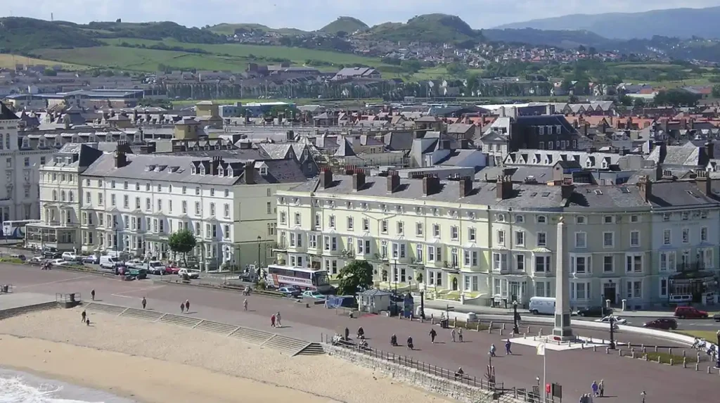
Llandudno occupies a flat isthmus between the Irish Sea and the Conwy Estuary, developed during the 1850s as a Victorian seaside resort. The town promenade curves along North Shore Beach, anchored by the Grade II listed Llandudno Pier extending 700 meters over the water. Rising 207 meters above the western end of the bay is the Great Orme, a Carboniferous limestone headland designated as a Country Park. Visitors ascend the headland via the Great Orme Tramway, a cable-hauled street tramway operating continuously since 1902. Beneath the limestone surface lie the Great Orme Bronze Age Copper Mines, where miners extracted ore 4,000 years ago using stone hammers.
Isle of Anglesey and South Stack Cliffs
The Isle of Anglesey covers 714 square kilometers, separated from mainland Wales by the 25-kilometer tidal channel of the Menai Strait. Thomas Telford completed the Menai Suspension Bridge in 1826, linking the island to Bangor via the world’s first major iron suspension bridge. On the western edge of Holy Island, South Stack Cliffs rise 60 meters from the sea, exposing folded Precambrian metamorphic rocks. A descent of 400 stone steps leads visitors across a footbridge to South Stack Lighthouse, constructed in 1809 to warn ships of coastal reefs. The surrounding Royal Society for the Protection of Birds reserve hosts breeding colonies of guillemots, razorbills, and choughs.
Portmeirion and the Llyn Peninsula
Portmeirion sits on a private wooded peninsula overlooking the Dwyryd Estuary near Penrhyndeudraeth in Gwynedd. Architect Sir Clough Williams-Ellis designed and built the Italianate village between 1925 and 1975 to demonstrate how architectural development enhances natural landscapes. The village comprises 50 colorful buildings, classical colonnades, a central piazza, and 70 acres of sub-tropical woodlands known as the Gwyllt. Westward extends the Llyn Peninsula, a 48-kilometer headland designated as an Area of Outstanding Natural Beauty in 1956. Coastal villages such as Abersoch, Aberdaron, and Nefyn provide access to sandy coves and the 146-kilometer Llyn Coastal Path.
How Did Industrial Engineering Shape the Landmarks of North Wales?
Nineteenth-century civil engineering and mineral extraction transformed North Wales into a global center for slate production and canal transport. UNESCO recognizes these engineering achievements through two distinct World Heritage designations in the region.
The Slate Landscape of Northwest Wales
UNESCO inscribed the Slate Landscape of Northwest Wales onto the World Heritage List in July 2021. The designation encompasses six areas across Gwynedd, including Penrhyn Quarry, Dinorwig Quarry, and the Ffestiniog Railway. During the 1890s, Welsh quarries employed 17,000 workers and produced nearly 500,000 tons of roofing slate annually for export worldwide. At Llanberis, the National Slate Museum occupies the original Victorian workshops of Dinorwig Quarry, housing an operational 15-meter waterwheel built in 1870. Nearby, the Ffestiniog Railway operates historic steam locomotives along a 21-kilometer narrow-gauge track opened in 1836 to transport slate from Blaenau Ffestiniog to Porthmadog.
Pontcysyllte Aqueduct and Llangollen Canal
Pontcysyllte Aqueduct carries the Llangollen Canal 38 meters above the River Dee near Wrexham in northeastern Wales. Civil engineers Thomas Telford and William Jessop constructed the aqueduct between 1795 and 1805 using cast-iron plates bolted together in a watertight trough. Nineteen hollow stone masonry pillars support the 307-meter iron channel across the Dee Valley. In 2009, UNESCO designated the aqueduct and 18 kilometers of surrounding canal infrastructure as a World Heritage Site. Canal boats and pedestrians cross the structure daily via a narrow towpath protected by an iron railing on one side and a 15-centimeter flange on the water side.
Zip World Penrhyn Quarry and Underground Caverns
Former industrial quarries in North Wales operate today as large-scale adventure tourism facilities. At Penrhyn Quarry in Bethesda, Velocity 2 operates as the fastest zip line in the world, spanning 1.5 kilometers over a flooded slate pit. Riders reach speeds exceeding 100 miles per hour at a height of 150 meters above the turquoise quarry lake. In Blaenau Ffestiniog, Llechwedd Slate Caverns houses subterranean trampoline nets and zip lines suspended inside Victorian underground mining chambers. These adaptive reuse projects sustain regional employment following the twentieth-century decline of heavy mineral extraction.
What Practical Details Should Visitors Know Before Touring North Wales?
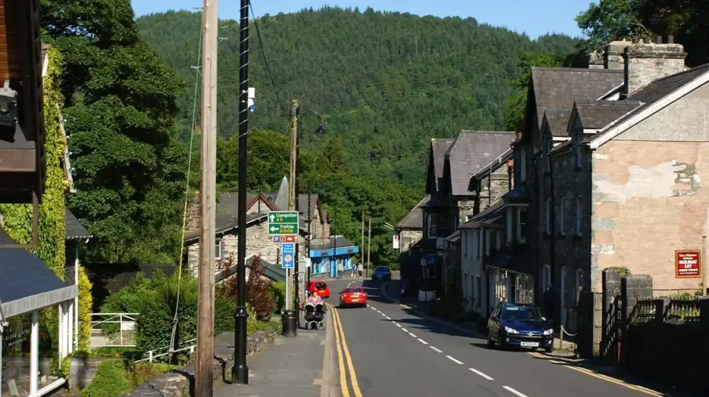
Touring North Wales requires planning around regional transport corridors, seasonal rainfall patterns, and official Welsh language conventions. Most travelers allocate five to seven days to explore coastal towns, mountain passes, and historical monuments across the six counties.
Transport Corridors and Public Transit
The A55 North Wales Expressway runs 140 kilometers from Chester to Holyhead, serving as the primary east-west coastal highway. Transport for Wales operates mainline trains along the North Wales Coast Line, stopping at Rhyl, Colwyn Bay, Llandudno Junction, and Bangor. Traveling south into Eryri requires boarding the Conwy Valley Line to Blaenau Ffestiniog or utilizing the Sherpa’r Wyddfa bus network. The Sherpa buses link Llanberis, Pen-y-Pass, Betws-y-Coed, and Beddgelert on regular schedules to reduce roadside parking congestion. Visitors exploring remote valleys on the Isle of Anglesey and the Llyn Peninsula rely on private vehicles due to limited rural bus frequencies.
Welsh Language and Cultural Heritage
North Wales serves as the heartland of the Welsh language, with Gwynedd recording 64.4 percent Welsh speakers and Anglesey recording 55.8 percent in the 2021 UK Census. Under the Welsh Language Measure 2011, all road signs, railway stations, and public museum displays appear in Welsh first, followed by English. In November 2022, the Eryri National Park Authority officially adopted the Welsh names Eryri and Yr Wyddfa in place of Snowdonia and Snowdon. Travelers encounter recurring geographic prefixes across maps, including Llan meaning church enclosure, Coed meaning wood, and Llyn meaning lake. Using standard Welsh greetings such as Bore da and Diolch demonstrates respect for local linguistic heritage.
Climate and Safety in Mountain Environments
North Wales experiences an oceanic climate characterized by mild summers, cool winters, and frequent precipitation driven by Irish Sea weather systems. Coastal towns like Llandudno receive approximately 800 millimeters of annual rainfall, whereas mountain summits in Eryri receive over 3,000 millimeters. Summit temperatures on Yr Wyddfa average 8 to 10 degrees Celsius lower than valley floor temperatures in Llanberis. Cloud cover envelops the high peaks on more than 200 days per year, reducing visibility to under ten meters. Hikers require waterproof jackets, layered thermal clothing, compasses, and Ordnance Survey Explorer OL17 maps throughout all four seasons.
Frequently Asked Questions About Places to See in North Wales
What is the best base town for exploring North Wales?
Llandudno and Conwy serve as the most practical base towns because they sit directly on the A55 expressway and the main coastal railway line. Both towns offer immediate access to Eryri National Park, the Isle of Anglesey, and coastal castles within a 45-minute drive.
How many days do you need to visit the top places in North Wales?
Visitors need four to five full days to experience the core landmarks of North Wales without rushing. This timeframe allows two days for Eryri National Park and Yr Wyddfa, one day for Conwy and Llandudno, one day for Anglesey, and one day for Pontcysyllte Aqueduct.
Can you visit North Wales without a car?
Travelers can reach major coastal towns including Rhyl, Colwyn Bay, Conwy, and Bangor via Transport for Wales trains from Chester or Manchester. The Sherpa’r Wyddfa bus network connects these rail hubs directly to mountain trailheads in Llanberis and Betws-y-Coed.
Is Yr Wyddfa hard to climb for beginners?
The Llanberis Path offers the most gradual ascent to the 1,085-meter summit of Yr Wyddfa, covering 14.5 kilometers round-trip over five to seven hours. Beginners with moderate fitness complete this route safely during dry summer weather with proper footwear and navigation gear.