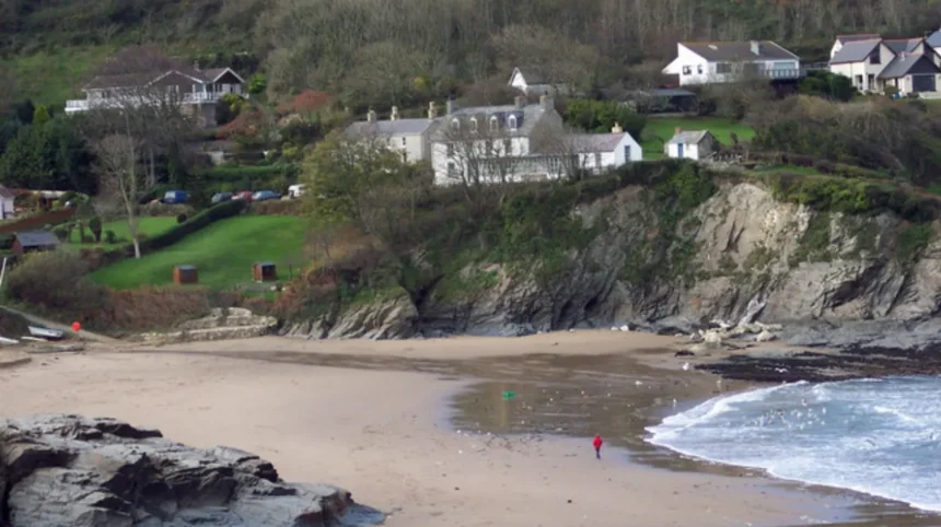
Aberporth Wales is a coastal village, community, and electoral ward located in the county of Ceredigion at the southern end of Cardigan Bay. It sits along the Ceredigion Coast Path, roughly six miles northeast of Cardigan and ten miles southwest of New Quay.
- What is the history and origin of Aberporth Wales?
- What are the main geographical features and beaches in Aberporth Wales?
- What wildlife and marine ecosystems exist in Aberporth Wales?
- What role does defense and technology play in Aberporth Wales?
- What tourism and infrastructure exist in Aberporth Wales?
- Frequently Asked Questions
The geographical area covers a coastal settlement positioned at coordinates 52.1333 degrees North and 4.5472 degrees West. The settlement connects to the main A487 trunk road via the B4333 route. Aberporth rests directly on the shore where the Afon Hownnant meets Cardigan Bay. This positioning creates two distinct sheltered sandy bays known as Traeth y Dyffryn and Traeth Dolwen. The topography transitions from low-lying sandy shores to steep coastal cliffs that border the Irish Sea. According to the United Kingdom Office for National Statistics census records, the community maintains a population of roughly two thousand three hundred residents. Nearly half of the resident population demonstrates fluency in the Welsh language. The local administration operates under Ceredigion County Council alongside the Aberporth Community Council. Aberporth functions as both a rural residential zone and a specialized center for marine tourism and technology testing.
What is the history and origin of Aberporth Wales?
Aberporth Wales originated as a maritime trading hub and herring fishing center dating back to the late thirteenth century. The area transformed from a medieval landing point into a major industrial port and military research site over several centuries.
The name Aberporth appears in written historical documentation dating to 1284, combining the Welsh words aber meaning mouth and porth meaning port. During the sixteenth century, the location served as an auxiliary landing station for the primary port of Cardigan. Historical records show that merchant vessels imported salt and fishing gear from Ireland to support food preservation efforts. Expansion occurred during the late seventeenth and early eighteenth centuries as local maritime trade expanded across Cardigan Bay. Industrial infrastructure developed rapidly along the southern shoreline of the cove. Construction included commercial lime kilns, coal distribution yards, and agricultural warehouses. By the nineteenth century, Aberporth became a primary center for the Welsh herring fishing industry. Records indicate that at least twenty full-time fishing smacks operated regularly out of the harbour. The local fishing industry declined significantly following the outbreak of First World War in 1914 due to shifting fish migrations. In 1939, the Air Ministry established a rocket testing facility nearby, transforming the economic base.
What are the main geographical features and beaches in Aberporth Wales?

Aberporth Wales features two clean sandy beaches, high coastal cliffs, and a sheltered ocean cove inside Cardigan Bay. Traeth y Dyffryn and Traeth Dolwen provide critical habitats for marine life and accessible recreational shores.
The coastal coastline contains two primary beaches separated by a high rocky headland. At low tide, the receding waters reveal expansive sand flats and rock pools that combine both areas into a single shoreline. Traeth y Dyffryn sits at the mouth of the river valley, while Traeth Dolwen features protected sea conditions. Examples of protected coastal features include tidal rock basins, sea caves, exposed reefs, and cliffside trails. Both beaches repeatedly earn European Blue Flag designations due to stringent water quality standards. The surrounding geology consists of Silurian sedimentary rock formations shaped by coastal erosion over thousands of years. The headlands feature elevated viewpoints that connect directly to the Wales Coast Path. Coastal erosion is managed through localized stone sea walls and natural beach nourishment processes. The local microclimate benefits from the Gulf Stream, maintaining moderate temperatures relative to inland Wales. The marine waters support diverse coastal vegetation, including sea kale, kelp beds, and coastal glasswort populations.
What wildlife and marine ecosystems exist in Aberporth Wales?
Aberporth Wales hosts a marine ecosystem containing semi-resident bottlenose dolphins, Atlantic grey seals, and various marine mammals. Cardigan Bay acts as a primary marine conservation zone protected under United Kingdom environmental law.
The sheltered marine waters around Aberporth form a key sanctuary for the largest coastal population of bottlenose dolphins in Europe. Observation records from marine biologists document regular dolphin sightings close to the shoreline between April and October. Examples of rare marine species sighted offshore include killer whales, harbour porpoises, leatherback sea turtles, and basking sharks. Atlantic grey seals frequently haul out on nearby isolated rocky ledges along the Ceredigion cliff bases. The intertidal zones host diverse aquatic life, including spider crabs, sea anemones, blennies, and shore crabs. Coastal bird populations nest on the steep cliff faces surrounding the main beaches. Avian species include fulmars, cormorants, razorbills, peregrine falcons, and Eurasian oystercatchers. Marine research institutions, including Aberystwyth University, conduct regular conservation monitoring within Cardigan Bay. The Special Area of Conservation designation enforces strict protective rules regarding motorized watercraft operations near cetacean groups.
What role does defense and technology play in Aberporth Wales?
Aberporth Wales serves as a national hub for defense research, rocket testing, and unmanned aerial vehicle technology. The Ministry of Defence operates a major testing range alongside the specialized ParcAberporth technology park.
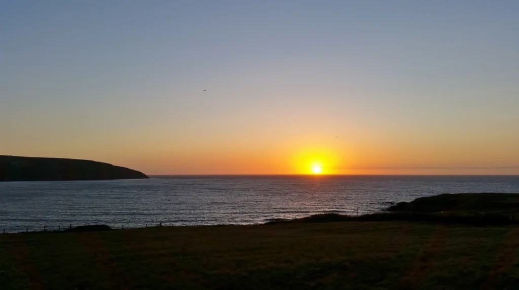
Defense operations began in Aberporth during 1939 with the establishment of an anti-aircraft artillery range. The site evolved into a missile testing station operated by defense company QinetiQ under contract with the UK Ministry of Defence. Range control monitors extensive danger areas spanning the open waters of Cardigan Bay. In 2001, state regional development agencies established ParcAberporth as a technology park focused on aerospace research. Examples of modern technology sectors in Aberporth include target tracking systems, autonomous flight software, military drones, and civil aerospace testing.
West Wales Airport, located adjacent to the complex, features a runway lengthened to 1,257 meters in 2008. The airport facilitates operator training, commercial flight testing, and unmanned system deployments. Academic partnerships with Aberystwyth University bring engineering research programs into the local technology cluster. Defense engineering represents the primary non-tourism employer for workers living in southern Ceredigion.
What tourism and infrastructure exist in Aberporth Wales?
Aberporth Wales provides visitor infrastructure including coastal trails, accommodations, public transportation, and seaside amenities. Tourism operates alongside traditional village services to support both seasonal visitors and local year-round residents.
The village tourism sector relies heavily on its Blue Flag beaches and direct access to regional walking paths. The Ceredigion Coast Path passes through the settlement, offering routes to Tresaith and Mwnt. Examples of local visitor accommodations include self-catering holiday cottages, guesthouses, glamping sites, and traditional pub inns. Public amenities include public parking areas, beach access ramps, public restrooms, and lifesaver stations. Local businesses operate seaside cafes, seafood shops, traditional pubs, and kayak rental facilities. Transport connection relies on regional bus services linking Aberporth to Cardigan, Aberystwyth, and Fishguard. The B4333 road serves as the primary vehicular link to the regional A487 highway network. Public infrastructure maintains strict environmental management standards to handle elevated summer visitor traffic. Environmental initiatives emphasize beach cleanliness, sustainable waste processing, and protection of delicate cliff pathways.
Frequently Asked Questions
What are the best things to do in Aberporth Wales?
Visitors can enjoy swimming at the Blue Flag beaches of Traeth y Dyffryn and Traeth Dolwen. Walking along the coastal path to Tresaith offers scenic views and dolphin watching opportunities in Cardigan Bay. The area is also popular for rock pooling, kayaking, and exploring local maritime history.
Is Aberporth Wales dog friendly?
Aberporth operates seasonal dog restrictions on its main beaches. Traeth Dolwen typically restricts dogs between May and September to maintain hygiene standards. However, sectioned areas on Traeth y Dyffryn and the surrounding coastal paths remain accessible to dog walkers year-round.
Why is Aberporth famous for defense and drone research?
Aberporth hosts a Ministry of Defence range operated by QinetiQ alongside ParcAberporth technology park. The nearby West Wales Airport features extended runways specifically designed for testing military and civil unmanned aerial vehicles. Its location on Cardigan Bay provides restricted airspace ideal for advanced aerospace testing.
Can you see dolphins in Aberporth Wales?
Yes, Cardigan Bay is home to Europe’s largest coastal population of bottlenose dolphins. Visitors regularly spot dolphins directly from the headlands and beach shores between spring and early autumn. High-power binoculars and calm sea conditions improve visibility from cliff viewpoints.
How do you get to Aberporth Wales by public transport?
Aberporth connects to major towns via regional bus routes, including services from Cardigan, Aberystwyth, and Fishguard. The nearest major train stations are located in Aberystwyth and Carmarthen. Drivers access the village via the B4333 road, located two miles off the main A487 trunk road.