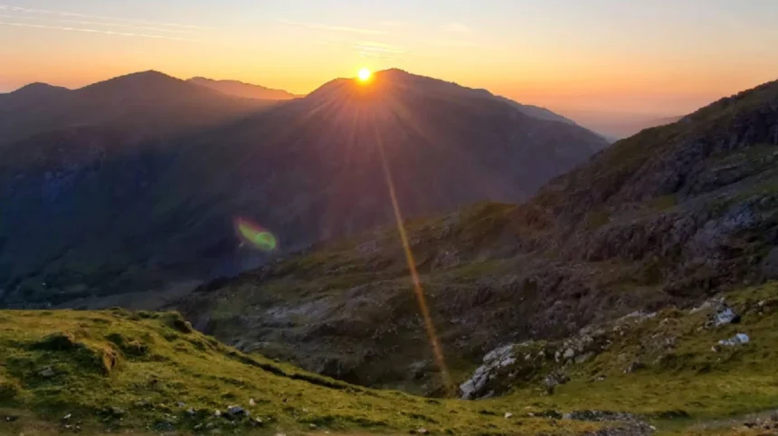
Mount Snowdon reaches an elevation of 1,085 meters above sea level in Eryri National Park, Gwynedd, Wales. It stands as the highest peak in Wales and the highest point in the British Isles south of the Scottish Highlands region.
- What are the main walking routes to the summit of Snowdon?
- Which Snowdon route is the easiest for beginners?
- How long does it take to hike up and down Snowdon?
- What weather conditions should hikers expect on Snowdon?
- What essential gear is required to climb Snowdon safely?
- How does parking and transportation work around Snowdon?
- Frequently Asked Questions
The mountain consists of Ordovician volcanic rock and sedimentary formations shaped by ancient glacial erosion. Glacial activity carved dramatic cums and ridges across the massif over thousands of years. The summit cairn sits directly above the eastern precipice of Cwm Dyli. The surrounding national park encompasses 823 square miles of protected terrain. The geographic region features diverse habitats, including alpine moss-heath, acidic grassland, and rare upland flora. Thousands of hikers visit the peak annually via established network paths. The local Welsh name Yr Wyddfa translates directly to the tumulus or burial mound. Legend connects the summit to the giant Rhita Gawr. The region transitioned into a protected national park in 1951 to conserve its unique biodiversity and geological features. Access remains open to the public year round.
What are the main walking routes to the summit of Snowdon?
Six primary routes lead to the summit of Mount Snowdon, varying significantly in distance, steepness, and technical difficulty. Hikers select paths based on physical fitness, mountain experience, and prevailing weather conditions during their visit to the region.
The Llanberis Path is the longest route at 4.75 miles one way, following a gradual incline alongside the mountain railway track. The Miners Track starts at Pen-y-Pass, covering 4 miles with a gentle initial section before ascending steeply past Llyn Llydaw. The Pyg Track also departs from Pen-y-Pass, climbing 3.5 miles along a rugged rocky trail with continuous elevation gain. The Watkin Path begins near Beddgelert, covering 3.7 miles with the greatest total elevation gain of 1,015 meters. The Rhyd Ddu Path offers a quieter 3.75-mile walk along the western ridge of the mountain. The Snowdon Ranger Path spans 3.75 miles from Llyn Cwellyn, offering steady gradients over wide zig-zag tracks. Each route presents distinct terrain, ranging from wide gravel paths to exposed rocky scrambles.
Which Snowdon route is the easiest for beginners?
The Llanberis Path is universally recognized as the easiest and most accessible route to the summit of Mount Snowdon for novice hikers. It offers a wider path and a more consistent gradient compared to the southern and eastern approaches.
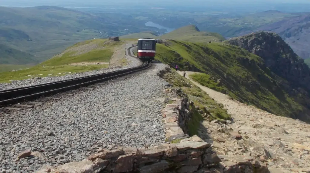
Starting from the village of Llanberis, this trail spans 9.5 miles round trip and gains 975 meters of total elevation. The path generally follows the track of the Snowdon Mountain Railway, providing clear navigation throughout the ascent. The lower section features a paved road before transitioning into a broad gravel track past the Halfway House café. Despite being classified as the easiest route, it still requires three to four hours of continuous uphill walking. The upper section near Clogwyn Station becomes exposed to severe weather and strong winds. Beginners must maintain proper physical conditioning and wear suitable footgear to complete the trek safely. The trail avoids steep drop-offs or technical scrambling sections found on alternative routes.
How long does it take to hike up and down Snowdon?
A standard round-trip hike up and down Mount Snowdon takes between five and seven hours for an adult walker of average fitness. Total duration depends heavily on the chosen route, weather conditions, trail crowding, and rest periods.
Faster hikers using direct routes like the Pyg Track can complete the ascent in two hours and the descent in one hour and thirty minutes. Novice walkers or groups utilizing the Llanberis Path typically spend four hours ascending and three hours descending the mountain. Extreme weather conditions, including heavy rain, high winds, or icy surfaces, significantly slow progression along the steep upper sections. Navigating crowded path bottlenecks near the summit during peak summer months adds additional travel time. Hikers must account for daylight hours and start early in the morning to avoid descending in darkness. Adequate time management ensures walkers complete the descent safely before weather conditions deteriorate.
What weather conditions should hikers expect on Snowdon?
The weather on Mount Snowdon is highly changeable, severe, and radically different from conditions at the base of the mountain in Llanberis. Summit temperatures are typically six to ten degrees Celsius colder than ground levels due to lapse rates.
High winds frequently gust over fifty miles per hour along exposed ridges, creating significant stability hazards for hikers. Cloud cover envelops the summit on more than two hundred days per year, reducing visibility to less than five meters. Heavy rainfall occurs regularly, transforming dry paths into fast-flowing water streams and making rocks extremely slippery. Winter conditions bring freezing temperatures, ice, and deep snowpack requiring specialized equipment like ice axes and crampons. Maritime air masses moving off the Atlantic Ocean create rapid weather shifts within thirty minutes. Hikers must check detailed mountain weather forecasts from the Met Office before attempting any summit attempt. Preparing for cold and wet conditions is critical even during warm summer months.
What essential gear is required to climb Snowdon safely?
Climbing Mount Snowdon safely requires specialized hiking equipment designed to withstand changing mountain weather and rough, uneven terrain. Standard urban clothing like jeans, cotton shirts, and fashion sneakers are unsafe and unacceptable for mountain environments.
Essential gear includes sturdy hiking boots with deep tread soles and ankle support to prevent slips on loose scree. A waterproof and windproof jacket paired with waterproof trousers protects against sudden rainstorms and driving cold winds. Layered synthetic or merino wool clothing helps regulate body temperature by wicking moisture away from the skin. A thirty-liter backpack should contain a printed Ordnance Survey map, a physical compass, a headlamp, and a first aid kit. Hikers must carry high-calorie food supplies and at least two liters of water per person for hydration. Emergency gear should feature a whistle, a foil survival blanket, and a fully charged mobile phone. Winter ascents demand rigid boots, microspikes or crampons, and a walking ice axe.
How does parking and transportation work around Snowdon?
Parking near the main Snowdon trailheads is strictly controlled, highly limited, and requires advance booking during peak visitation seasons throughout the year. The Pen-y-Pass car park serves the Pyg Track and Miners Track and must be pre-booked online months ahead.
Unbooked drivers face immediate turnaways or high fines for parking illegally along narrow rural road verges in Gwynedd. The Snowdon Sherpa bus network provides reliable transportation connecting all main path starting points, local villages, and peripheral parking lots. Hikers frequently park in larger designated lots in Llanberis, Nant Peris, Beddgelert, or Rhyd Ddu, then take the bus to Pen-y-Pass. Bus services run frequently during spring, summer, and autumn seasons, catering specifically to early morning walkers. The Snowdon Mountain Railway offers a heritage rack-and-pinion train service from Llanberis directly to the summit station. Drivers should check local transport authority updates to verify road closures and seasonal schedule changes before setting off.
- Read More: Check local road safety and travel notices before planning regional transport.
- Related Article: Explore outdoor lifestyle and activity features.
Frequently Asked Questions
Can I take my dog when I climb Mount Snowdon?
Yes, dogs are permitted on all six main paths of Mount Snowdon. Owners must keep dogs on leads at all times due to grazing livestock, steep precipices, and heavy trail congestion.
Is there a cafe or toilet facilities at the summit?
The Hafod Eryri summit visitor center features a cafe, gift shop, and restrooms when operational. Facilities are open strictly from late spring through early autumn when the mountain railway runs.
Do I need a permit to walk up Mount Snowdon?
No permits or entry fees are required to hike Mount Snowdon via any public footpath. The mountain remains open to all members of the public twenty-four hours a day.
Which Snowdon route is the most dangerous to hike
Crib Goch is the most dangerous route, involving an exposed knife-edge scrambling ridge with vertical drops on both sides. It requires advanced mountaineering experience, surefootedness, and calm weather.
Can beginners hike Snowdon in the winter months?
Beginners should avoid hiking Snowdon in winter conditions due to severe ice, snow, and extreme wind hazards. Winter ascents require specialized mountaineering skills, ice axes, and crampon training.