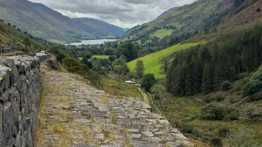
The Mach Loop is one of the world’s best-known military aviation viewing locations and attracts thousands of aviation enthusiasts, photographers, and outdoor visitors every year. Located within the mountains of southern Eryri National Park, formerly Snowdonia National Park, the Mach Loop forms part of the United Kingdom’s Low Flying System. Royal Air Force pilots and military crews from allied nations use this area to practise realistic low-level flying in challenging terrain. Its dramatic scenery, public viewing locations, and international aviation reputation make it one of Wales’ most distinctive attractions. This guide explains where the Mach Loop is located, why it exists, how it operates, when to visit, and what visitors should expect.
- Where Is the Mach Loop in Wales?
- What Is the Mach Loop and Why Was It Created?
- How Does the Mach Loop Work for Military Flight Training?
- Why Is the Mach Loop Famous Among Aviation Photographers?
- What Aircraft Can You See Flying in the Mach Loop?
- When Is the Best Time to Visit the Mach Loop in Wales?
- How Can You Visit the Mach Loop Safely and Responsibly?
- What Other Attractions Can You Visit Near the Mach Loop?
- Frequently Asked Questions
Where Is the Mach Loop in Wales?
The Mach Loop is located in southern Eryri National Park in Gwynedd, North Wales, near the market town of Machynlleth. It forms part of the United Kingdom’s Low Flying Area 7 and is surrounded by mountains, valleys, forests, and rural roads that provide excellent public viewing locations.
The Mach Loop lies approximately 15 kilometres north of Machynlleth and extends through several mountain valleys in central Wales. The training area sits within one of Britain’s designated military low-flying zones, allowing fast jets and military transport aircraft to conduct realistic operational training over varied terrain.
The route passes near several well-known locations including Corris, Dolgellau, Dinas Mawddwy, and Cadair Idris. These communities sit within the wider landscape of Eryri National Park, which covers more than 2,100 square kilometres and protects some of Wales’ most significant natural scenery.
Unlike a traditional airport or military airbase, the Mach Loop is not a single location. Instead, it is a network of interconnected valleys used by military aircraft to practise terrain-following flight. Pilots navigate through the valleys while maintaining strict operational procedures and approved flight safety standards.
Several public viewpoints overlook sections of the route. Cad East, Cad West, Bwlch, and Blue Bell are the most recognised locations for aircraft observation. These elevated hillsides allow visitors to safely watch aircraft flying through the valleys while remaining outside operational military areas.
Road access is available from nearby towns including Machynlleth, Dolgellau, and Bala. Most viewpoints require visitors to park responsibly and complete a moderate walk across uneven mountain paths before reaching the observation areas.
The surrounding landscape includes forests, rivers, lakes, and mountain peaks that attract hikers, cyclists, wildlife enthusiasts, and landscape photographers throughout the year. Even without aircraft activity, the area remains one of the most scenic destinations in North Wales.
The Mach Loop’s combination of spectacular geography, public accessibility, and military aviation has earned worldwide recognition among aviation enthusiasts and professional photographers.
What Is the Mach Loop and Why Was It Created?
The Mach Loop is a military low-level flying training area designed to help aircrew develop navigation, aircraft handling, tactical flying, and operational decision-making in mountainous terrain. It supports realistic training that prepares military pilots for complex missions in demanding environments.
The United Kingdom established its Low Flying System after the Second World War to improve pilot readiness under realistic flying conditions. Mountain valleys provide terrain that closely resembles operational environments where military aircraft often conduct transport, surveillance, and combat support missions.
The Mach Loop forms part of Low Flying Area 7, one of several designated military training regions across the United Kingdom. Aircraft operate under carefully controlled procedures established by the Ministry of Defence to ensure both flight safety and public protection.
Low-level flying develops essential pilot skills including terrain awareness, visual navigation, aircraft control, and mission coordination. Flying through narrow valleys requires continuous concentration, precise speed management, and accurate communication between aircrew and military controllers.
Training missions involve different aircraft depending on operational requirements. Fast jets practise tactical manoeuvres, transport aircraft rehearse low-level supply missions, and helicopters develop terrain-following techniques used during military operations and humanitarian support.
The route also supports multinational defence cooperation. NATO partner nations regularly participate in joint exercises that strengthen operational compatibility between allied air forces. International crews benefit from challenging terrain while following common military procedures.
Aircraft operating within the Mach Loop remain subject to strict altitude limits, weather restrictions, environmental regulations, and airspace management. These measures balance effective military training with public safety and environmental protection across the surrounding countryside.
Today, the Mach Loop remains one of Europe’s most respected military aviation training environments and continues to support pilot development for the Royal Air Force and allied nations.
How Does the Mach Loop Work for Military Flight Training?
The Mach Loop works by allowing military aircraft to fly through designated mountain valleys while practising realistic low-level navigation, tactical manoeuvres, and terrain-following techniques. Every flight follows strict operational procedures that ensure safety, efficiency, and effective military pilot training.
Military aircraft enter Low Flying Area 7 after receiving operational clearance and completing detailed mission planning. Pilots follow approved routes through interconnected valleys while maintaining assigned altitudes, speeds, and communication procedures established by military air traffic management.
The mountainous landscape provides realistic challenges that cannot be replicated in standard airspace. Pilots continuously adjust aircraft position, speed, and altitude while responding to changing terrain, weather conditions, and mission objectives throughout each training exercise.
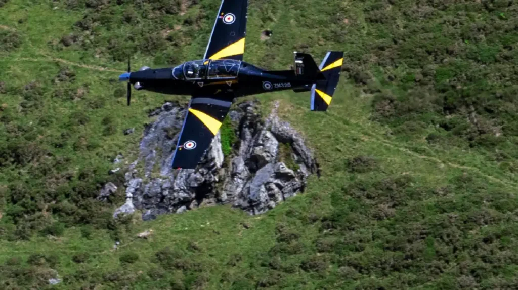
Different aircraft perform different training tasks. Eurofighter Typhoon fighters practise tactical low-level flight, Airbus A400M Atlas transport aircraft rehearse supply operations, Lockheed Martin F-35B Lightning II aircraft develop combat mission skills, and BAE Hawk T2 aircraft support advanced pilot instruction.
Training also includes navigation without relying entirely on satellite systems. Pilots use visual landmarks, terrain recognition, aeronautical charts, onboard instruments, and coordinated mission planning to improve operational awareness during low-level flight.
Weather conditions form an important part of military preparation. Rain, cloud, changing visibility, and strong winds require pilots to adapt while maintaining safe aircraft control and following established operational regulations throughout every mission.
Every flight is monitored through military planning systems that coordinate aircraft movements, training priorities, and airspace management. These procedures reduce operational risk while allowing multiple aircraft types to use the training area efficiently.
The Mach Loop remains an essential part of Britain’s military aviation training programme because it develops practical flying skills that directly support operational readiness, multinational cooperation, and the safe execution of defence missions in complex environments.
Why Is the Mach Loop Famous Among Aviation Photographers?

The Mach Loop is famous because it allows photographers to capture military aircraft flying at eye level through mountain valleys. This rare flying environment creates dramatic images of fast jets operating during low level training in a natural landscape that is difficult to find elsewhere in Europe.
Military aviation photography depends on opportunities to safely observe aircraft in realistic operational conditions. The Mach Loop provides one of the few public locations where photographers can legally watch Royal Air Force and allied military aircraft perform low flying exercises. Unlike airport photography, aircraft pass close to elevated viewpoints, creating striking perspectives against the mountains of Eryri National Park.
Aircraft frequently photographed include the Airbus A400M Atlas transport aircraft, for example tactical airlift missions, the Eurofighter Typhoon, for example air defence training, the Lockheed Martin F-35B Lightning II, for example fifth generation combat exercises, and the BAE Hawk T2, for example advanced pilot instruction. Visiting NATO aircraft from the United States, Germany, Italy, and other allied nations also use the route during multinational exercises.
Popular photography viewpoints include Cad East, for example the most recognised location overlooking a sharp valley bend, Cad West, for example an alternative hillside position with wider visibility, Bwlch, for example a viewpoint suitable for aircraft approaching from different directions, and Blue Bell, for example a quieter location offering varied photographic angles.
Photographers normally use telephoto lenses between 100 mm and 400 mm for aircraft close ups, while wider lenses between 24 mm and 70 mm capture aircraft alongside the surrounding mountains. Fast shutter speeds freeze aircraft movement, whereas slower shutter speeds create motion blur that highlights speed while maintaining aircraft sharpness.
Weather conditions strongly influence photography. Clear skies improve visibility, while changing cloud cover creates varied lighting conditions throughout the day. Wales experiences frequent weather changes, making flexibility important when planning photography sessions at the Mach Loop.
Visitors should remember that military flying schedules remain operationally sensitive. Aircraft activity varies daily according to training requirements, aircraft availability, maintenance programmes, weather, and operational priorities. No public timetable guarantees flying activity on any specific day.
Respecting the countryside remains essential. Visitors should remain on designated footpaths, avoid disturbing livestock, carry litter away, and follow local guidance issued by Eryri National Park. Responsible behaviour protects both the environment and continued public access.
The combination of dramatic scenery, realistic military training, public accessibility, and international aviation interest has established the Mach Loop as one of the world’s best locations for military aviation photography.
What Aircraft Can You See Flying in the Mach Loop?
The Mach Loop hosts a wide variety of military aircraft used for pilot training, tactical transport, reconnaissance, and multinational defence exercises. Aircraft types vary throughout the year because flying schedules depend on operational training requirements, weather conditions, maintenance programmes, and international military cooperation.
The Royal Air Force operates several aircraft through the Mach Loop during routine low flying exercises. The Eurofighter Typhoon performs air combat training, the BAE Hawk T2 supports advanced fast jet instruction, the Airbus A400M Atlas practises tactical transport missions, and the Airbus Voyager occasionally conducts support operations.
The Royal Navy also participates through the Fleet Air Arm. The Lockheed Martin F-35B Lightning II conducts advanced training for carrier operations and tactical missions. The aircraft represents the United Kingdom’s fifth generation multirole combat capability and regularly operates from RAF Marham before participating in wider UK training exercises.
United States military aircraft frequently visit during NATO exercises. Examples include the Boeing C-17 Globemaster III strategic transport aircraft, the Lockheed Martin MC-130J Commando II special operations aircraft, the Boeing KC-46 Pegasus aerial refuelling aircraft, and the Lockheed Martin F-35A Lightning II used by the United States Air Force.
European NATO partners also use the route. Aircraft from Germany, Italy, France, the Netherlands, Belgium, Norway, and other allied nations occasionally conduct joint training missions within the United Kingdom’s Low Flying System to improve interoperability and operational readiness.
Helicopters also appear in the Mach Loop. Common examples include the Boeing CH-47 Chinook heavy lift helicopter, the Leonardo AW159 Wildcat maritime helicopter, and the Airbus H145 Jupiter used for military flying instruction. Helicopter flights often follow lower valley routes than fast jets.
Transport aircraft create different viewing opportunities compared with fighter aircraft. Large aircraft maintain lower speeds while navigating valleys, allowing photographers additional time to compose images. Fighter aircraft travel significantly faster, producing dramatic visual impact within only a few seconds.
Aircraft appearances remain unpredictable because military operations take priority over public viewing. Some days feature numerous aircraft movements, while others experience no flying activity at all. Seasonal exercises occasionally increase the number of participating aircraft from multiple allied air forces.
Every aircraft operating within the Mach Loop follows strict military regulations, approved low flying procedures, and comprehensive safety standards designed to protect pilots, local communities, wildlife, and other airspace users throughout central Wales.
When Is the Best Time to Visit the Mach Loop in Wales?
The best time to visit the Mach Loop is during weekdays between spring and autumn because military training activity generally occurs more frequently. Morning and afternoon flying periods provide the greatest opportunity to observe aircraft, although no public schedule guarantees flight operations.
Military flying usually takes place from Monday to Friday because operational training follows normal defence planning cycles. Weekends generally experience lower activity unless special exercises or operational requirements are scheduled by the Ministry of Defence.
Spring offers comfortable temperatures, longer daylight hours, and greener landscapes that improve visibility and photography. Summer provides the longest observation periods but also attracts larger numbers of aviation enthusiasts, especially during school holidays and favourable weather conditions.
Autumn remains popular because changing foliage creates colourful mountain scenery while visitor numbers often decline after summer. Winter visits remain possible, although shorter daylight hours, stronger winds, heavier rainfall, and occasional snow can affect accessibility across mountain paths.
Weather conditions influence both aircraft activity and visitor comfort. Low cloud, heavy rain, fog, and poor visibility sometimes limit military flying. Checking local weather forecasts before travelling helps visitors prepare suitable clothing and equipment for rapidly changing mountain conditions.
Most visitors arrive early in the morning to secure parking and reach viewpoints before flying begins. Popular locations such as Cad East and Bwlch become busy during favourable weather, particularly when aviation communities expect increased military activity.
Comfortable hiking boots improve safety because footpaths include steep gradients, uneven rocks, muddy sections, and exposed terrain. Waterproof clothing, food, drinking water, navigation tools, and fully charged mobile devices are recommended since facilities remain limited around many viewing locations.
Visitors should never enter restricted land or attempt to approach aircraft operating areas. Viewing aircraft from recognised public viewpoints ensures personal safety while respecting military operations, private property, and environmental conservation across Eryri National Park.
Planning around weather forecasts, weekday travel, seasonal conditions, and sufficient walking time significantly improves the overall visitor experience. Even without aircraft activity, the surrounding mountains, valleys, and landscapes make the Mach Loop one of the most scenic destinations in central Wales.
How Can You Visit the Mach Loop Safely and Responsibly?
The Mach Loop can be visited safely by using designated public footpaths, respecting private land, preparing for mountain conditions, and following local guidance. Responsible behaviour protects visitors, supports local communities, preserves the natural environment, and ensures continued public access to the area’s popular aviation viewpoints.
Most viewing locations require a moderate hike across uneven terrain. Popular viewpoints such as Cad East, Cad West, Bwlch, and Blue Bell are reached on foot using established walking routes. Visitors should remain on marked paths to reduce erosion and avoid damaging sensitive habitats within Eryri National Park.
Appropriate clothing is essential throughout the year. Waterproof jackets, sturdy hiking boots, layered clothing, and suitable backpacks help visitors adapt to rapidly changing mountain weather. Even during summer, temperatures can fall quickly on exposed hillsides, particularly when strong winds develop.
Carrying sufficient drinking water, snacks, and a fully charged mobile phone improves safety during longer visits. Many viewpoints have no nearby shops, cafés, or public facilities. Planning ahead reduces unnecessary travel and ensures visitors remain comfortable throughout the day.
Parking responsibly is equally important. Visitors should use designated parking areas and avoid blocking narrow country roads, farm entrances, gates, or emergency access routes. Illegal parking creates difficulties for local residents, farmers, and emergency services operating in rural communities.
Wildlife and livestock should always be respected. Sheep, cattle, birds, and protected habitats form part of the surrounding landscape. Visitors should keep noise to a minimum, avoid disturbing animals, and take all litter home to help preserve the area’s natural beauty.
Drone flying is generally unsuitable around the Mach Loop because military aircraft operate at very low altitudes. Drone use can create significant safety risks and may breach aviation regulations. Visitors should always follow Civil Aviation Authority guidance and any local restrictions before operating unmanned aircraft.
Aircraft should never distract visitors from their surroundings. Mountain terrain includes steep slopes, loose rocks, uneven ground, and sudden drops. Remaining aware of footing while watching aircraft helps prevent accidents and injuries.
Responsible tourism benefits everyone. Respecting local communities, protecting the environment, and following safety guidance ensures the Mach Loop remains an outstanding destination for aviation enthusiasts, photographers, hikers, and nature lovers for many years.
What Other Attractions Can You Visit Near the Mach Loop?
The Mach Loop sits within one of Wales’ most scenic regions, making it an excellent base for exploring mountains, historic towns, lakes, forests, and heritage attractions. Visitors can combine aviation photography with hiking, sightseeing, and cultural experiences across southern Eryri National Park.
The market town of Machynlleth lies a short drive from the Mach Loop and serves as the main gateway for visitors. It offers accommodation, restaurants, cafés, supermarkets, fuel stations, and local shops. The town also has strong historical links with Welsh leader Owain Glyndŵr and remains an important cultural centre.
Cadair Idris is one of Wales’ most famous mountains and attracts thousands of walkers each year. Several well-marked routes lead to its summit, offering panoramic views across Eryri National Park, Cardigan Bay, and the surrounding valleys. The mountain is recognised for both its geological importance and Welsh folklore.
Talyllyn Lake provides opportunities for walking, photography, kayaking, and peaceful countryside relaxation. The lake sits beneath the southern slopes of Cadair Idris and is surrounded by dramatic mountain scenery that attracts outdoor enthusiasts throughout the year.
The Talyllyn Railway is one of the world’s oldest preserved narrow-gauge railways. Heritage steam trains operate between Tywyn and Nant Gwernol, allowing visitors to experience historic railway travel through the beautiful Fathew Valley while learning about Wales’ industrial heritage.
Coed y Brenin Forest Park offers extensive outdoor recreation including mountain biking, hiking trails, running routes, and family-friendly woodland walks. The visitor centre provides facilities, information, and access to one of the United Kingdom’s leading mountain biking destinations.
Visitors interested in Welsh history can also explore Harlech Castle, a UNESCO World Heritage Site built during the reign of King Edward I in the late thirteenth century. The castle overlooks Cardigan Bay and represents one of the finest surviving examples of medieval military architecture in Britain.
The surrounding region also includes waterfalls, rivers, scenic driving routes, and traditional Welsh villages. These attractions allow visitors to enjoy the landscape even when military flying is limited, making the Mach Loop an ideal destination for a full day or weekend itinerary.
Combining aviation photography with outdoor activities and cultural attractions creates a richer travel experience while supporting local tourism businesses throughout central Wales.
The Mach Loop is one of the most recognised military aviation training locations in the world. Situated within the Low Flying Area 7 system in southern Eryri National Park, it allows Royal Air Force and allied military aircraft to conduct realistic low-level training through the mountains of central Wales.
Its international reputation comes from the rare opportunity to view fast jets and military transport aircraft from elevated public viewpoints. Locations such as Cad East, Cad West, Bwlch, and Blue Bell have become well known among aviation photographers while remaining surrounded by some of Wales’ most spectacular natural scenery.
Although military flying attracts thousands of visitors each year, the Mach Loop also offers excellent hiking, wildlife observation, landscape photography, and access to nearby attractions including Machynlleth, Cadair Idris, Talyllyn Lake, and the Talyllyn Railway. This combination makes the area appealing even on days without aircraft activity.
Careful planning, respect for local communities, responsible countryside behaviour, and awareness of changing mountain weather help ensure a safe and enjoyable visit. Whether you are an aviation enthusiast, photographer, or traveller exploring Wales, the Mach Loop remains one of the country’s most distinctive and memorable destinations.
Frequently Asked Questions
Is the Mach Loop open to the public?
Yes. The Mach Loop is accessible from public rights of way and recognised viewing locations. Visitors can hike to viewpoints such as Cad East and Bwlch without paying an entrance fee. Everyone should stay on public footpaths, respect private land, and follow local safety guidance.
Do aircraft fly through the Mach Loop every day?
No. There is no published flying timetable for the Mach Loop. Military aircraft operate according to Royal Air Force and NATO training requirements, weather conditions, aircraft availability, and operational priorities. Some days have frequent activity, while others have none.
What is the best viewpoint at the Mach Loop?
Cad East is widely regarded as the most popular viewpoint because it offers elevated views of aircraft banking through the valley. Bwlch, Cad West, and Blue Bell are also excellent locations, each providing different photographic angles depending on flight direction.
Can you photograph military aircraft at the Mach Loop?
Yes. Photography is permitted from public viewing areas. Aviation photographers from around the world visit the Mach Loop to capture low-flying Royal Air Force and allied military aircraft. Visitors should remain on designated paths and avoid interfering with military operations.
How long should you spend at the Mach Loop?
Most visitors spend between four and eight hours at the Mach Loop. This allows enough time to hike to a viewpoint, wait for possible aircraft activity, enjoy the surrounding scenery, and explore nearby attractions in southern Eryri National Park.